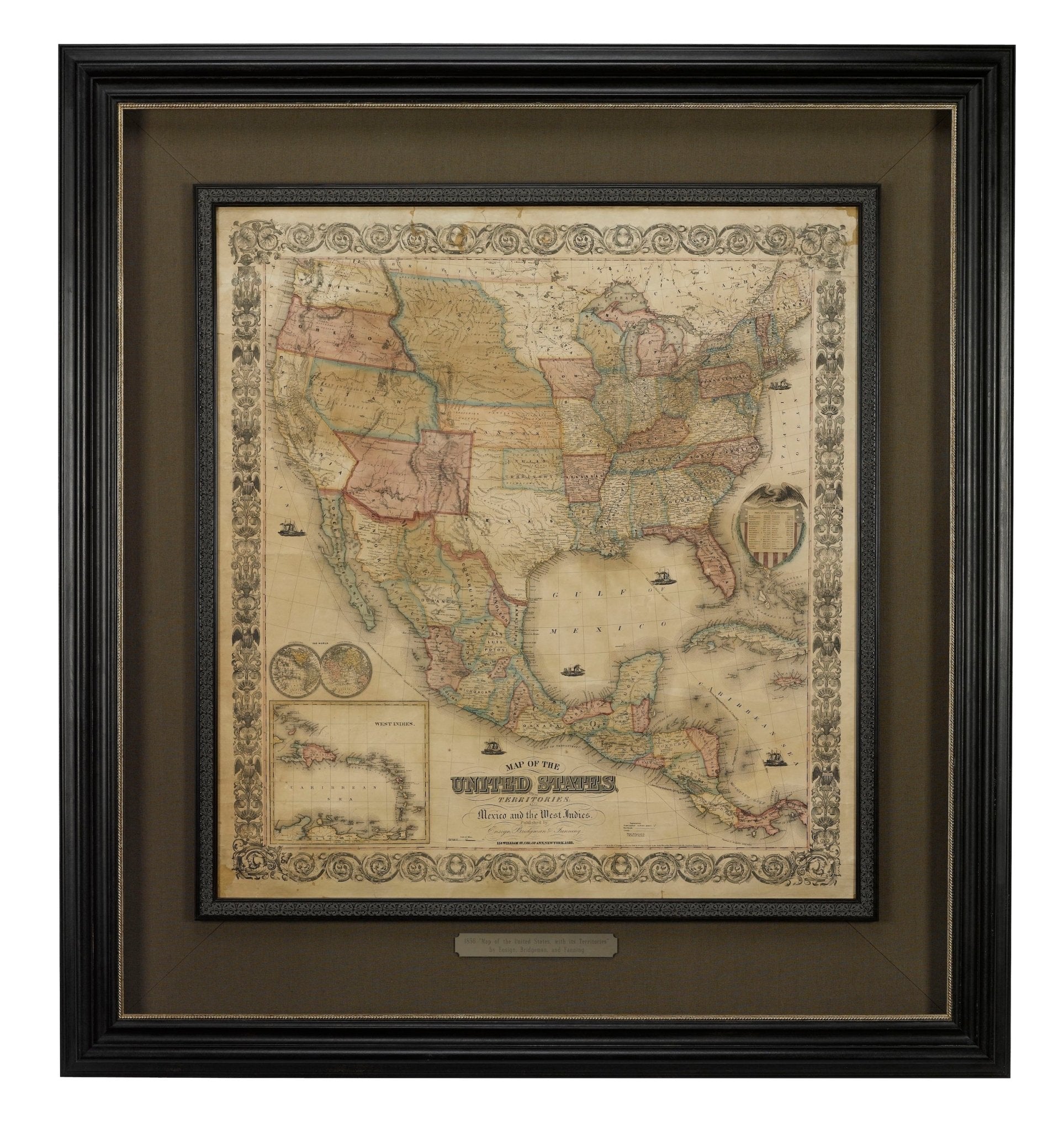
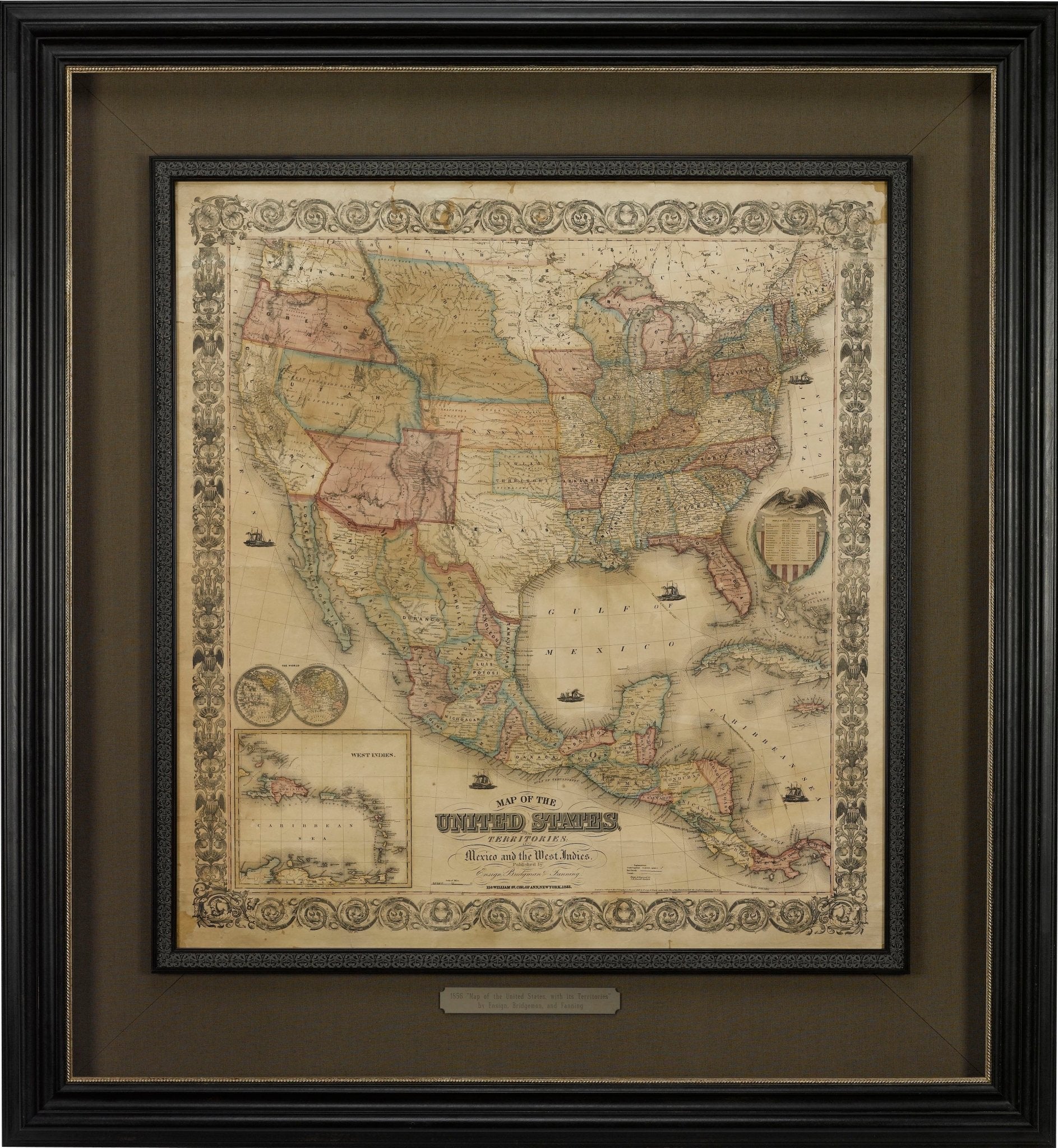
1856 "Map of the United States, with its Territories; also Mexico and the West Indies" by Ensign, Bridgeman, and Fanning
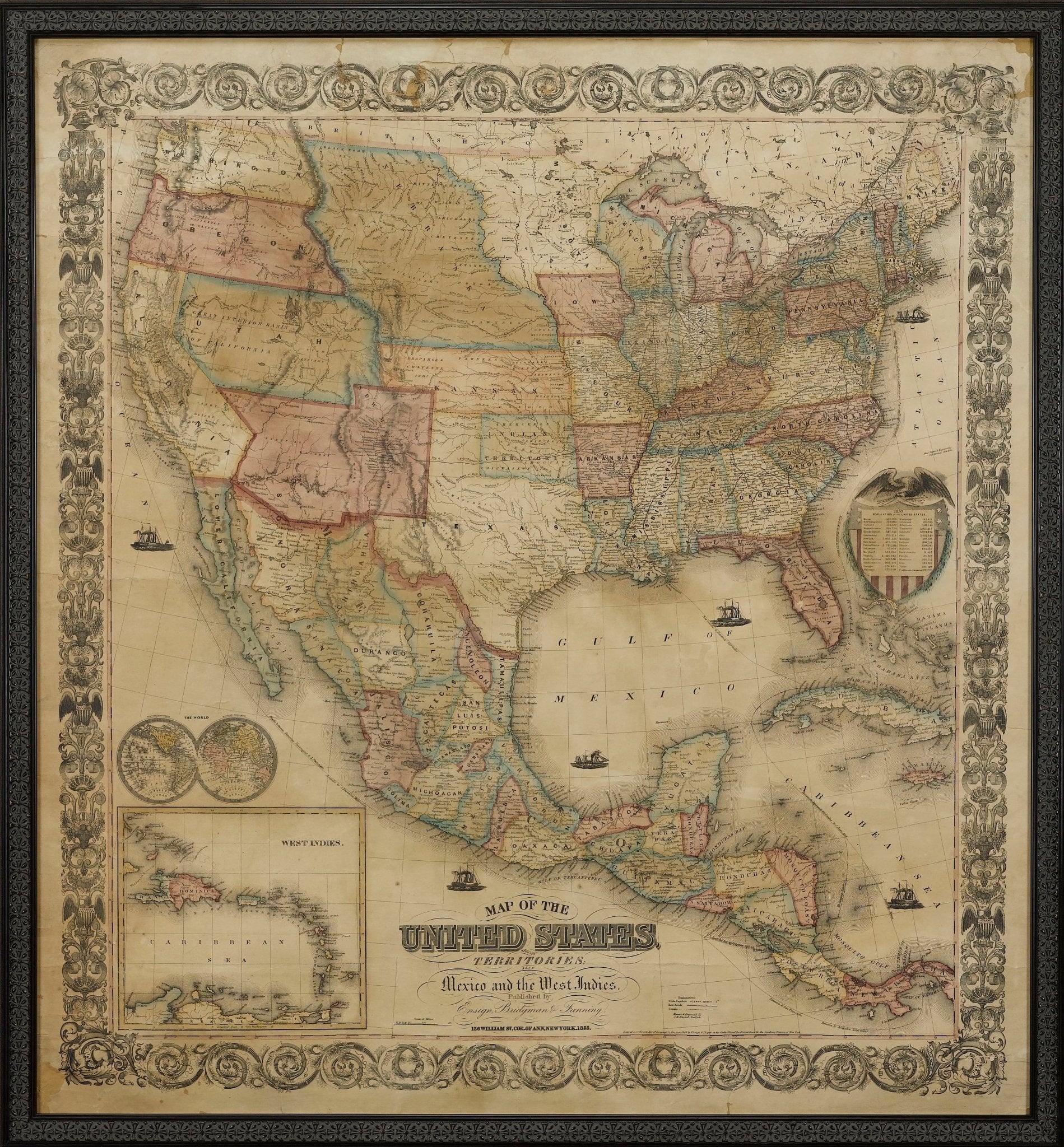
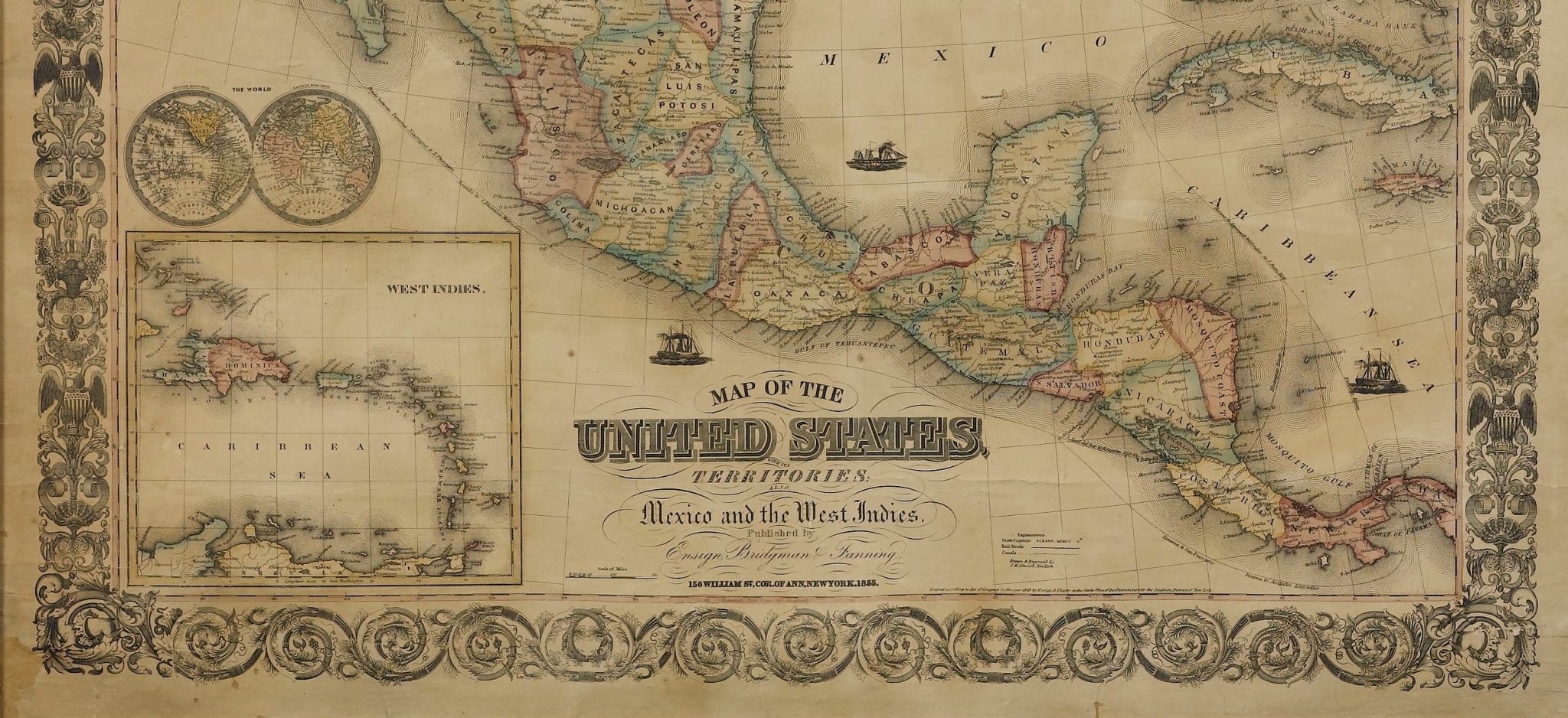
Presented is a scarce American wall map of the United States and Mexico issued by Ensign, Bridgman, and Fanning in 1856. As the title suggests, the map covers all of the United States, as well as Mexico, Cuba, and Central America as far as Panama. Additional iInset maps in the lower left illustrate the World on a double hemispheric projection and the West Indies.
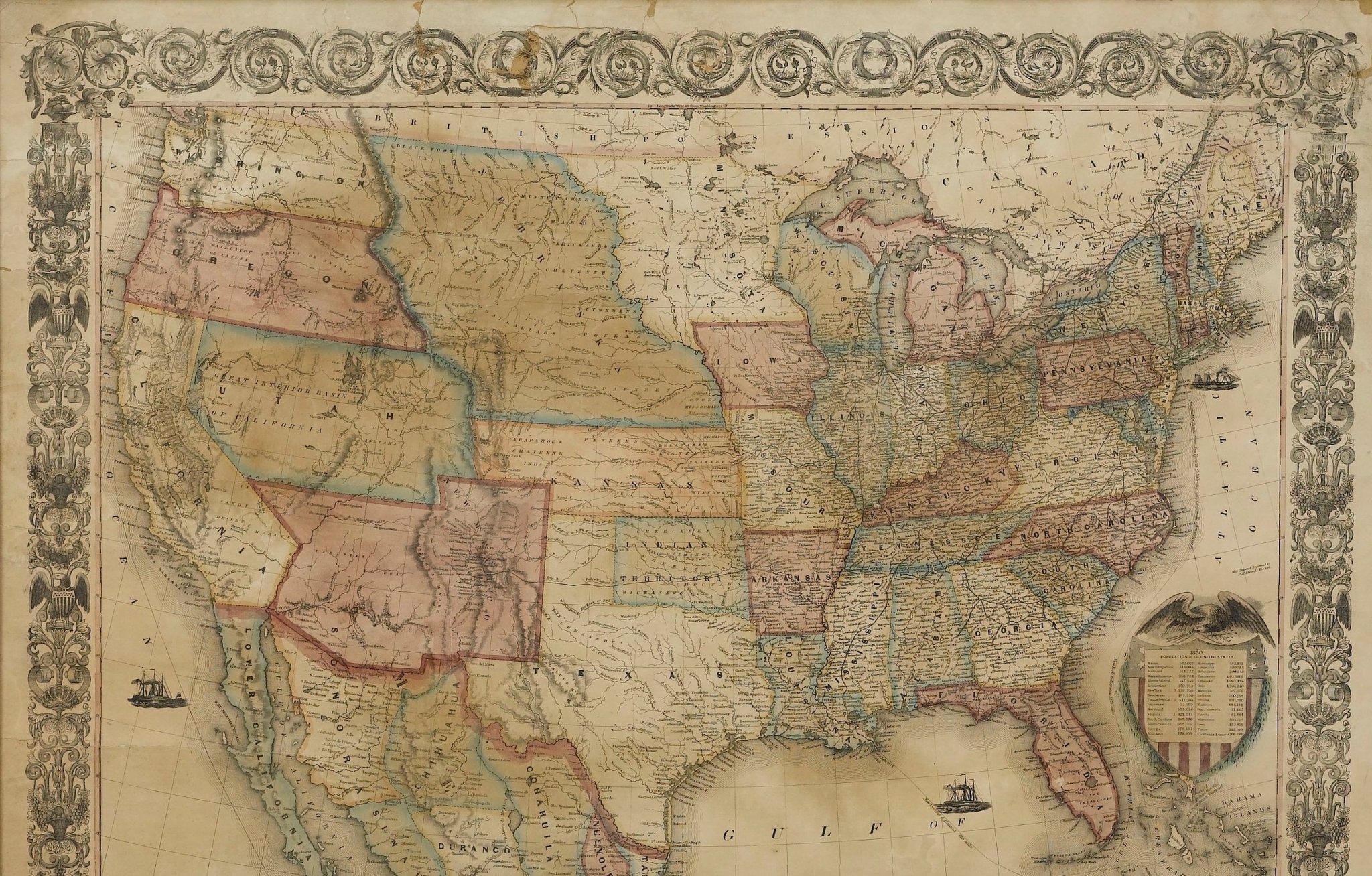
The focus of the map is the westward expansion and settlement of the United States. The map was updated accordingly, to indicate territorial and border changes west of the Mississippi River. In this 1856 printing, Texas is configured with borders established as a result of the Compromise of 1850 and New Mexico has added new territory thanks to the Gadsden Purchase. The borders of Kansas and Nebraska adhere to the Kansas-Nebraska Act of May 30, 1854 in which Nebraska stretches to the Canadian border.
Published at the tail’s end of the gold rush, the gold region in the Sacramento Valley, California is highlighted. The map notes exploration and travel routes to the west, including Fremont's Route, The Oregon Trail, and the Santa Fe Caravan route. American Indian lands are identified throughout.
This map was first published in 1849 by Horace Thayer and Edward Hooker Ensign, who had it engraved by John M. Atwood. The imprint varied over the years, with the 1851 edition also attributed to “Ensign and Thayer,” an 1853 edition attributed solely to Horace Thayer, and editions starting in 1855 attributed to “Ensign, Bridgeman, and Fanning,” like the present example. The map proved popular due to its more manageable size and was updated annually through at least 1857.
CONDITION:
Very good condition considering age and past use. Engraved map, with hand coloring. Map is dated 1855, but published in 1856. Paper is mostly healthy, with mild to moderate toning and scattered stains. Previously restored and stabilized, now newly backed onto archival linen.
Map has been artfully framed to conservation standards in a custom wooden frame, with acid-free mats, and UV glass.
Framed Dimensions: 54 1/4" H x 50" W x 3 1/4" D.
Accompanied by our company's letter of authenticity.
Pickup available at Colorado
Usually ready in 4 hours

1856 "Map of the United States, with its Territories; also Mexico and the West Indies" by Ensign, Bridgeman, and Fanning
Colorado
1 Lake Avenue
Colorado Springs CO 80906
United States
Choose options


Frequently Asked Questions
FAQs
Yes, all of our Antiques are certified authentic. Every antique comes with a signed Letter of Authenticity that details the item’s history, its current condition including any conservation, binding, or framing work, and the item’s provenance. The Letters of Authenticity are priced valuations by our authentication specialists, who assure that items are original and unconditionally guaranteed as genuine for life.
We pack and ship your items from our gallery in Colorado Springs. You may also choose to come pick up your order. Antique items are carefully packed and insured during shipping. The shipping price will be calculated at checkout.
We acquire from a variety of trusted sources all over the world, but mostly through auctions and private collections within the United States. All provenance information will be listed on the Letter of
Authenticity accompanying your purchase.

