
1864 "Amerique du Nord" by Adolphe Hippolyte Dufour
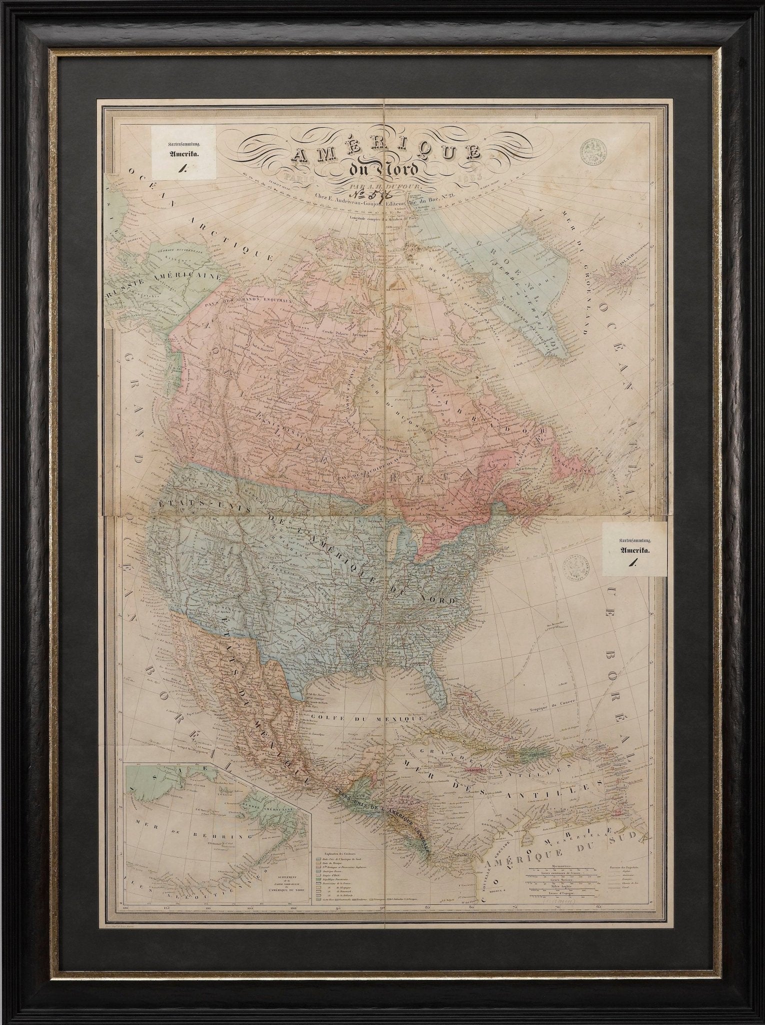
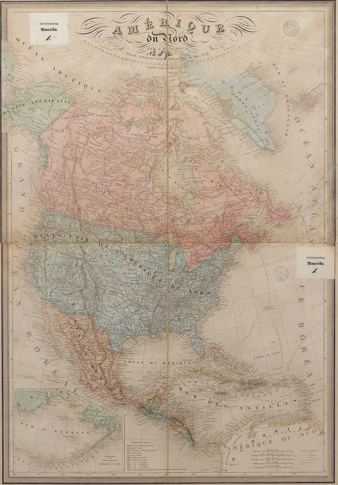
Offered is a map of North America entitled "Amerique du Nord" from 1864. This rare, separately published wall map was produced by Adolphe Hippolyte Dufour. This map includes vibrant and elaborate hand-coloring within country borders, as well as brightly colored lines representing state borders, which stand in stark contrast. The work is extremely detailed with labels of cities and rivers across the continent. The work is dissected into four separate sheets and is laid neatly on two sheets of linen. There are two stamps for the German Ministry of Foreign Affairs, which existed until the 1920s. This map has also appeared in Andriveau-Goujon's Atlas Choix.
This map covers an extensive amount of land in the North American continent. The work displays land from the Polar Ice Cap to as far down as the northern edge of South America. The map includes an unusual view of the Transmississippi West, with a misshaped Texas, as well as Nebraska Territory, Kansas extending to the Rocky Mountains, Washington, and Oregon. New Mexico depicted is above Arizona (Baylor line) and the Territory of Shoshone is shown (pre-Idaho). Nevada's eastern border is nearly at the western edge of Salt Lake, an early effort to reduce the Mormon influence, although its eastern border is very odd. Nevada's lower tip, which would include Clark County (Las Vegas), is shown in Arizona. The map is very collectible due to its terrific early Western Territorial names and boundaries. This map provides a variety of detailed nautical routes, as well as an inset map at the lower left showing the edge of present day Alaska. The land of Alaska is labeled here as “Russian America,” relating to Russian colonial possessions in North America that lasted from 1733 to 1867.
Adolphe Hippolyte Dufour (1795 - 1865) was a French-based map and atlas publisher active in the middle to late 19th century, working primarily in Paris. Dufour was a student of Emile Lapie, another famous French cartographer, and has worked with numerous other cartographers to publish a wide array of maps and atlases. He is well known for his famous elephant folio entitled Atlas Universel physique, historique et politique geographie ancienne et moderne. Alexandre Vuillemin was Dufour’s student and ultimately his successor.
CONDITION:
Overall good condition considering age and use. Some significant soiling, specifically at right side, and some scattered foxing. Coloring is still quite vibrant. Stabilized on linen. 35 1/2" H x 24 1/3" W total sheet size. The map is framed according to the highest archival standards in an elegant black and gold frame.
Framed dimensions: 44 1/2" H x 33" W x 1 1/2" D.
Accompanied by our company's letter of authenticity.
Pickup available at Colorado
Usually ready in 4 hours

1864 "Amerique du Nord" by Adolphe Hippolyte Dufour
Colorado
1 Lake Avenue
Colorado Springs CO 80906
United States
Choose options


Frequently Asked Questions
FAQs
Yes, all of our Antiques are certified authentic. Every antique comes with a signed Letter of Authenticity that details the item’s history, its current condition including any conservation, binding, or framing work, and the item’s provenance. The Letters of Authenticity are priced valuations by our authentication specialists, who assure that items are original and unconditionally guaranteed as genuine for life.
We pack and ship your items from our gallery in Colorado Springs. You may also choose to come pick up your order. Antique items are carefully packed and insured during shipping. The shipping price will be calculated at checkout.
We acquire from a variety of trusted sources all over the world, but mostly through auctions and private collections within the United States. All provenance information will be listed on the Letter of
Authenticity accompanying your purchase.

