1868 "Lloyd's Topographical Railway Map of North America, or The United States Continent in 1900" Hanging Wall Map
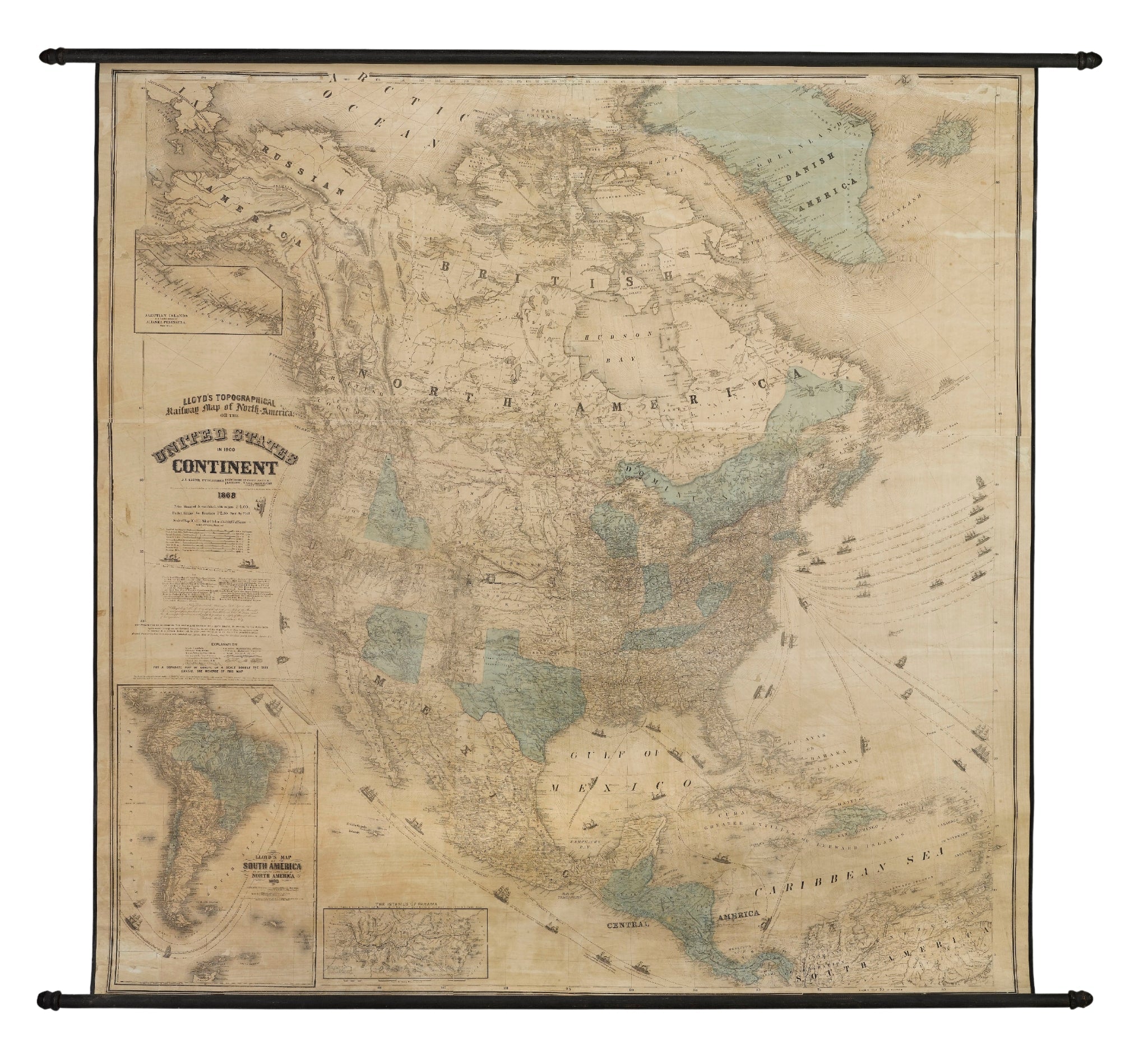
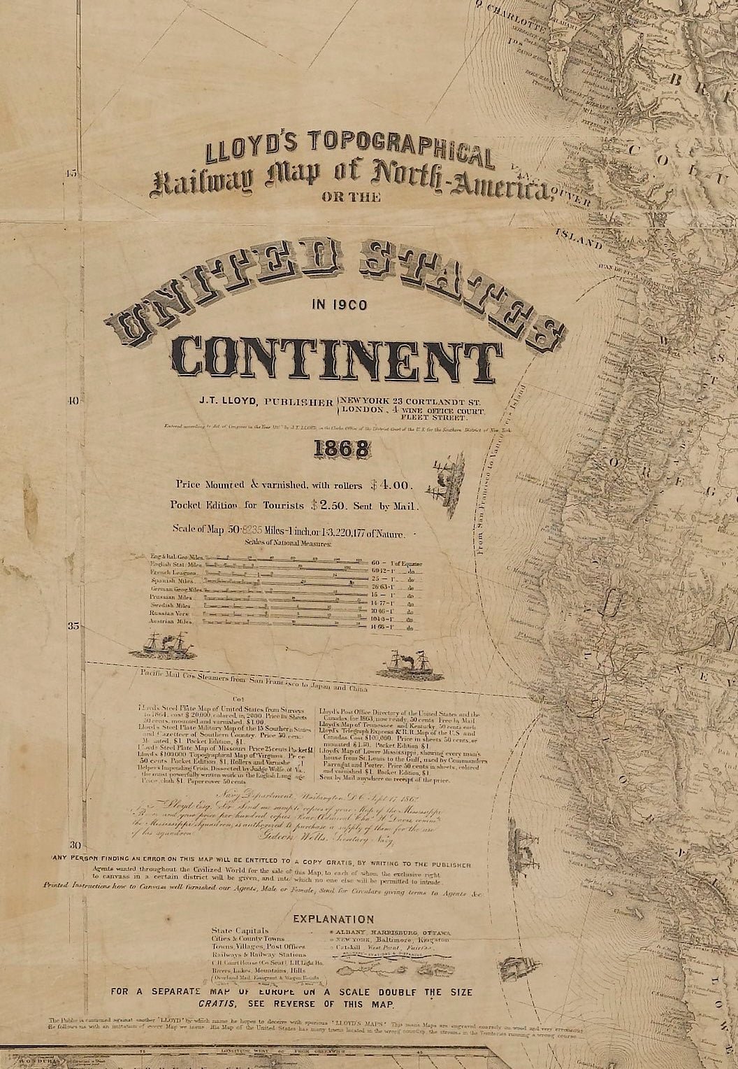
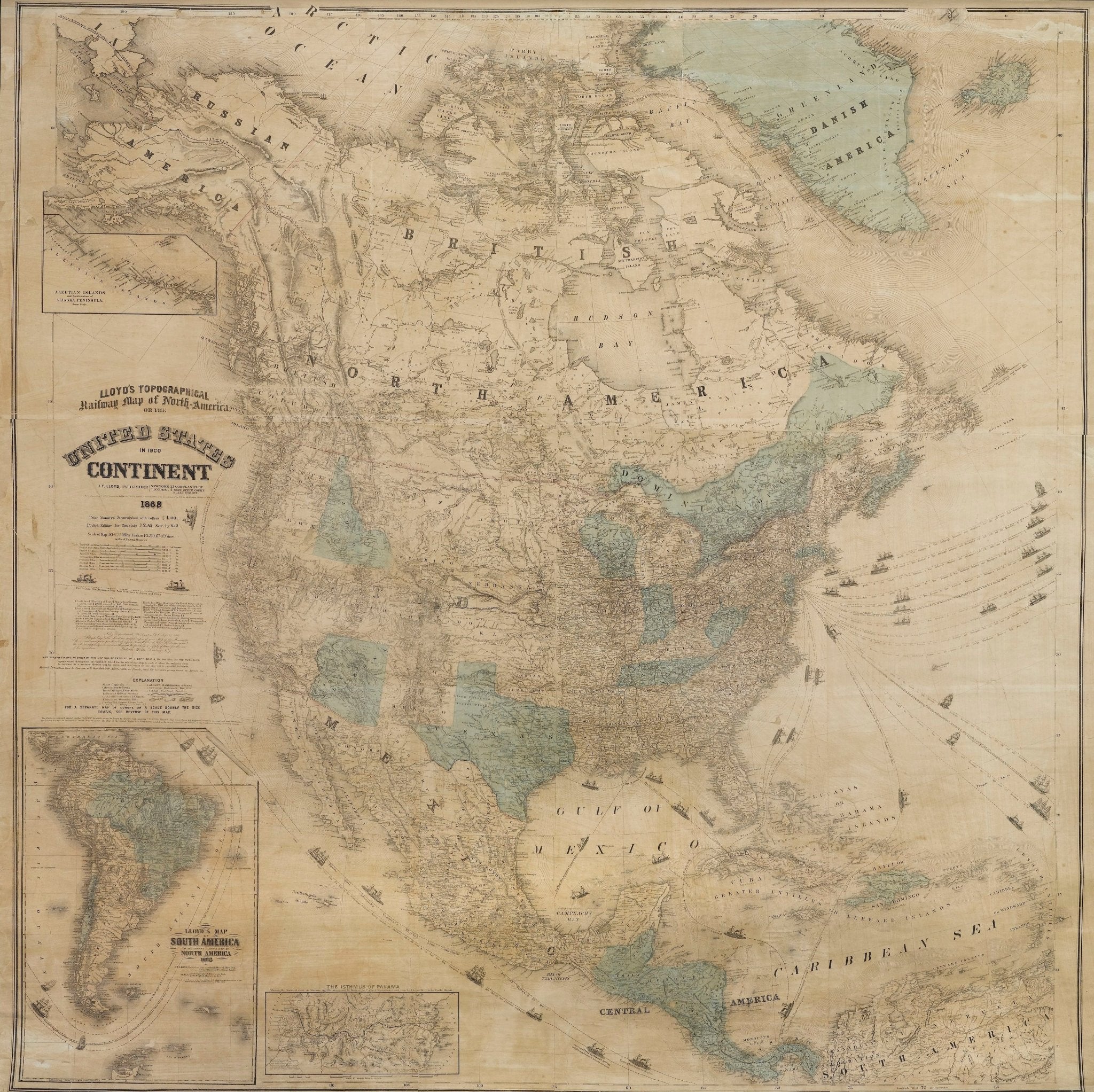
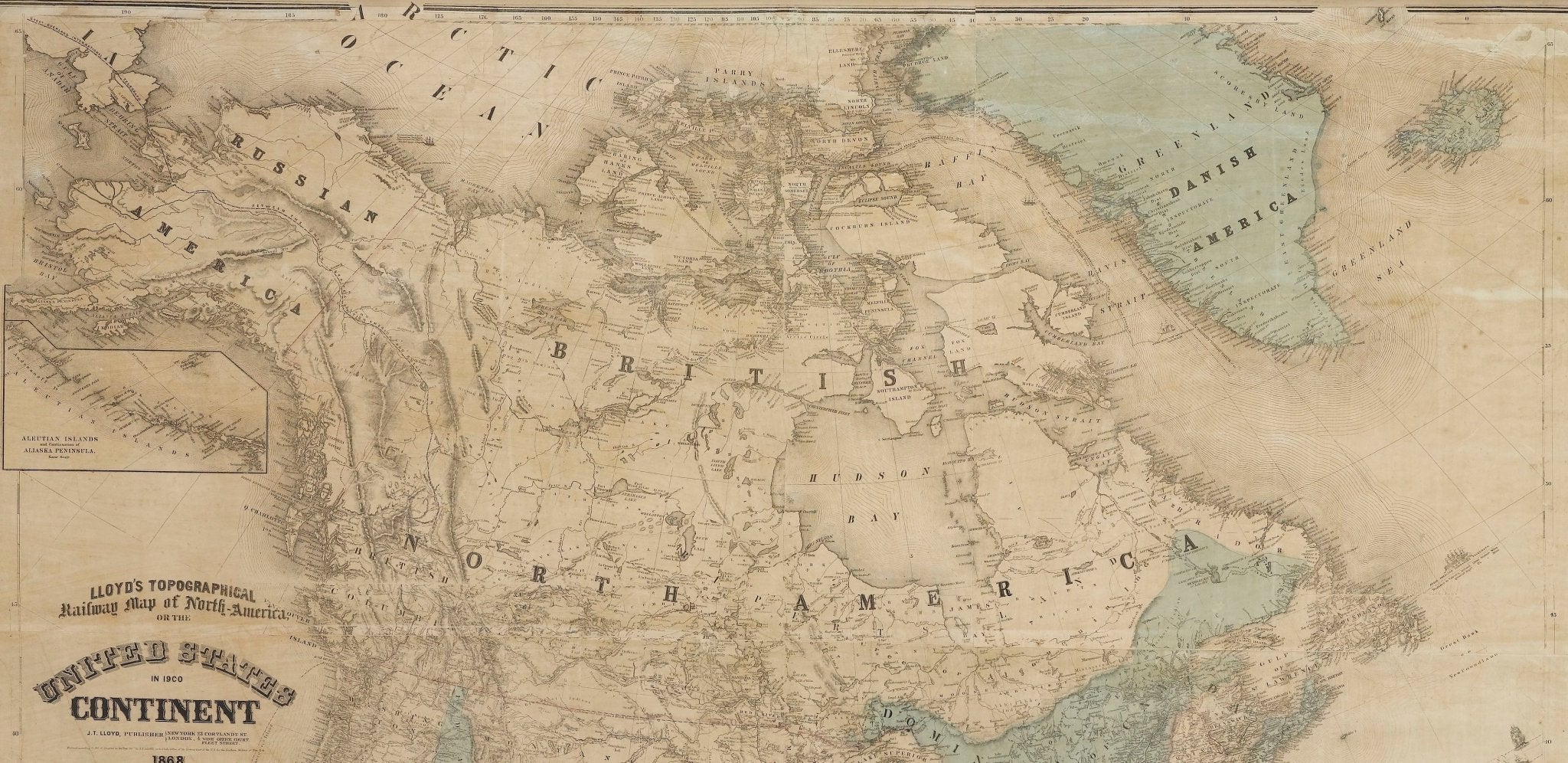
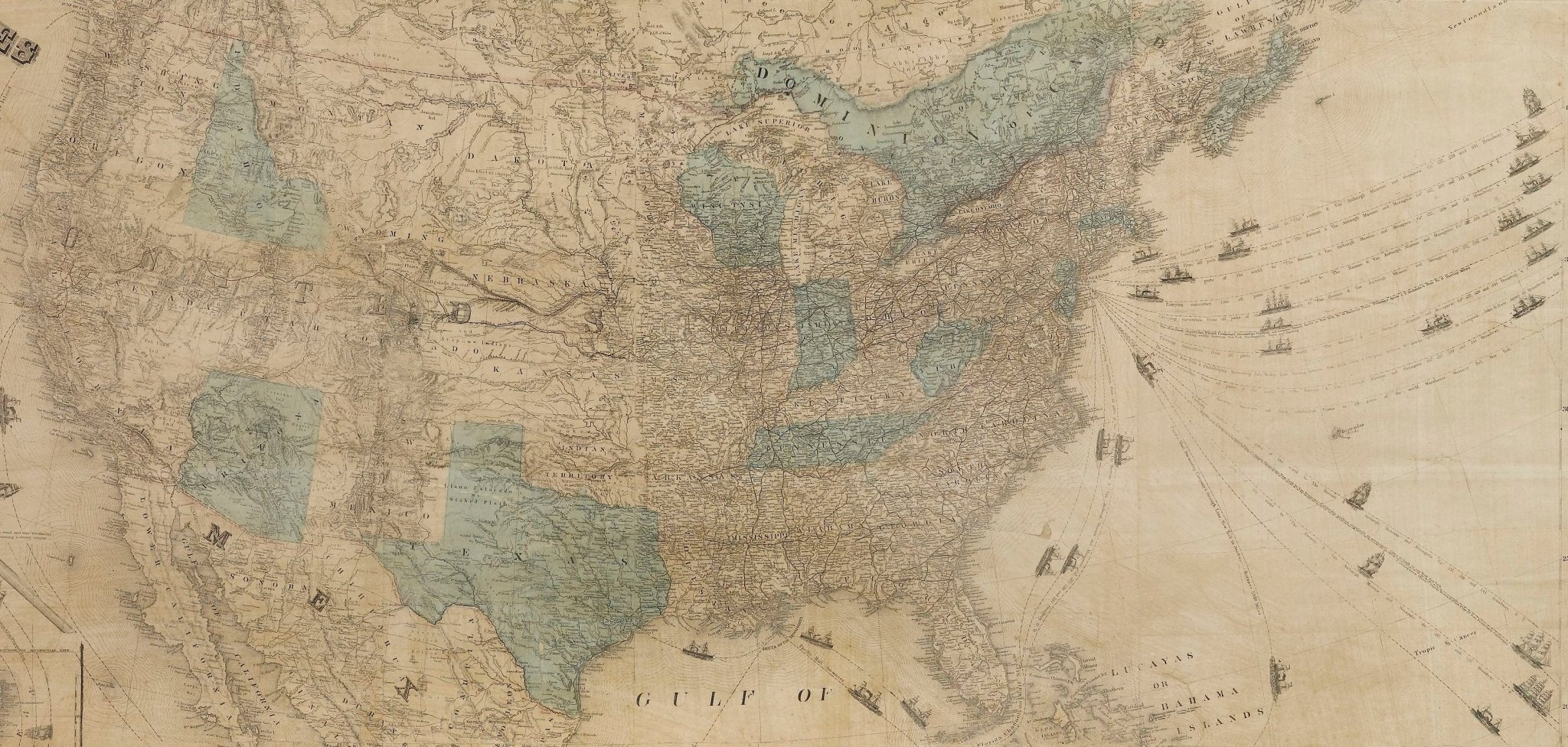
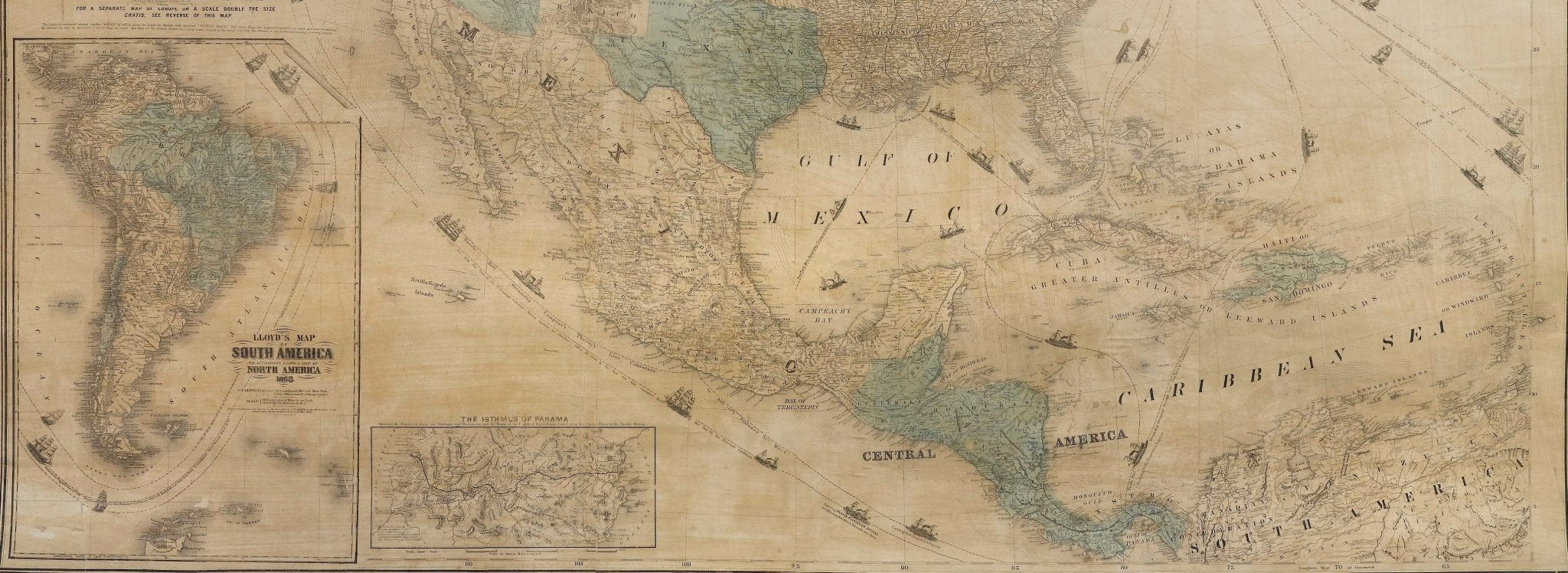
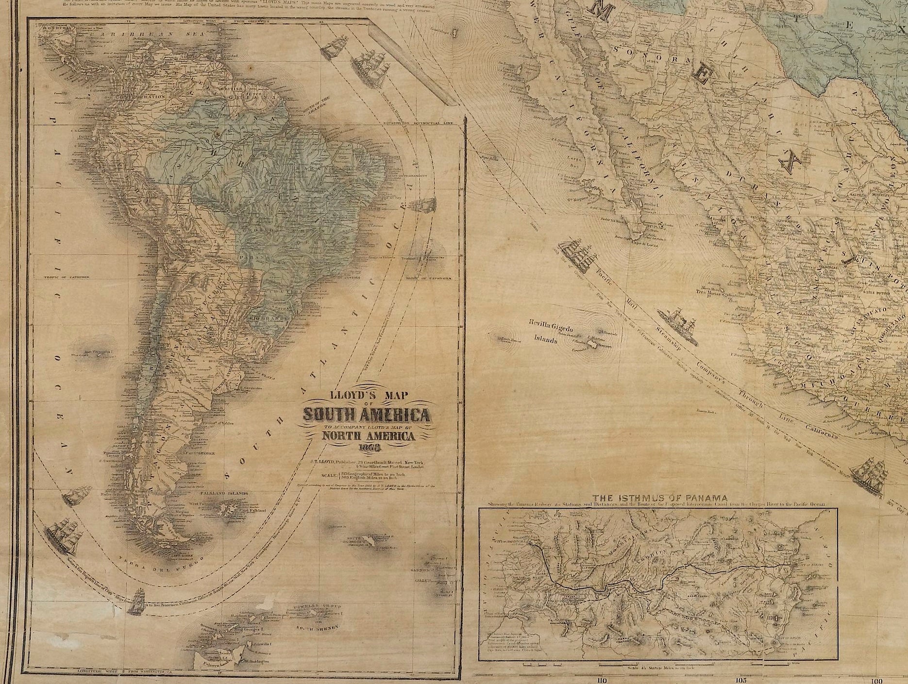
Presented is “Lloyd's Topographical Railway Map of North-America, or the United States Continent in 1900.” This map was published by J. T. Lloyd, in New York, in 1868. A large, hanging map of the United States, Central America, and adjacent northern territories, this map covers the area from the Arctic Ocean and extends as far south as the Caribbean Sea. The continuation of South America is shown in an inset map along the left margin, along with inset maps of “The Aleutian Islands and Continuation of the Alaskan Peninsula" and “The Isthmus of Panama.” According to the publisher’s description at lower left, this map was originally issued in two states: "Price Mounted & varnished, with rollers" for 4 dollars, and "Pocket Edition for Tourists" for $2.50.
Throughout the map, the states, state capitals, cities and county towns are all well labeled. A reference key in the bottom margin provides symbols for railways, post offices, court houses, rivers, lakes, mountains, and hills. As emphasized in the map’s title, this map is especially notable for the countless railway lines and stations depicted, both current and proposed routes, snaking across the continent.
Lloyd created this map as both a topographical railroad map and a prophetic look into the future, an idealized hope for what America will look like in the year 1900. The map was first published in 1866, just one year after the conclusion of the Civil War. Hopeful signs of growth and reconciliations thus dominate the map, with both northern and southern ports and towns all connected to each other and the world via flourishing railways, steamships, and communication routes. Highlights of Lloyd's 20th century vision include a transcontinental railroad, two international telegraph lines, and robust fleets of clipper ships and steamships leaving from New York and San Francisco on the coasts and from the Delta of the Mississippi in the south.
This map also offers interesting insight about the map trade of the times, revealing the competitive and boastful nature of print publishing. Lloyd used the margins of this map to list and advertise his other maps for sale, with prices and a quoted endorsement from Gideon Welles, Secretary to the Navy. So sure of the quality of his work, Lloyd boasts that "Any one finding an error in this Map will be entitled to a copy, gratis, by writing to the Publisher." He also advises against his customers purchasing from other mapmakers, specifically his rival H. H. Lloyd. He writes "The Public is cautioned against another 'Lloyd' by which name he hopes to deceive with spurious 'Lloyd's Maps.' This man's Maps are engraved coarsely on wood and very erroneous. He follows us with an imitation of every Map we issue. His Map of the United States has many towns located in the wrong counties, the streams in the Territories running a wrong course…."
There is much to glean from this expansive and impressive 19th century hanging wall map.
CONDITION:
Very good condition, considering age and past use. Hand-colored with light blue watercolor wash, original to map. Colors are attractive, with some fading. Paper is healthy, with a few edge chips from rolling, minimal stains, and overall toning. Map has been restored and backed with linen. Presented on wooden rollers, as issued. Map is sold unframed, as-is.
Unframed dimensions: 60 x 67 1/2".
Accompanied by our company's letter of authenticity.
Pickup available at Colorado
Usually ready in 4 hours

1868 "Lloyd's Topographical Railway Map of North America, or The United States Continent in 1900" Hanging Wall Map
Colorado
1 Lake Avenue
Colorado Springs CO 80906
United States
Choose options


Frequently Asked Questions
FAQs
Yes, all of our Antiques are certified authentic. Every antique comes with a signed Letter of Authenticity that details the item’s history, its current condition including any conservation, binding, or framing work, and the item’s provenance. The Letters of Authenticity are priced valuations by our authentication specialists, who assure that items are original and unconditionally guaranteed as genuine for life.
We pack and ship your items from our gallery in Colorado Springs. You may also choose to come pick up your order. Antique items are carefully packed and insured during shipping. The shipping price will be calculated at checkout.
We acquire from a variety of trusted sources all over the world, but mostly through auctions and private collections within the United States. All provenance information will be listed on the Letter of
Authenticity accompanying your purchase.

