
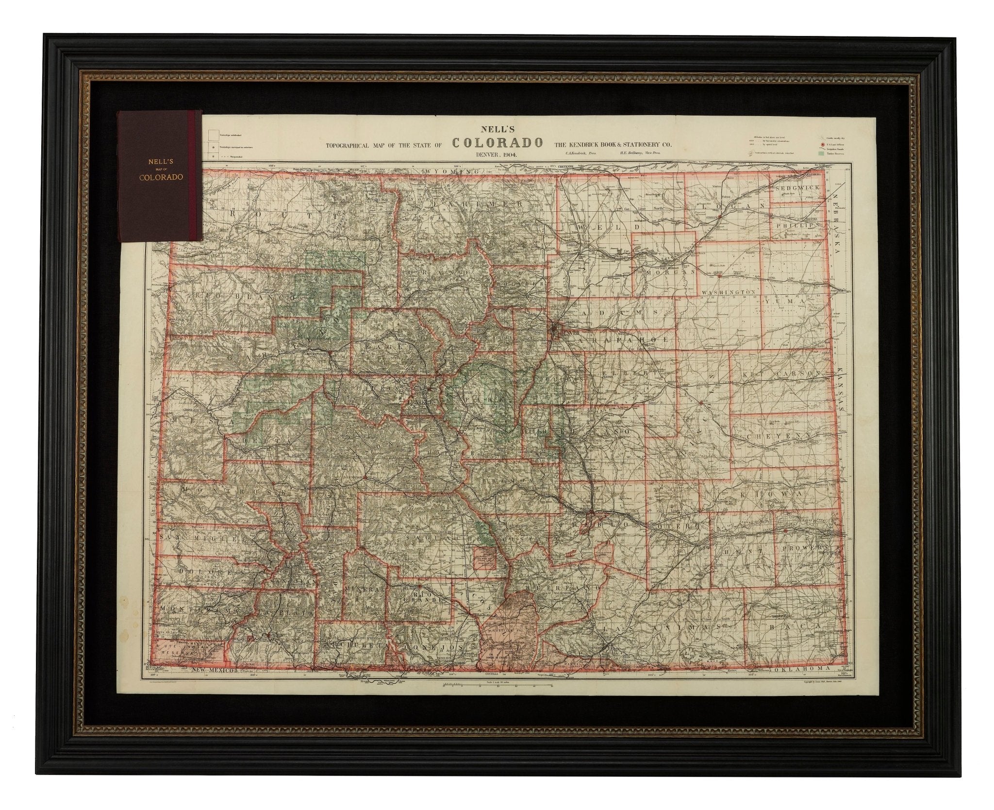
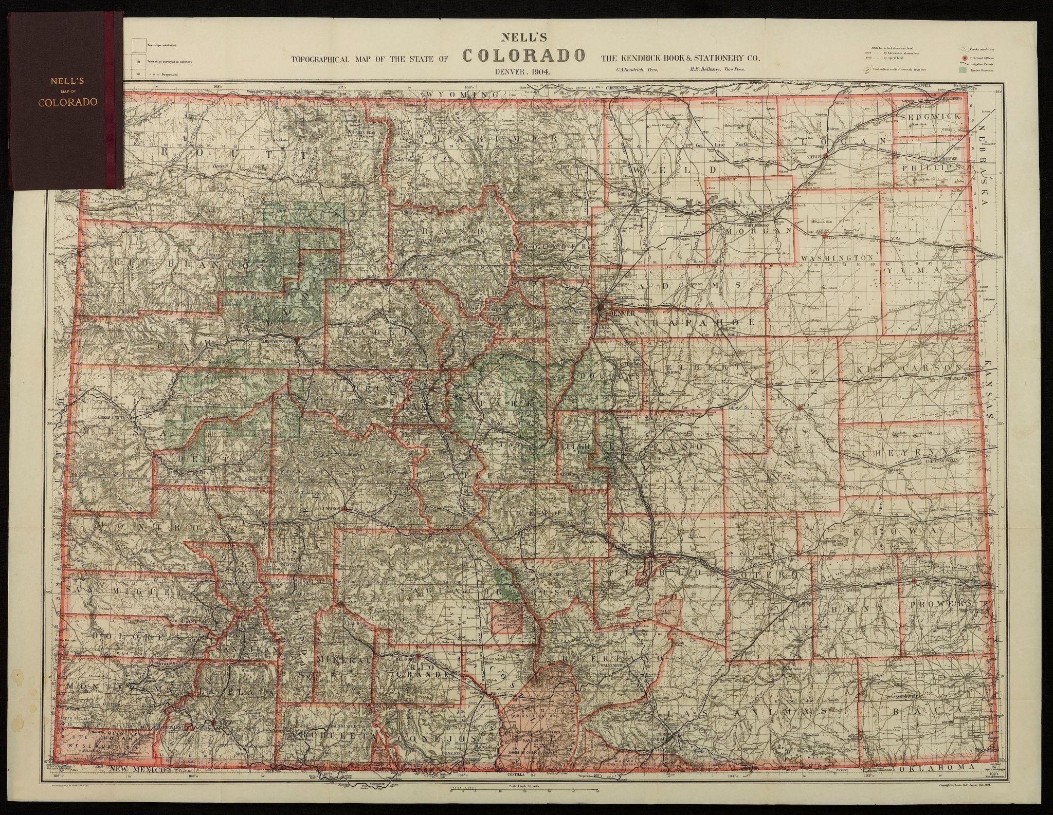
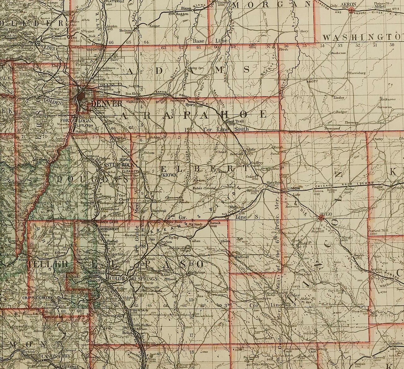
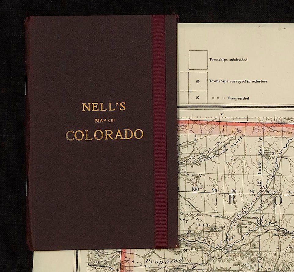
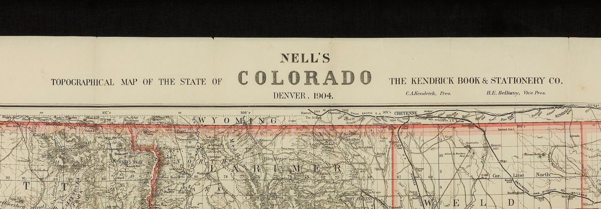
1904 "Nell's Topographical Map of the State of Colorado"
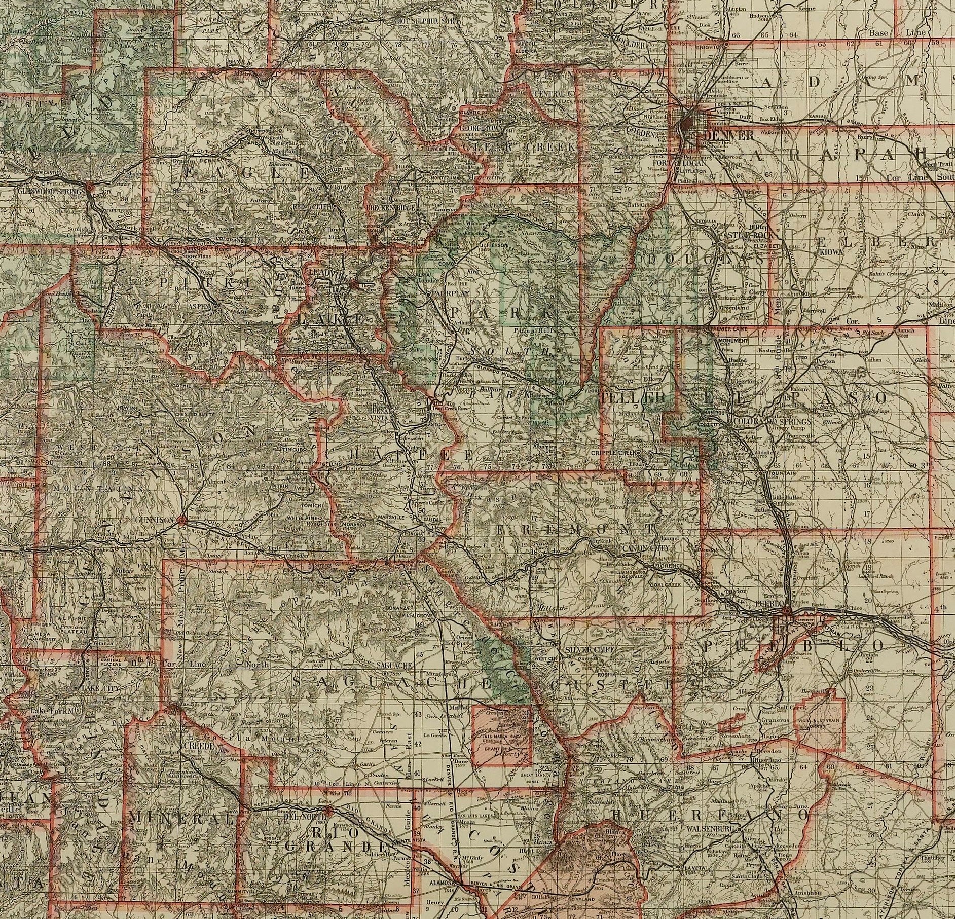
This highly detailed pocket map is a topographical map of the state of Colorado by Louis Nell from 1904. The map "has been compiled from all available surveys in existence... [I]t is consequently the most complete and accurate one ever published, and shows all the information useful to settlers, miners and travelers."
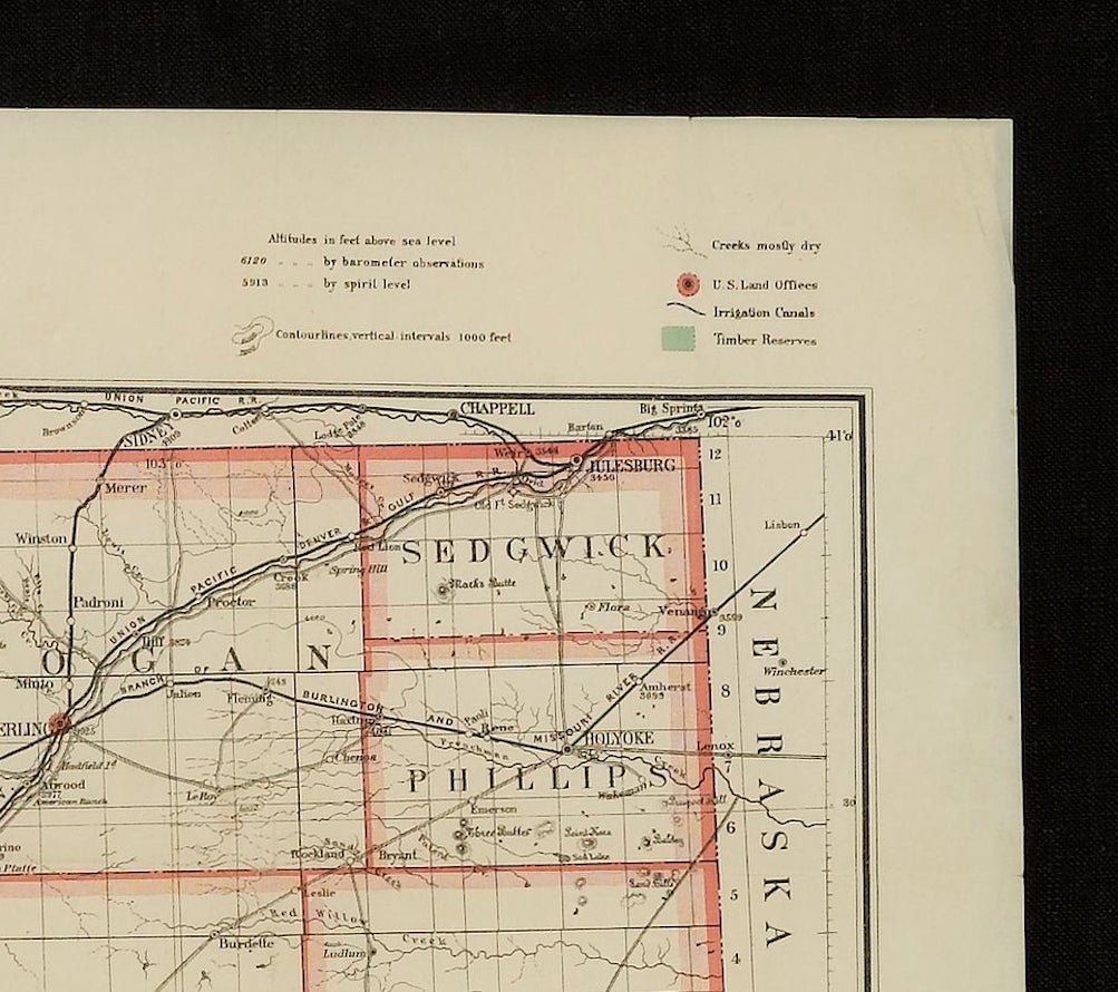
The map is fully engraved with virtually no area left untouched by the engraver. The map is colored to indicate Forest Reserves, agricultural lands, timber reserves, watersheds, and creeks. Towns, villages, settlements, mining areas, railroads and townships are also highlighted. The map is drawn on a scale of 10 miles to every 1 inch. A legend in the upper border outlines the various colors and symbols used within the delicately engraved image.
Louis Nell traveled to Colorado in the mid-1870s as a topographical assistant to leading cartographer George Wheeler. Nell enjoyed the area so much that he settled there and published a series of maps of the state between the years 1880 and 1907. He formed one of the most continuous cartographic records available for the period immediately following Colorado statehood. His intensely detailed maps captured the rapid development of the state, including the great Silver Boom during the late 19th century.
The map was published in Denver by the Kendrick Book & Stationery Company in 1904. The publisher's label on the front endpaper, opposite a 12-page index of towns and their respective populations, summarizes the production nicely in great contemporary language. "This Map of Colorado has been compiled from all available surveys in existence, it is consequently the most complete and accurate one ever published, and shows all the information useful to settlers, miners and travelers, viz: The New Mining Camps, the latest Land Office Surveys, all the modes of transportation, as railroads, roads, and practicable mountain trails, the United States Timber Reserves, the principal irrigation canals in south-eastern Colorado and the more important ranches in those parts where villages are scarce. This is the only map published showing the wagon roads, mountain trails and passes as well as the railroads, and may be safely taken as a guide to travelers, wheelmen, hunters, and prospectors. The map exhibits over 2,000 altitudes of mountains, passes, railroad stations and other towns in feet above sea level, and the approximate height of any location can be found by interpolation between the nearest enclosing contour lines representing vertical intervals of 1,000 feet."
CONDITION:
Overall very good condition. Pocket map that folds into 45 panels and remains affixed to original brown cloth gilt boards. A few small spots of separation along fold lines, since stabilized, and very faint scattered spotting confined to the margins. Printed color is bold.
The map has been framed according to the highest conservation standards, with its original booklet.
Framed Dimensions: 41" H x 50 3/4"W x 2 1/4"D.
Accompanied by our company's letter of authenticity.
Pickup available at Colorado
Usually ready in 4 hours
1904 "Nell's Topographical Map of the State of Colorado"
Colorado
1 Lake Avenue
Colorado Springs CO 80906
United States
Choose options
Frequently Asked Questions
FAQs
Yes, all of our Antiques are certified authentic. Every antique comes with a signed Letter of Authenticity that details the item’s history, its current condition including any conservation, binding, or framing work, and the item’s provenance. The Letters of Authenticity are priced valuations by our authentication specialists, who assure that items are original and unconditionally guaranteed as genuine for life.
We pack and ship your items from our gallery in Colorado Springs. You may also choose to come pick up your order. Antique items are carefully packed and insured during shipping. The shipping price will be calculated at checkout.
We acquire from a variety of trusted sources all over the world, but mostly through auctions and private collections within the United States. All provenance information will be listed on the Letter of
Authenticity accompanying your purchase.