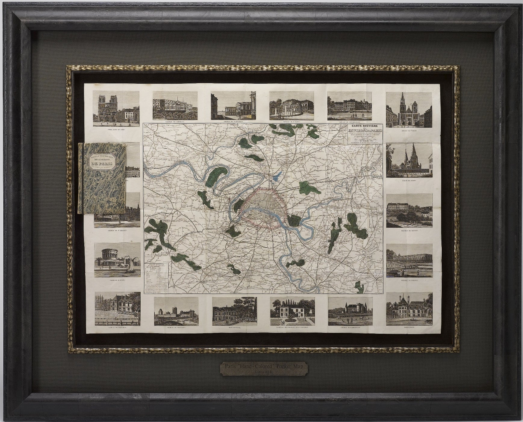
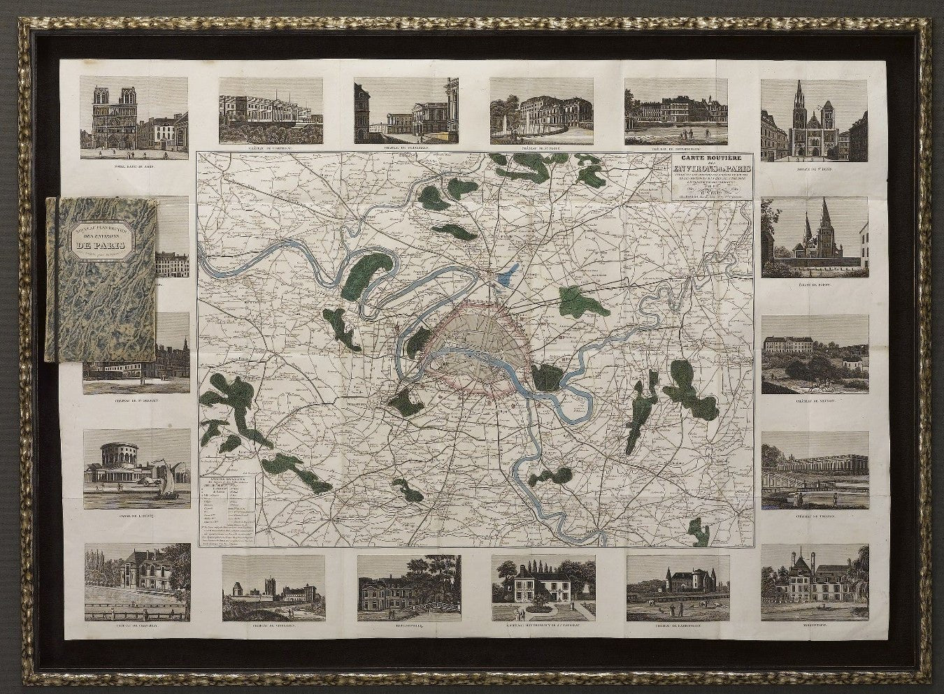
1841 Carte Routiere des Environs de Paris
Sale price$3,250.00

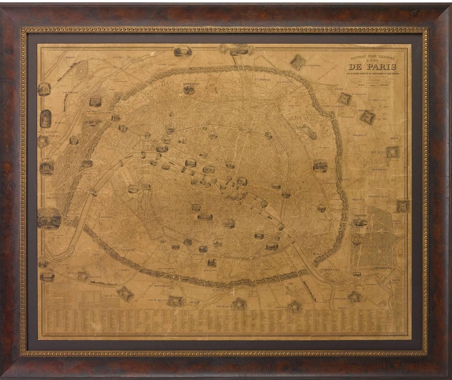
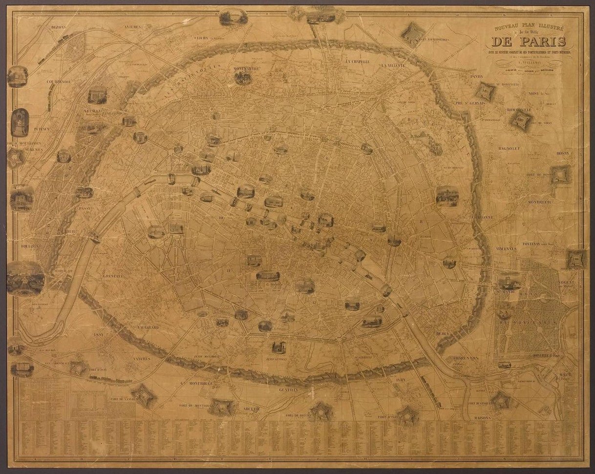
1845 Nouveau Plan Illustre de la Ville de Paris by A. Vuillemin
Sale price$3,950.00
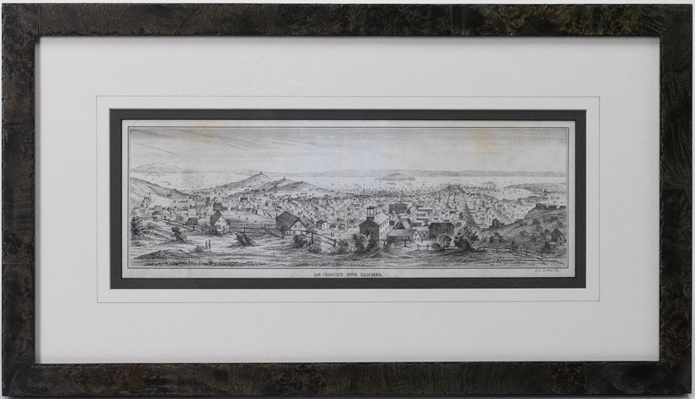
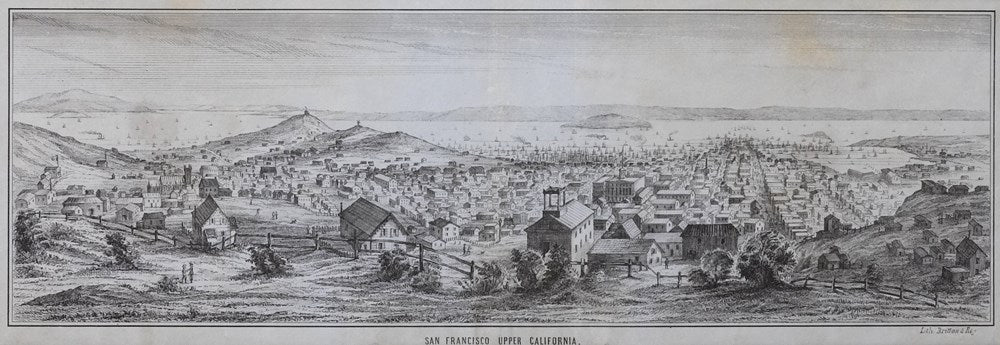
1851 “San Francisco, Upper California” Lettersheet by Britton & Rey
Sale price$1,295.00
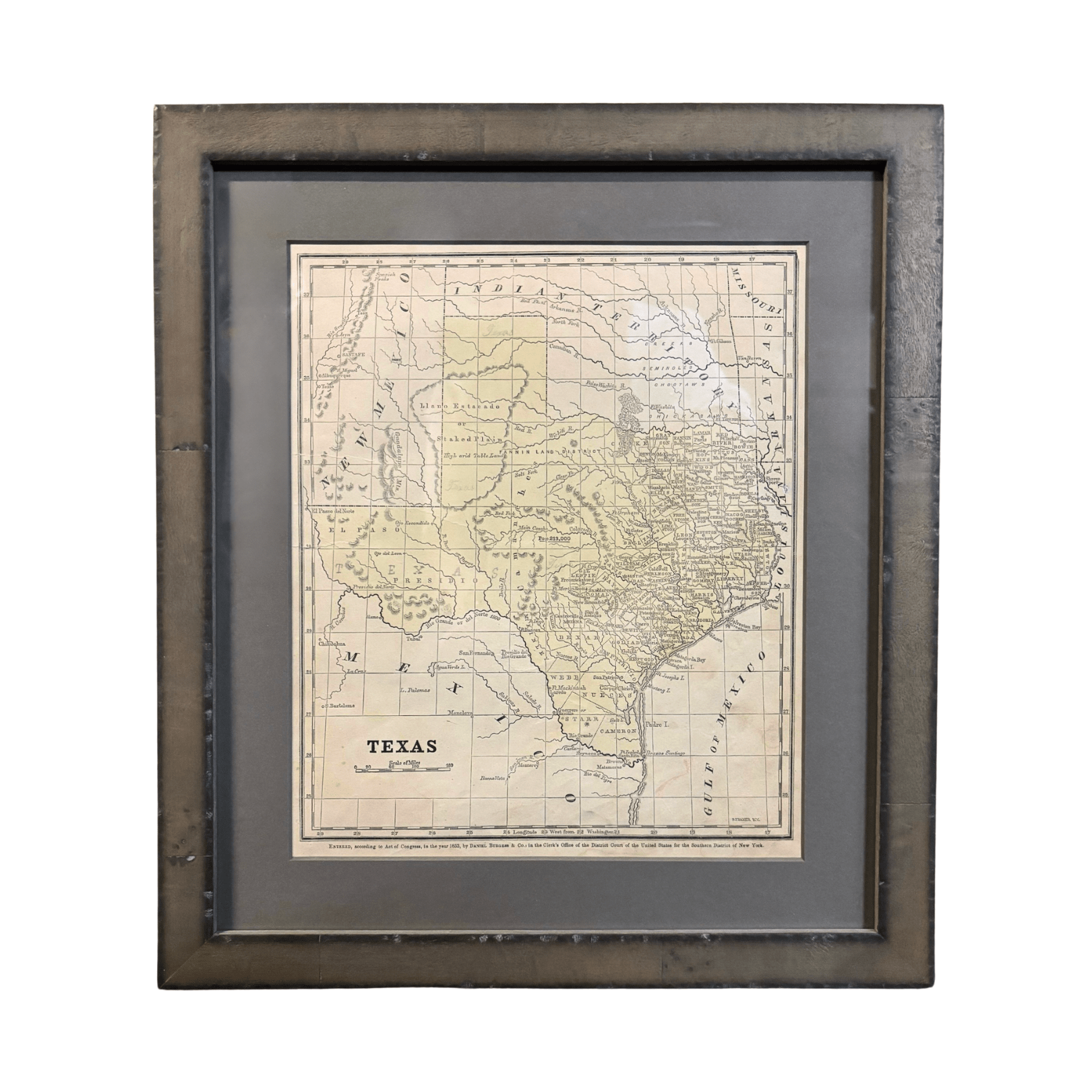

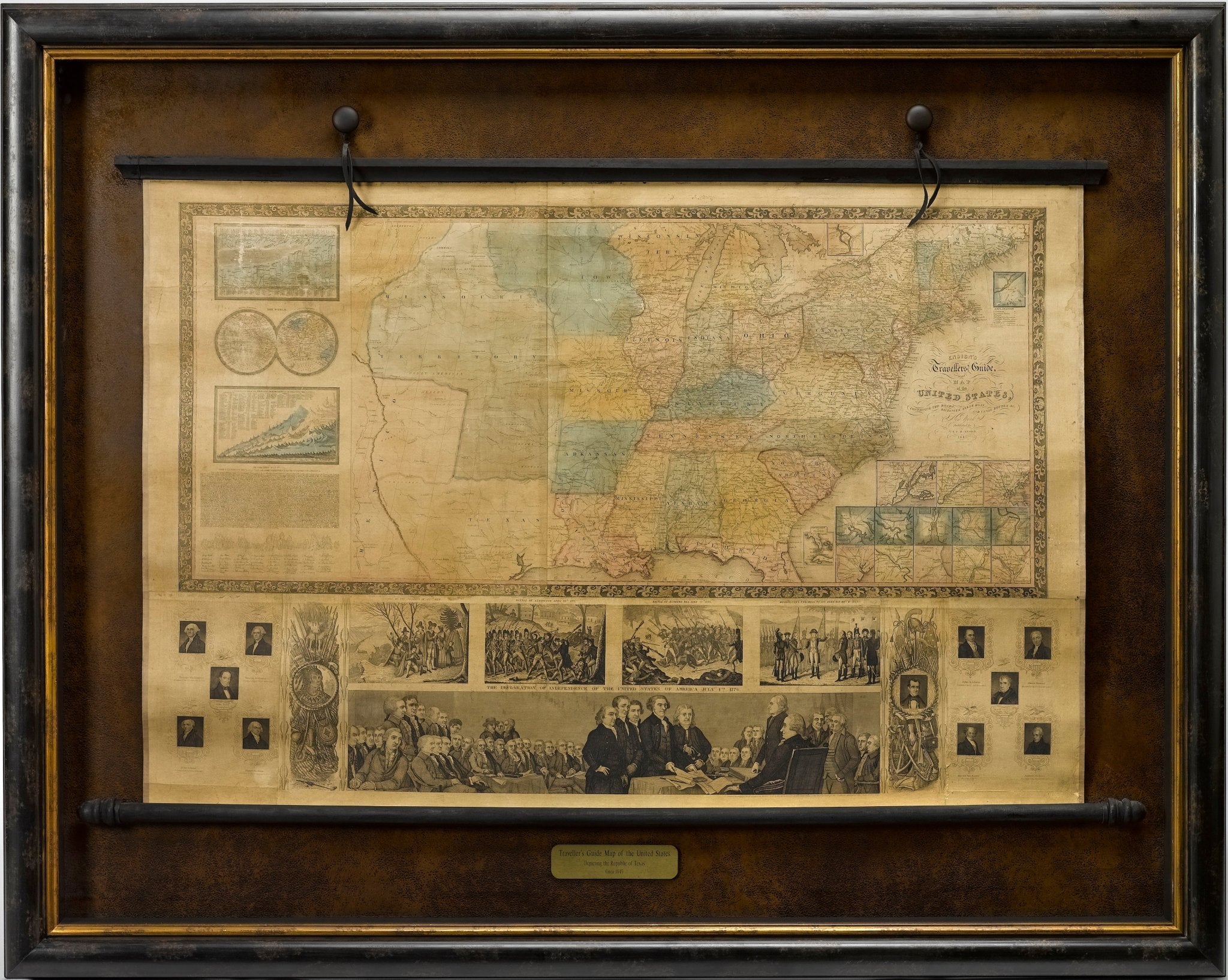
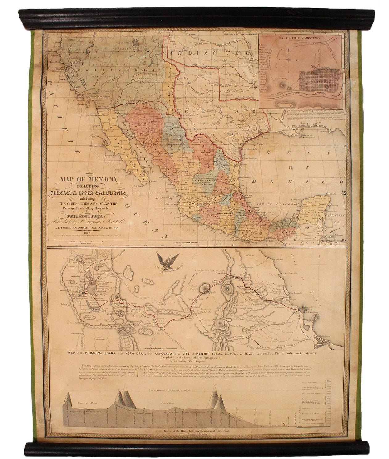
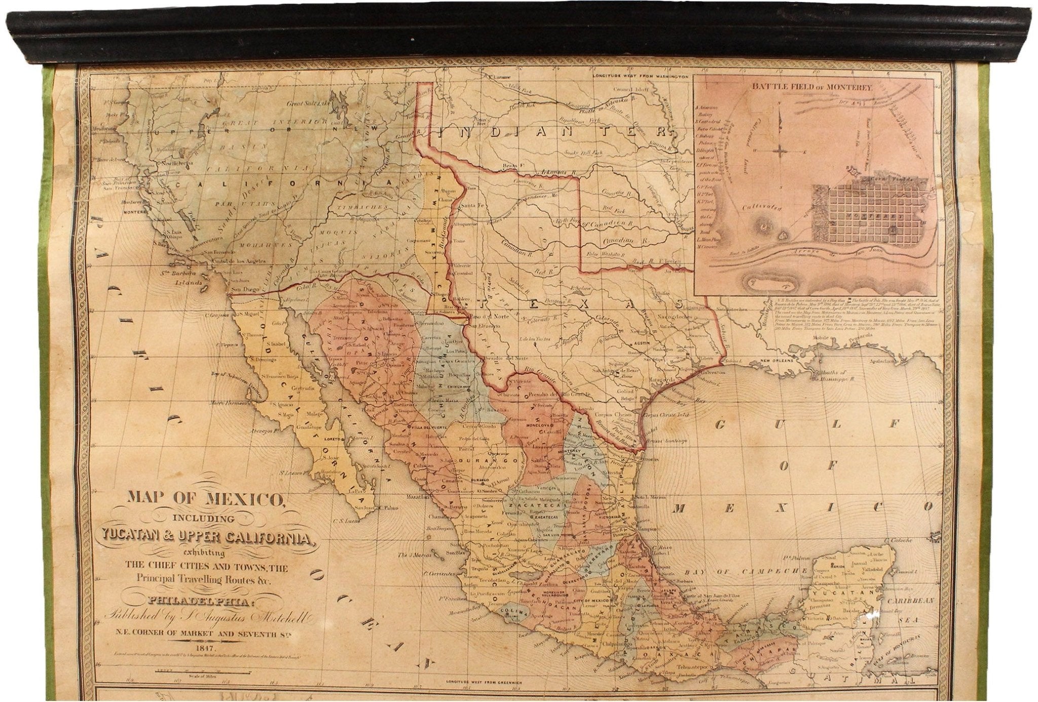
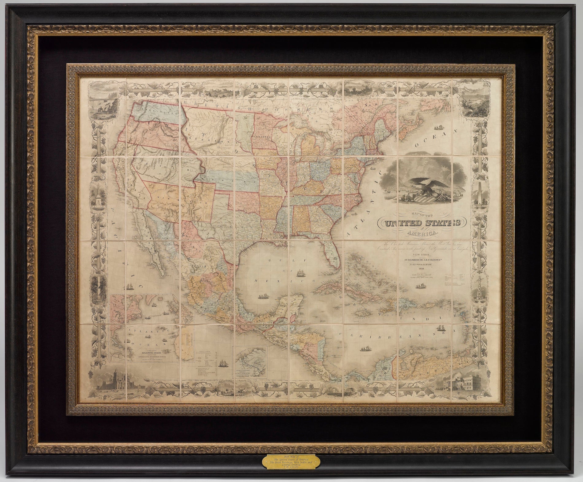
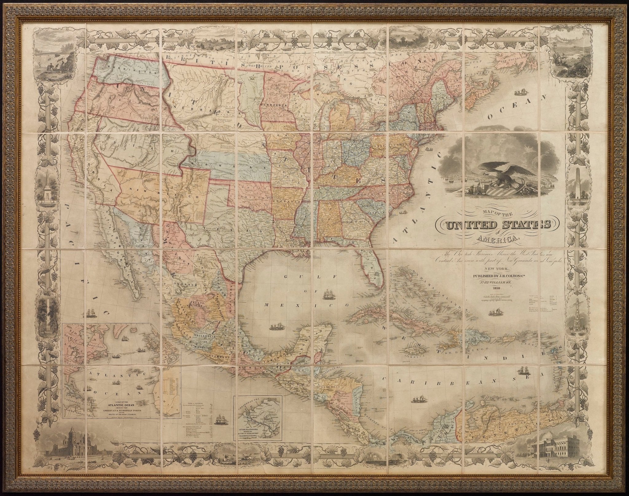
1853 "Texas" Map by Daniel Burgess
Sale price$850.00
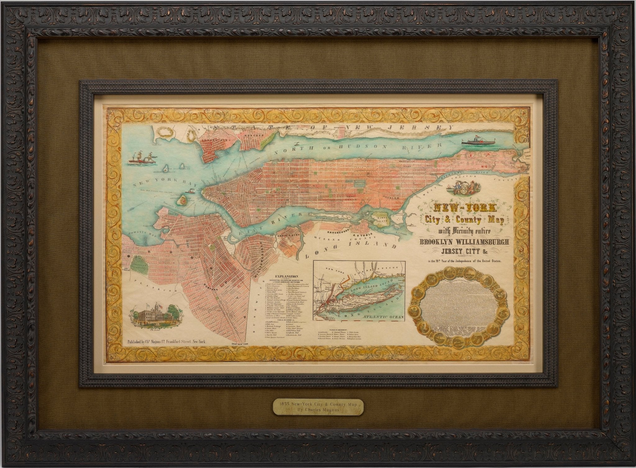
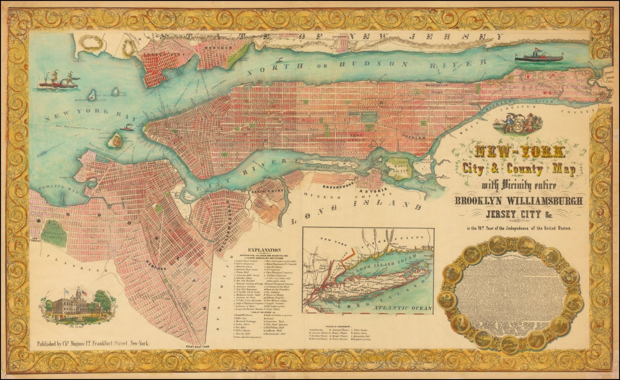
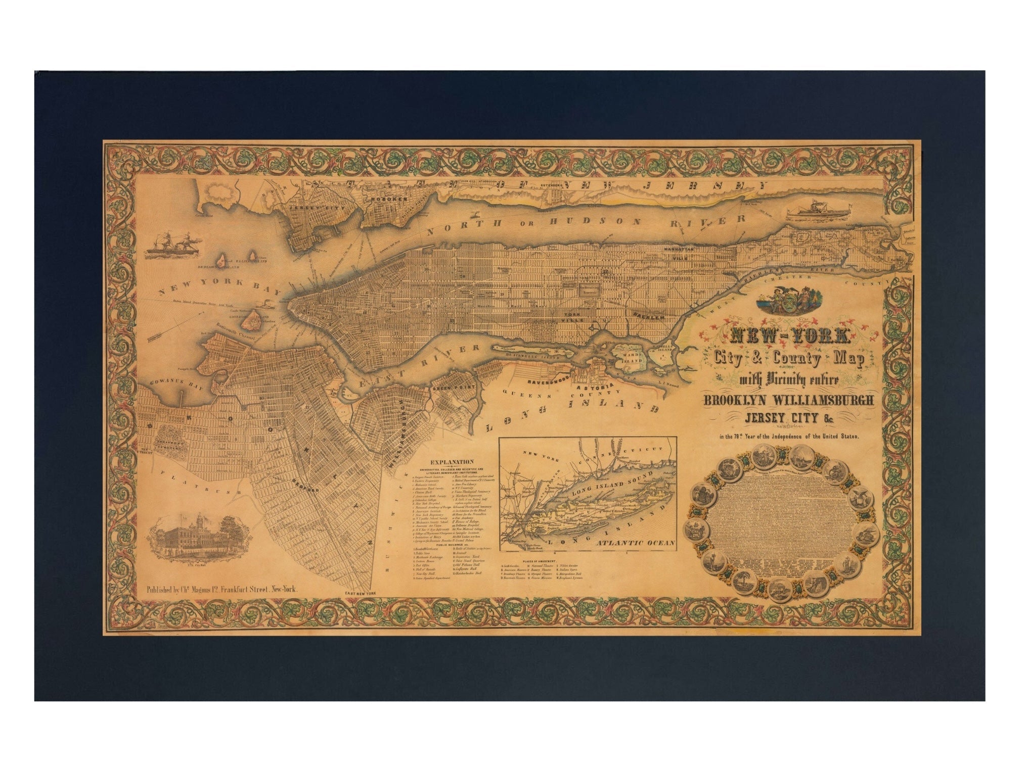
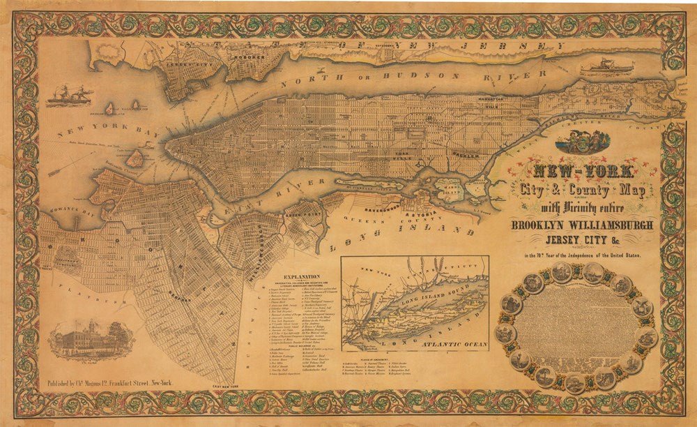
1855 "New-York City & County Map with Vicinity entire Brooklyn Wiliamsburgh Jersey City &c." Map by Charles Magnus
Sale price$7,950.00
Regular price$9,500.00
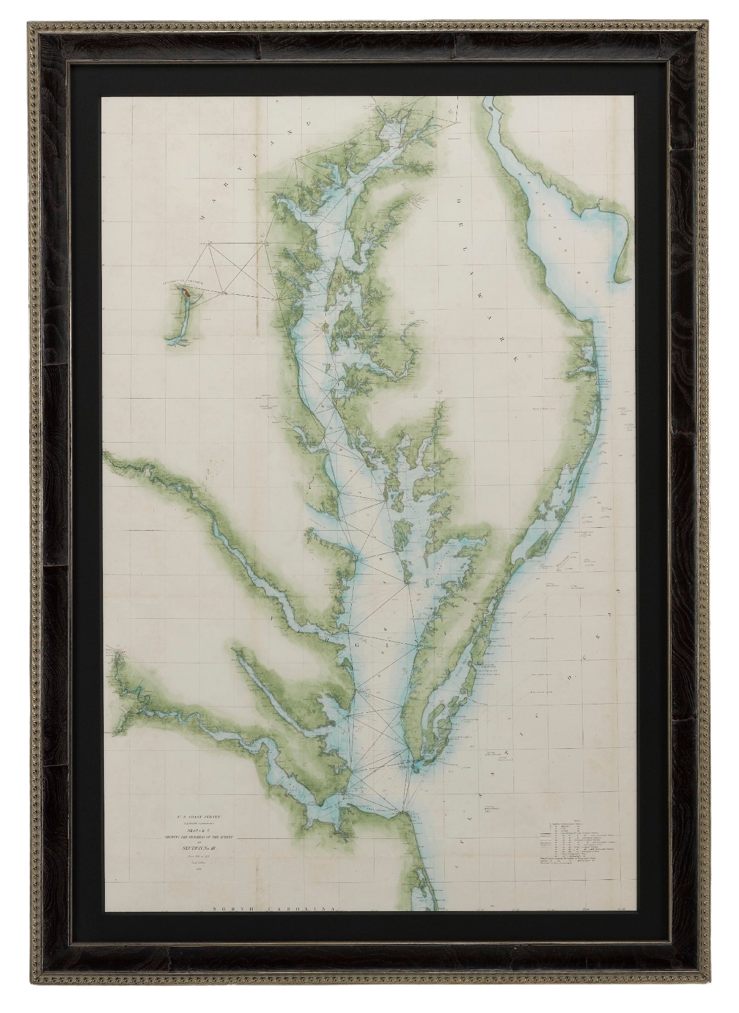
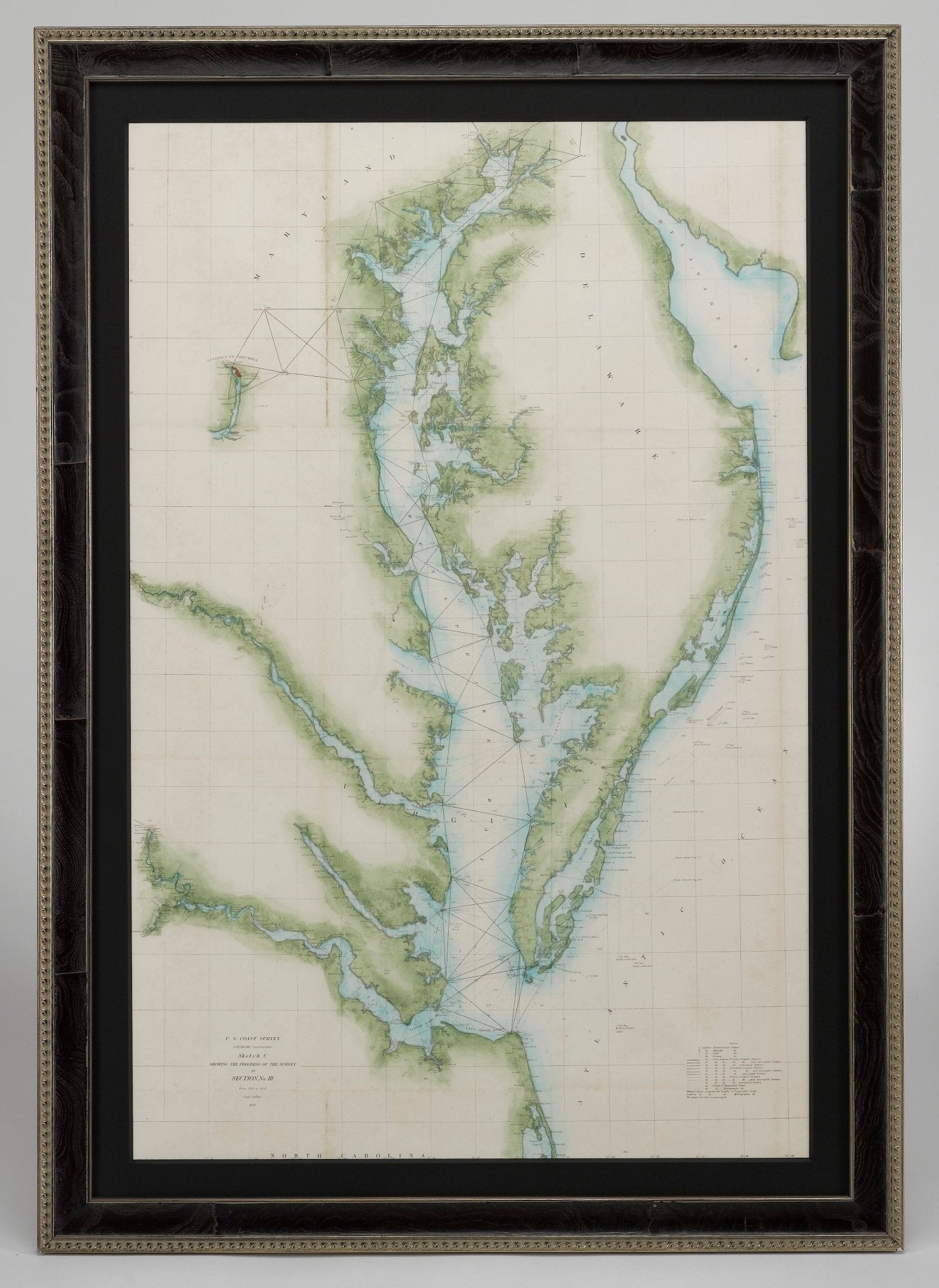
1856 "U.S. Coast Survey Map of Chesapeake Bay and Delaware Bay" by A. D. Bache.
Sale price$4,250.00


1860 "Johnson's North and South Carolina" by Johnson & Browning
Sale price$1,125.00
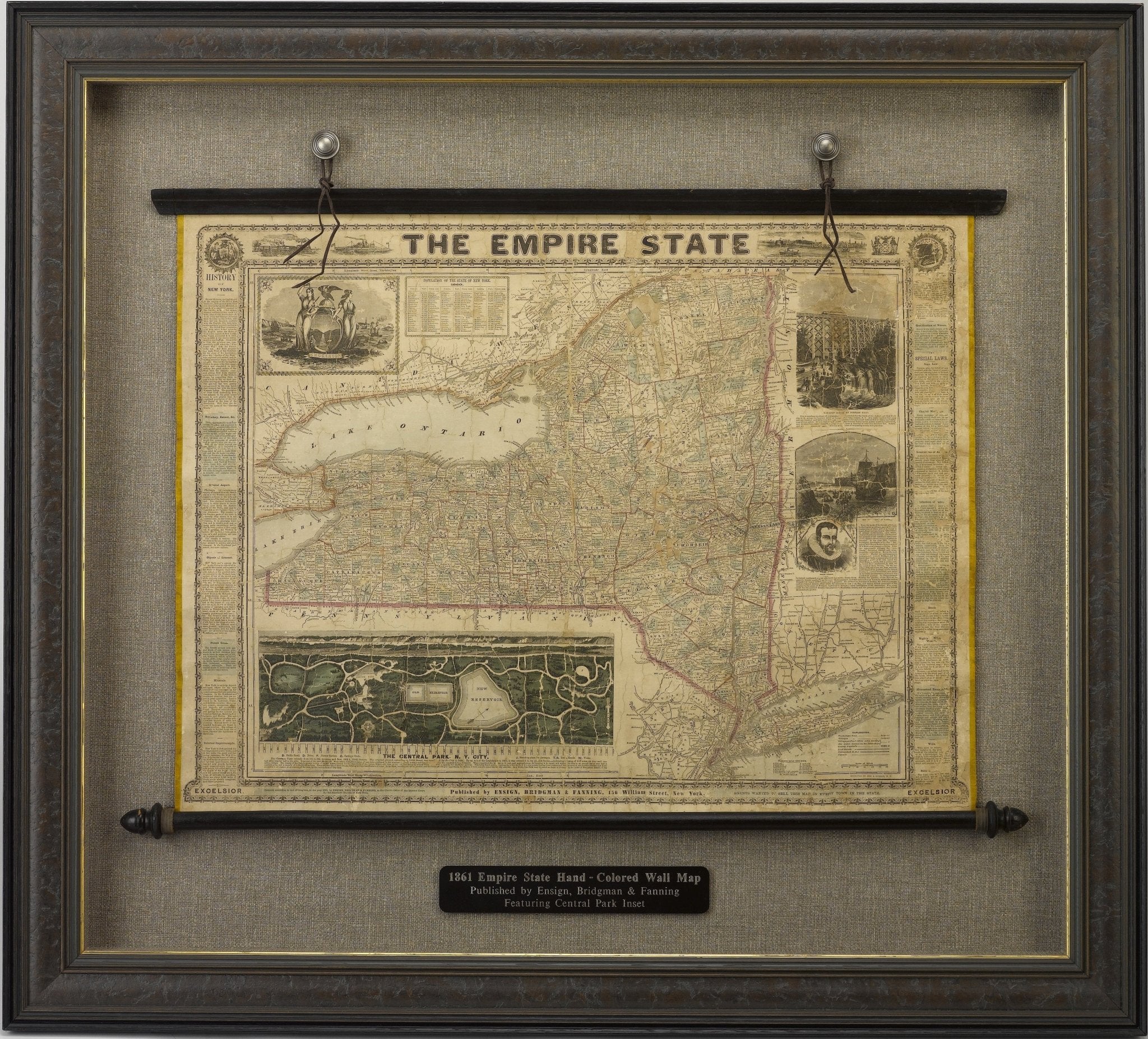
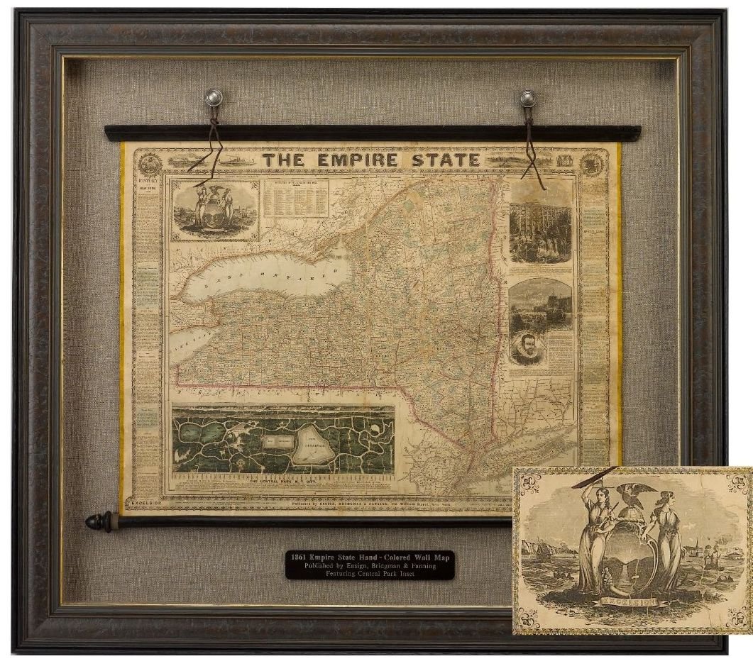
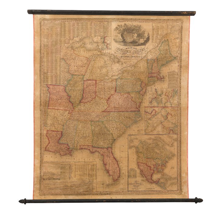
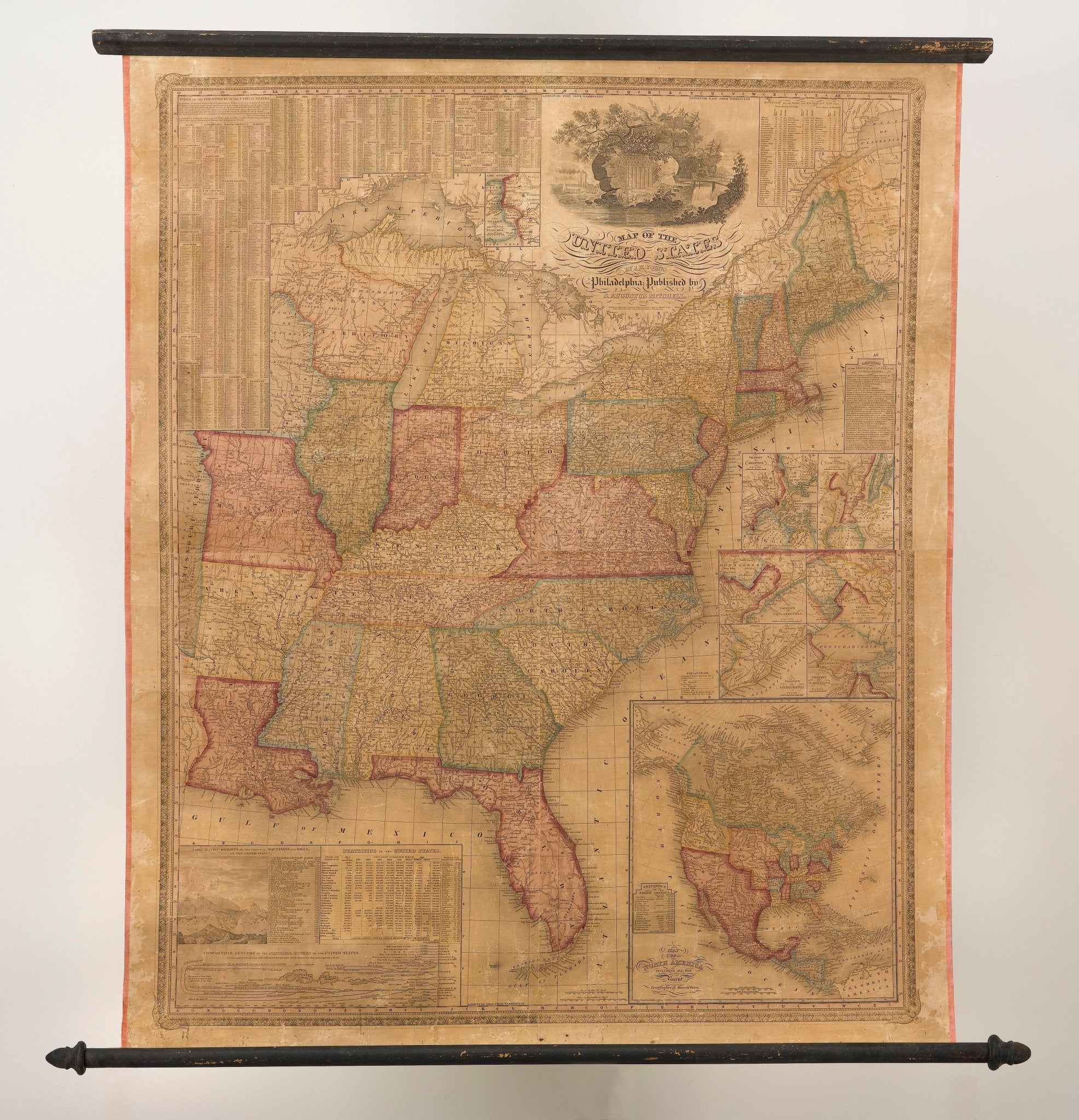
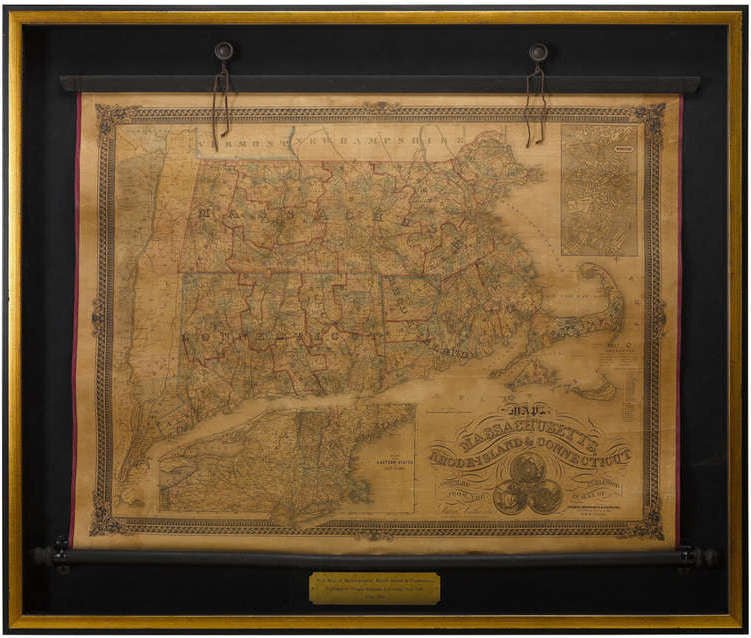
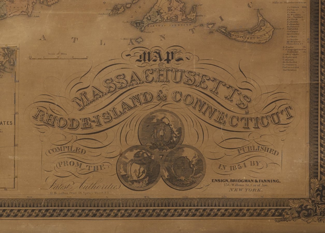
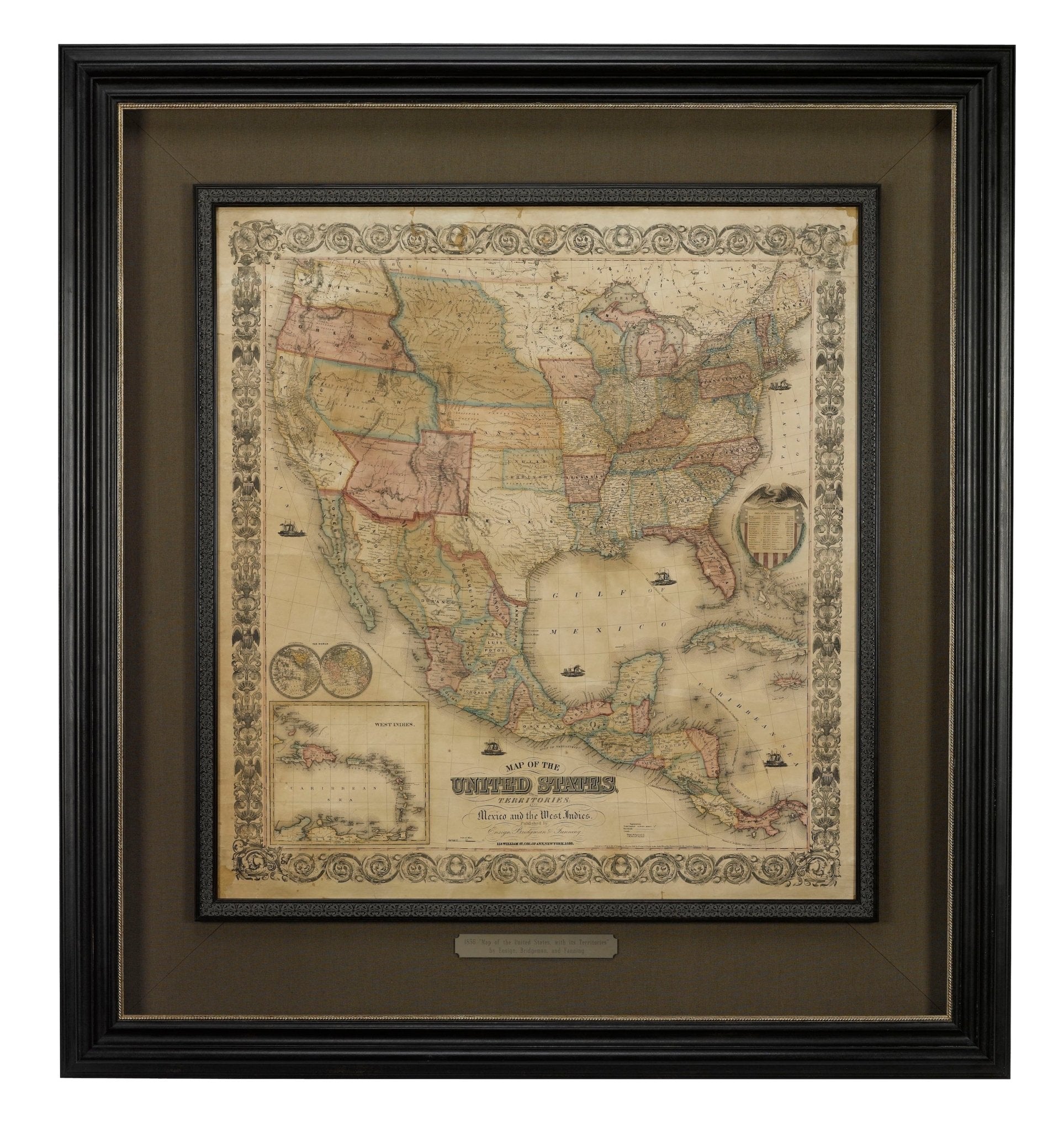
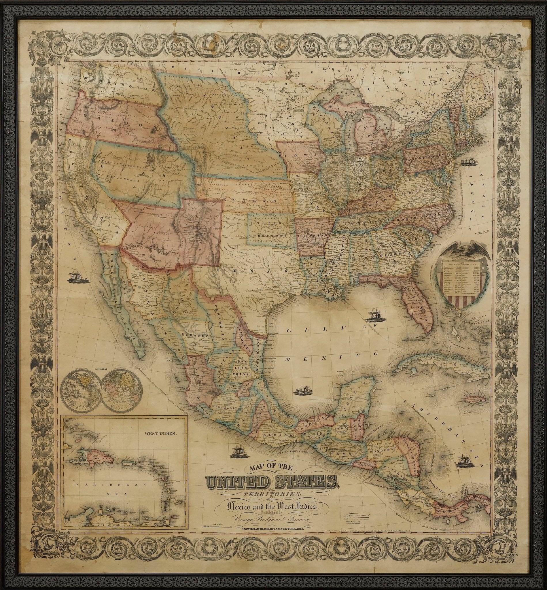
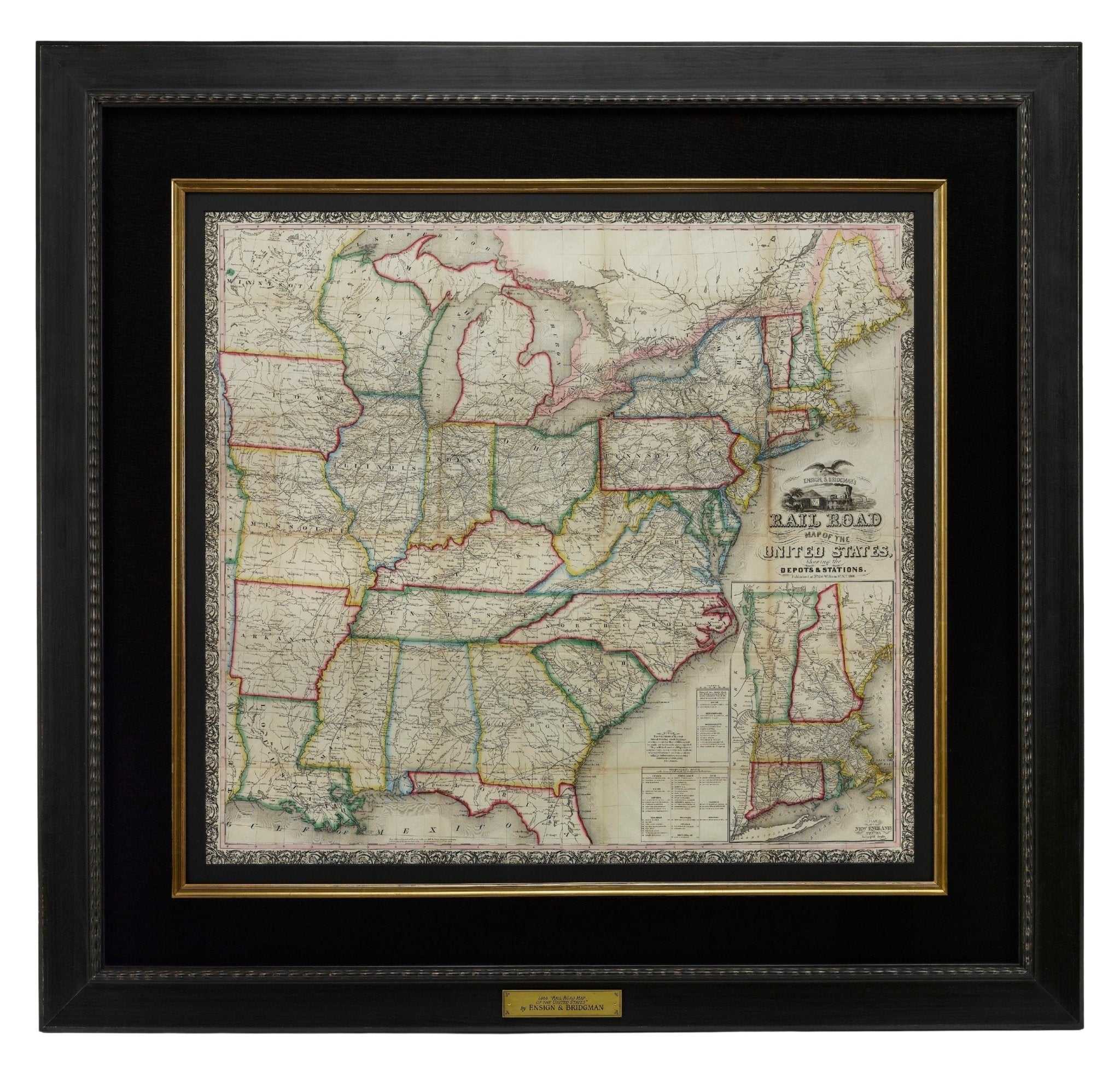
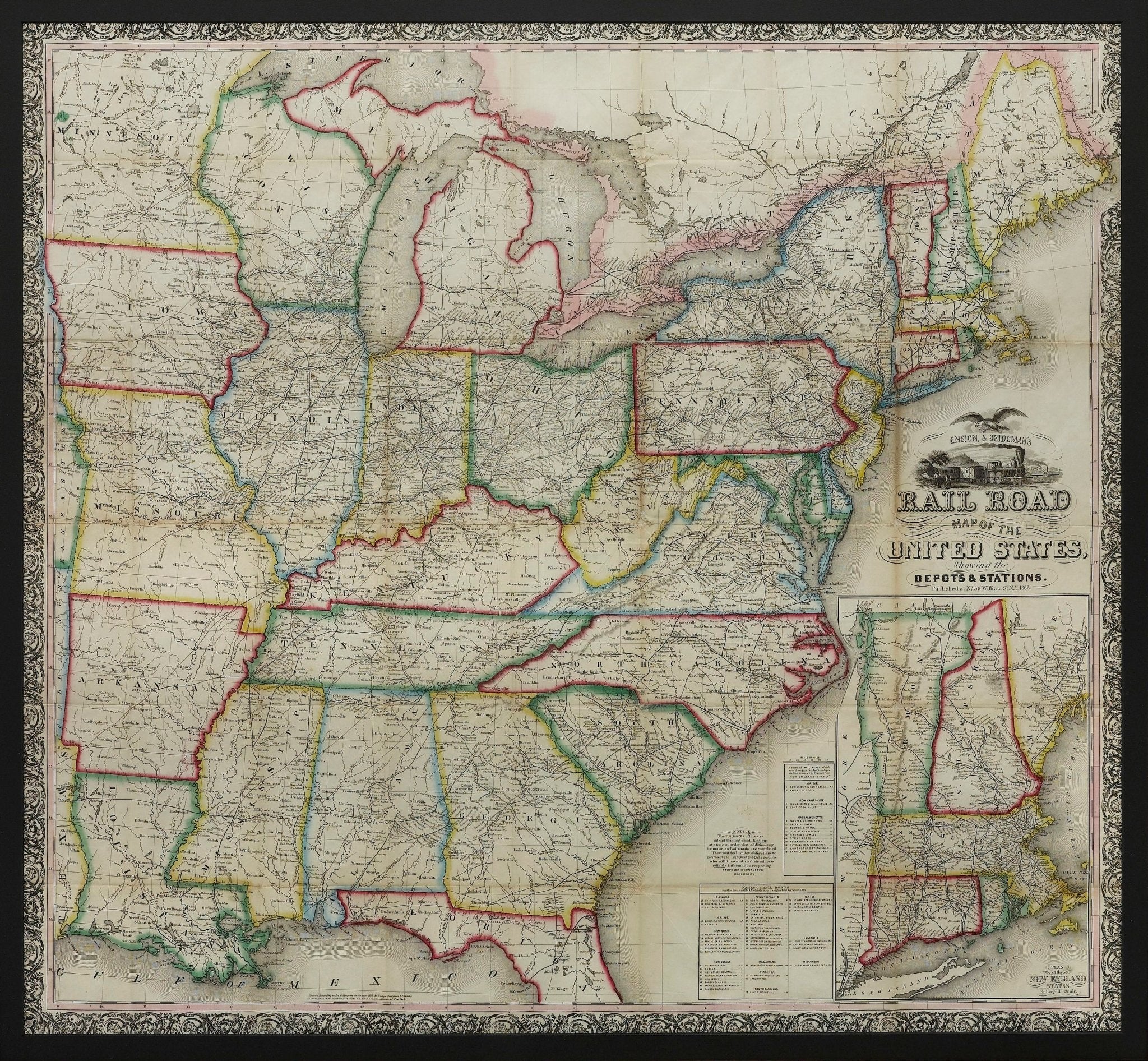
1861 "The Empire State" Wall Map by Ensign, Bridgman & Fanning
Sale price$7,950.00
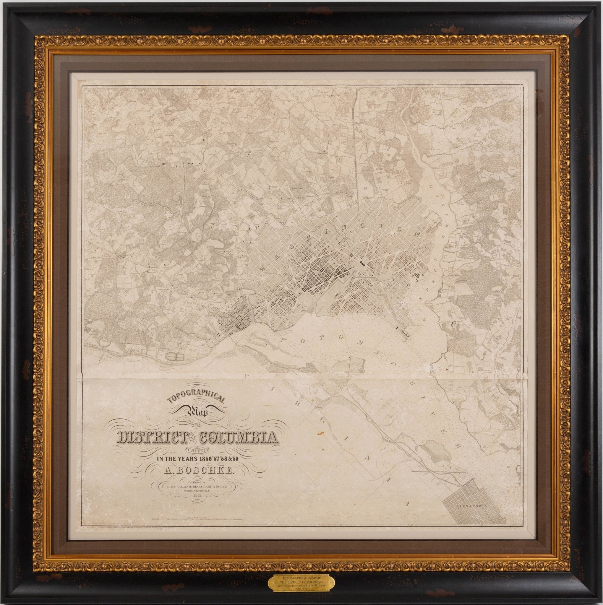
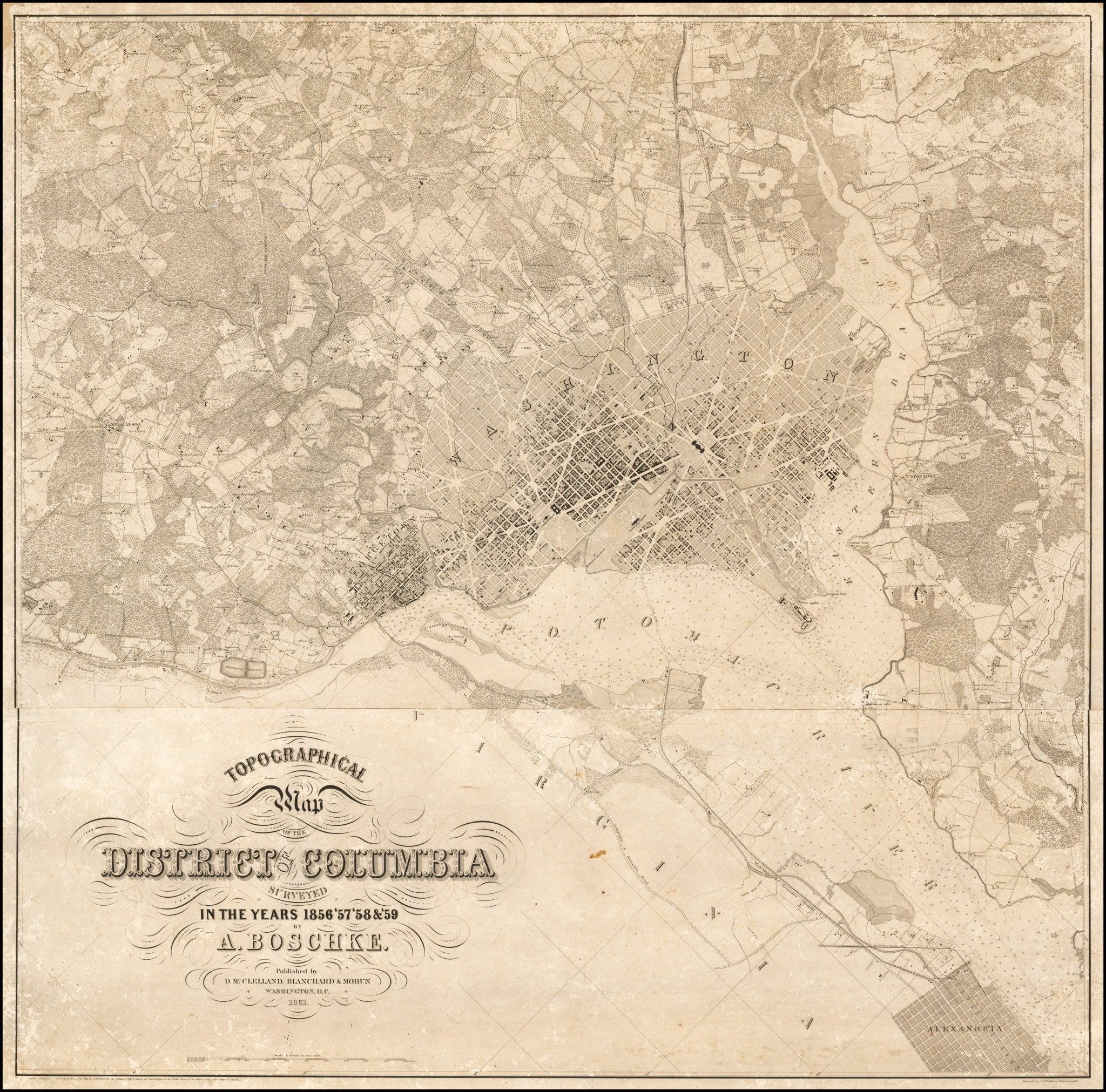
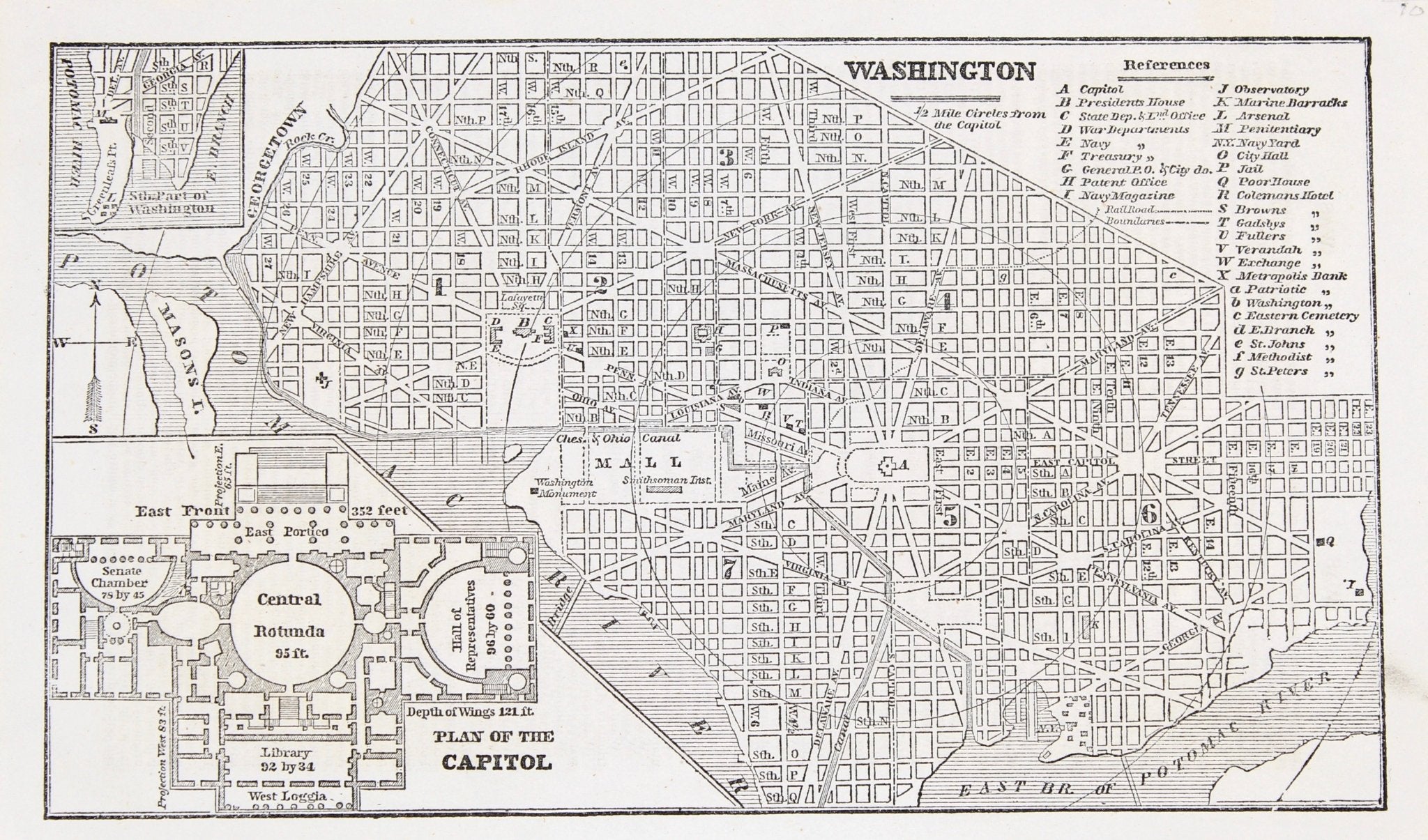
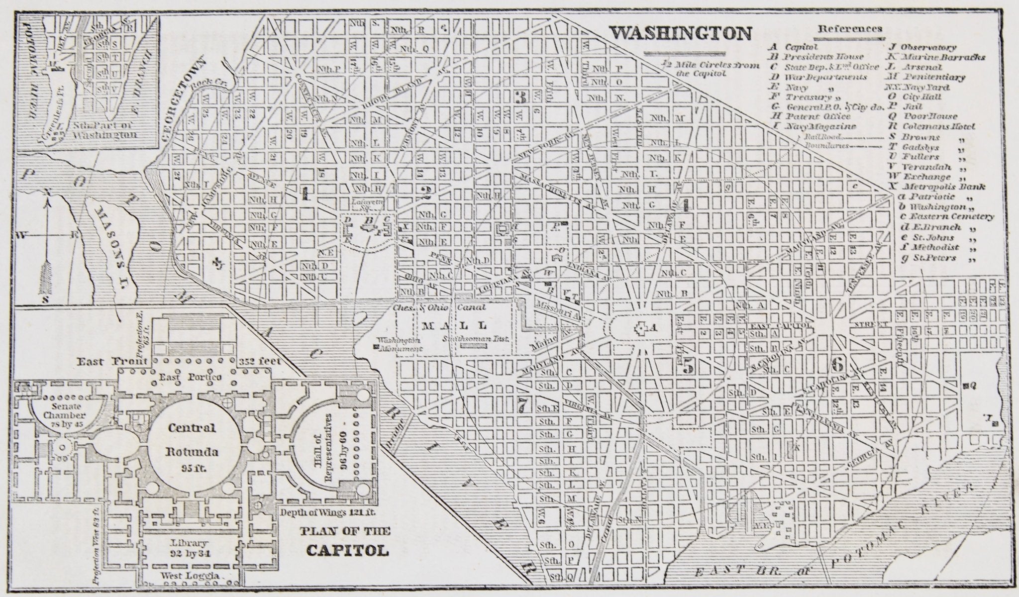
1861 "Topographical Map of the District of Columbia Surveyed in the Years 1856 '57 '58 & '59" by Albert Boschke
Sale price$40,000.00
Regular price$45,000.00
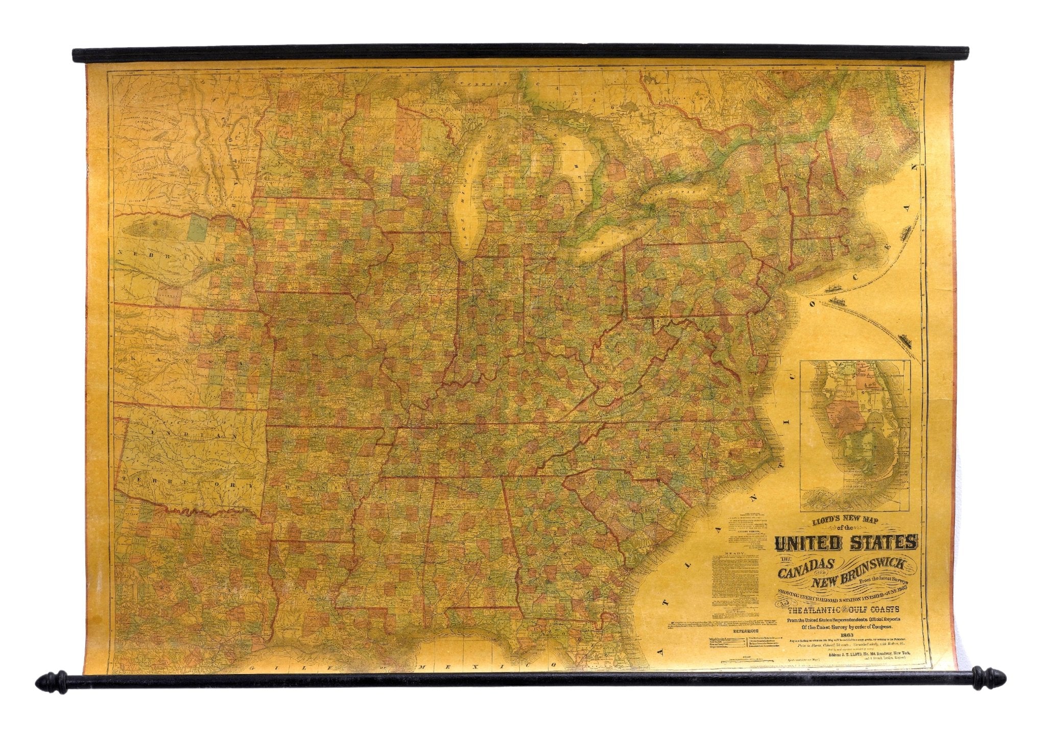
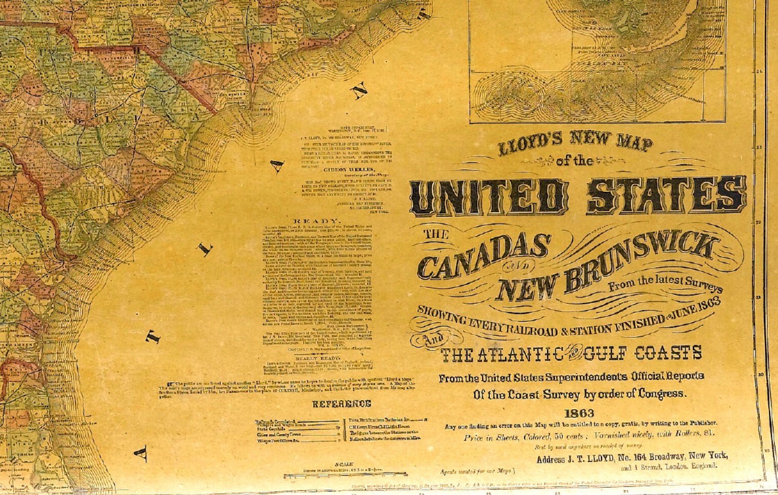
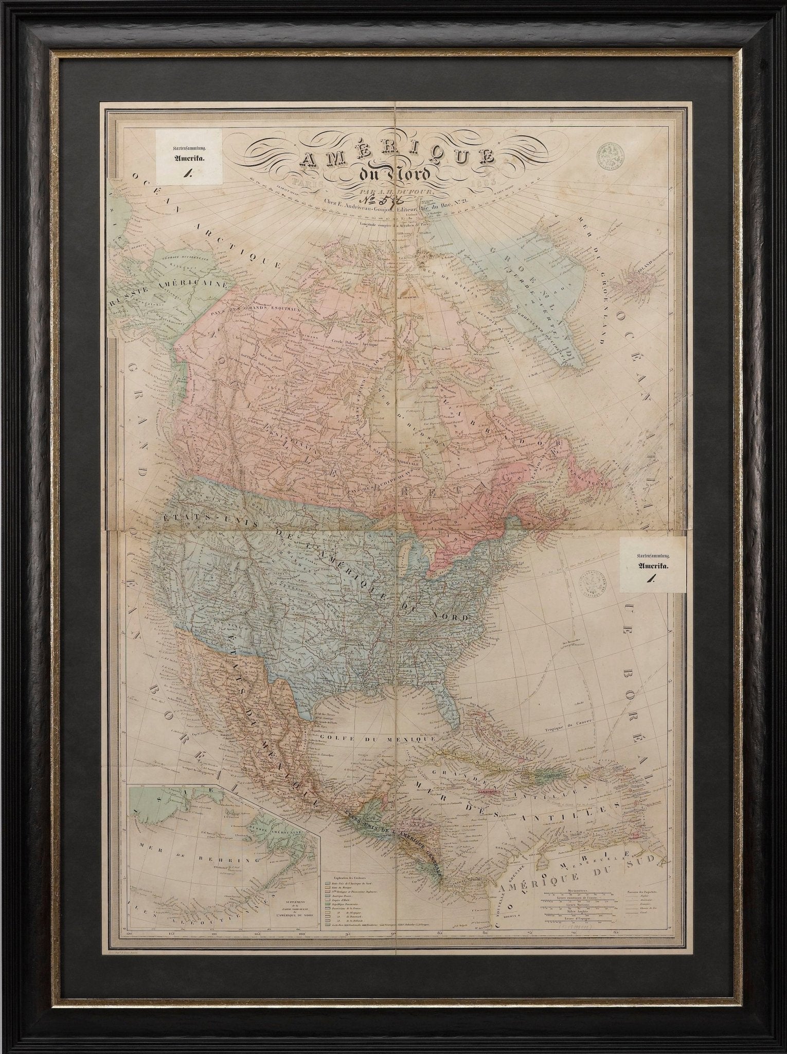
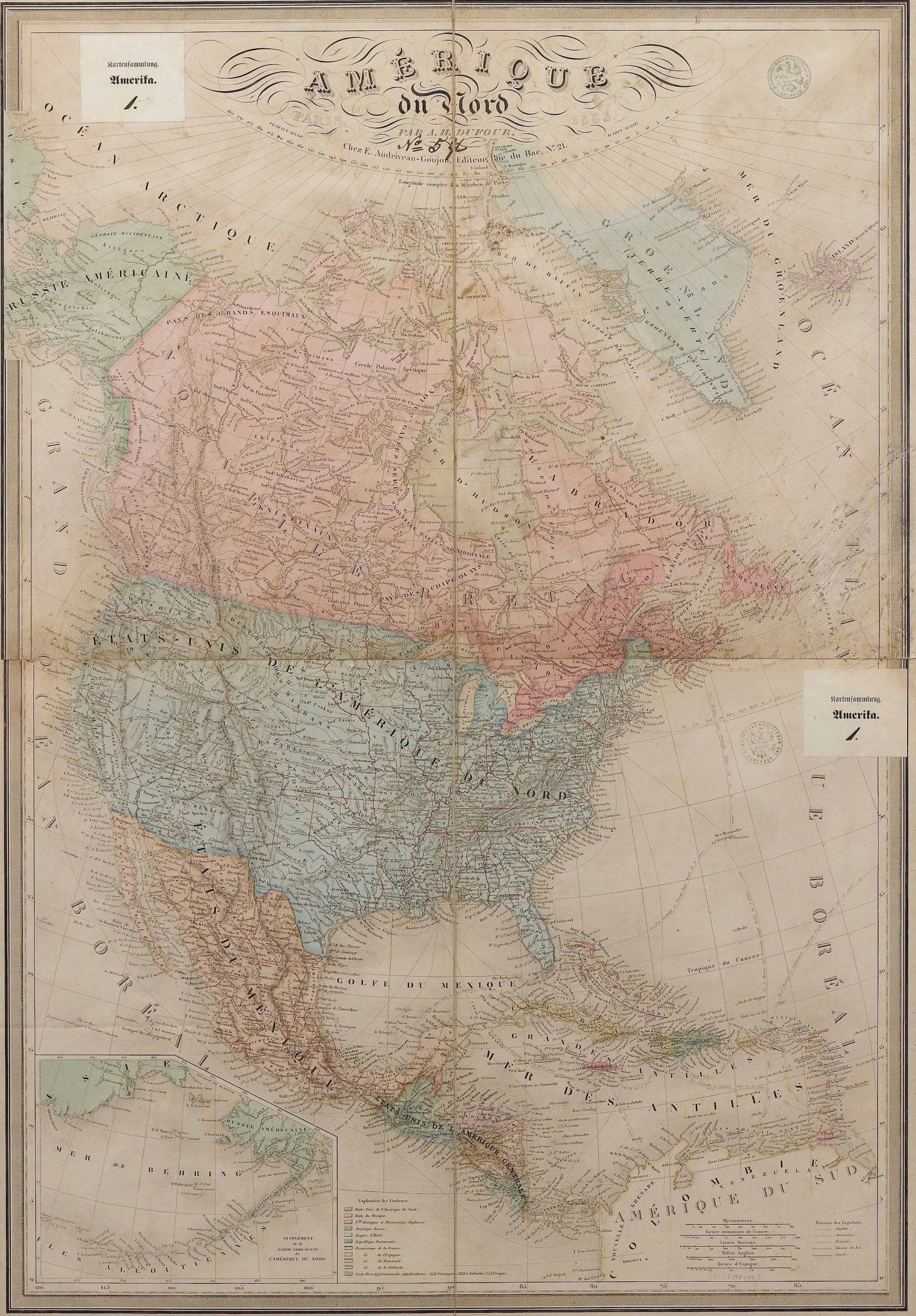
1864 "Amerique du Nord" by Adolphe Hippolyte Dufour
Sale price$4,500.00


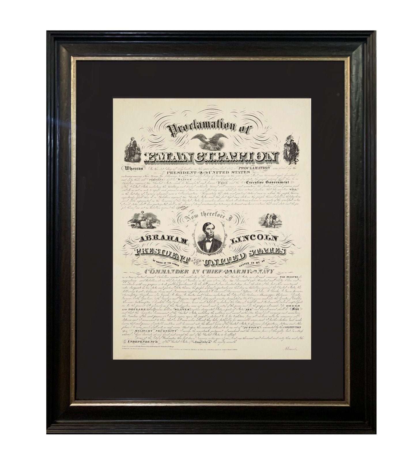
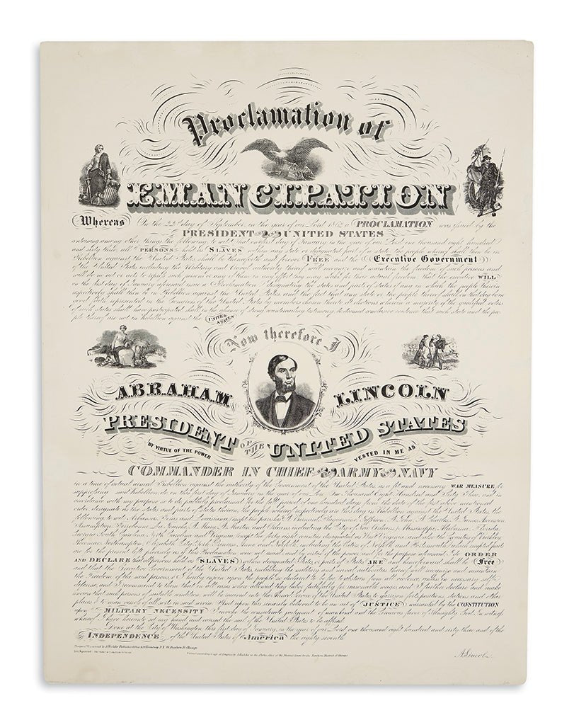
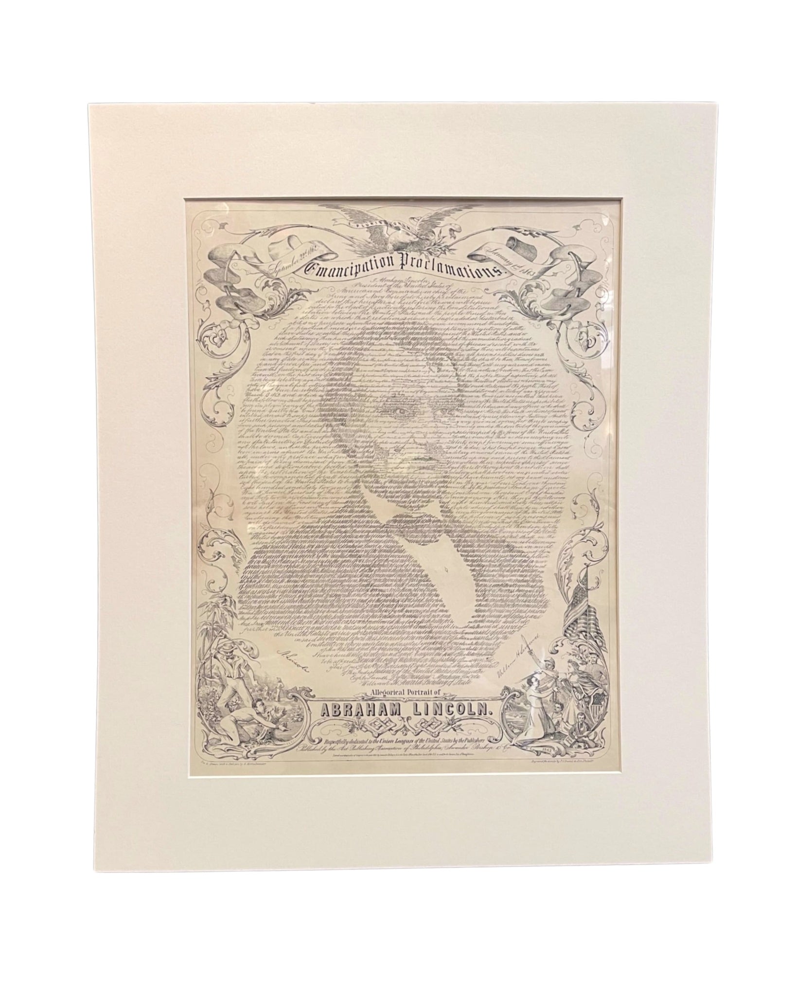
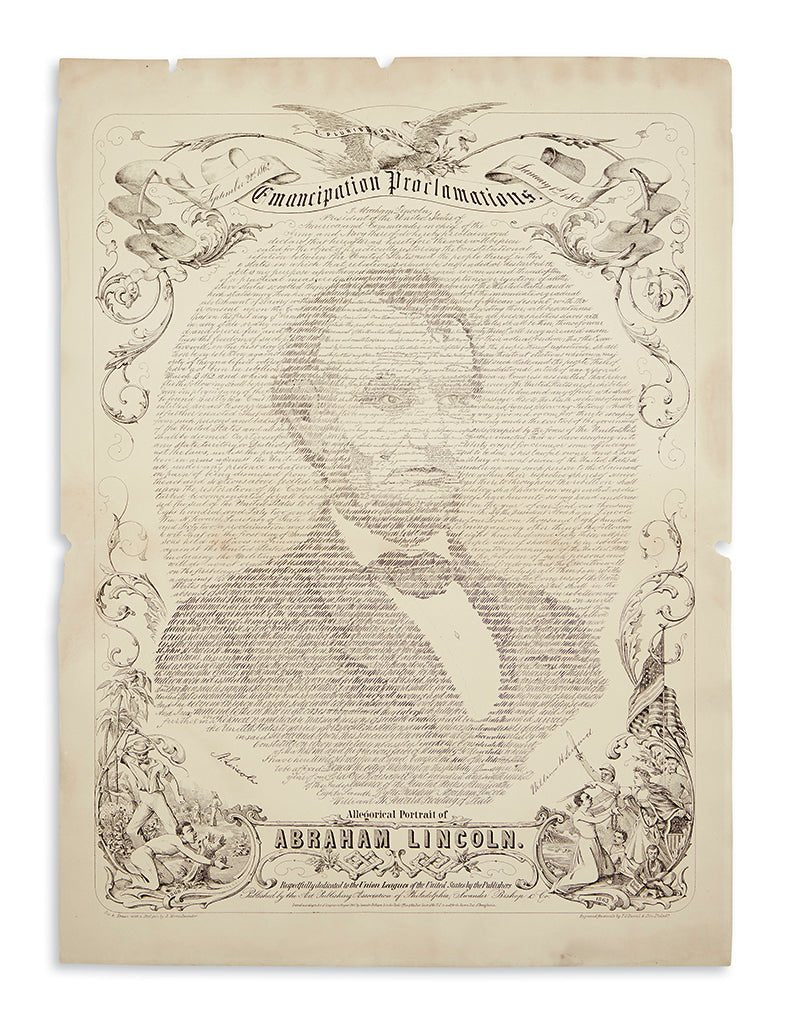
1864 Abraham Lincoln Presidential Election Soldier's Ballot
Sale price$1,500.00
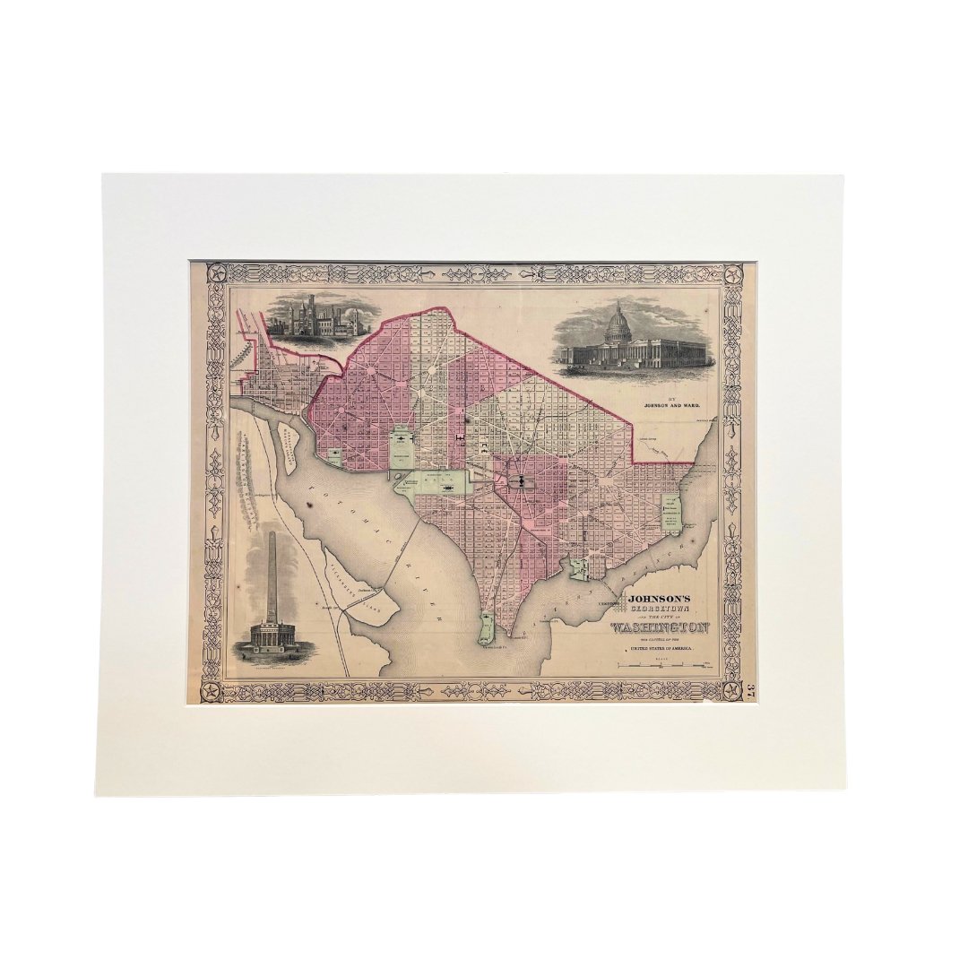
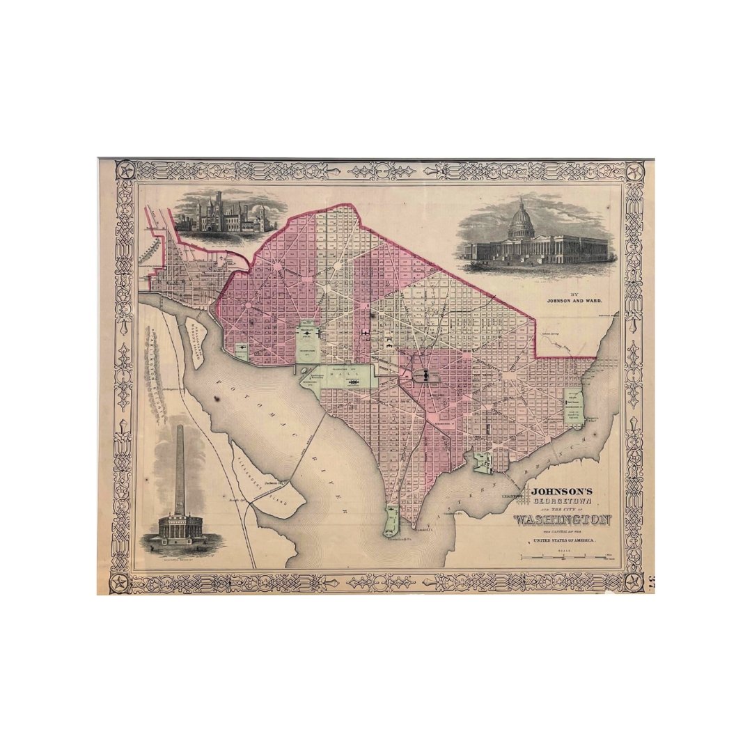
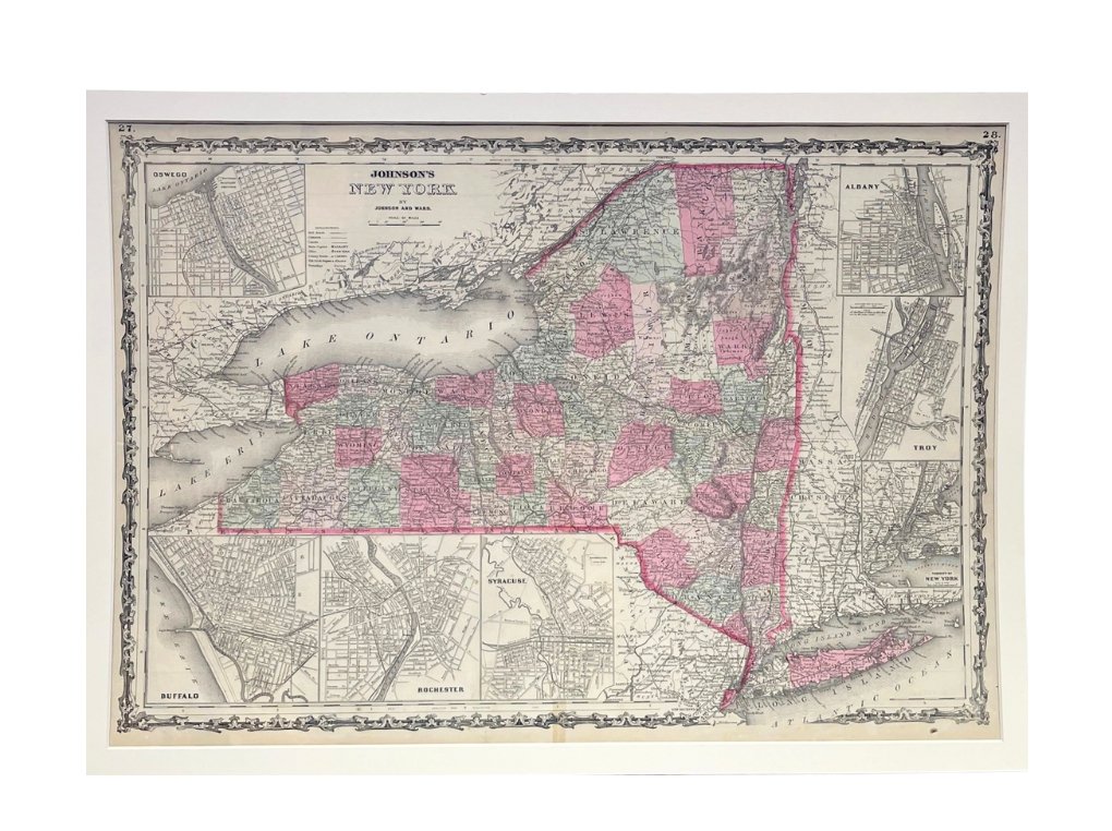
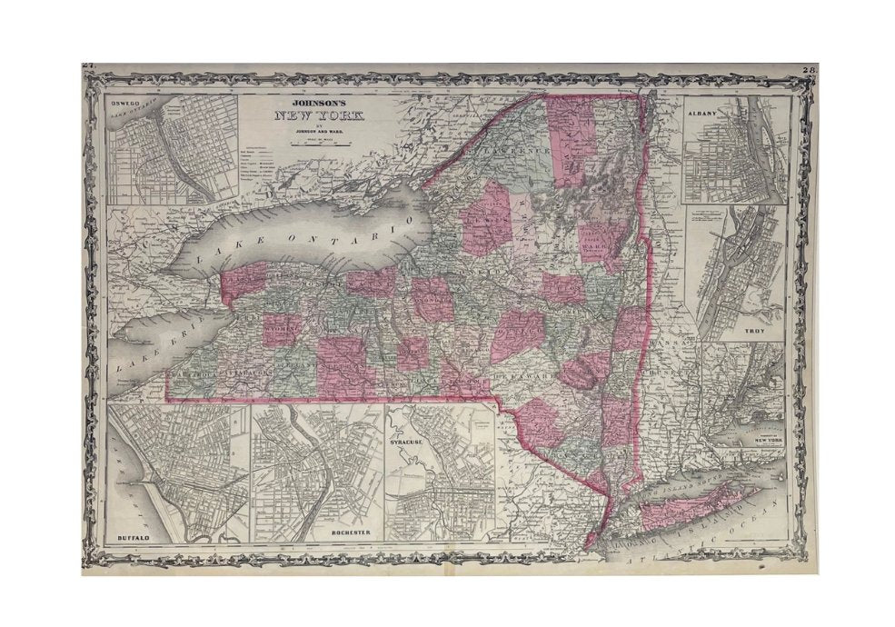
1865 "Johnson's New York" Map by Johnson and Ward
Sale price$650.00
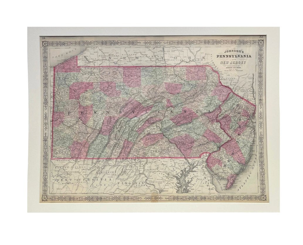
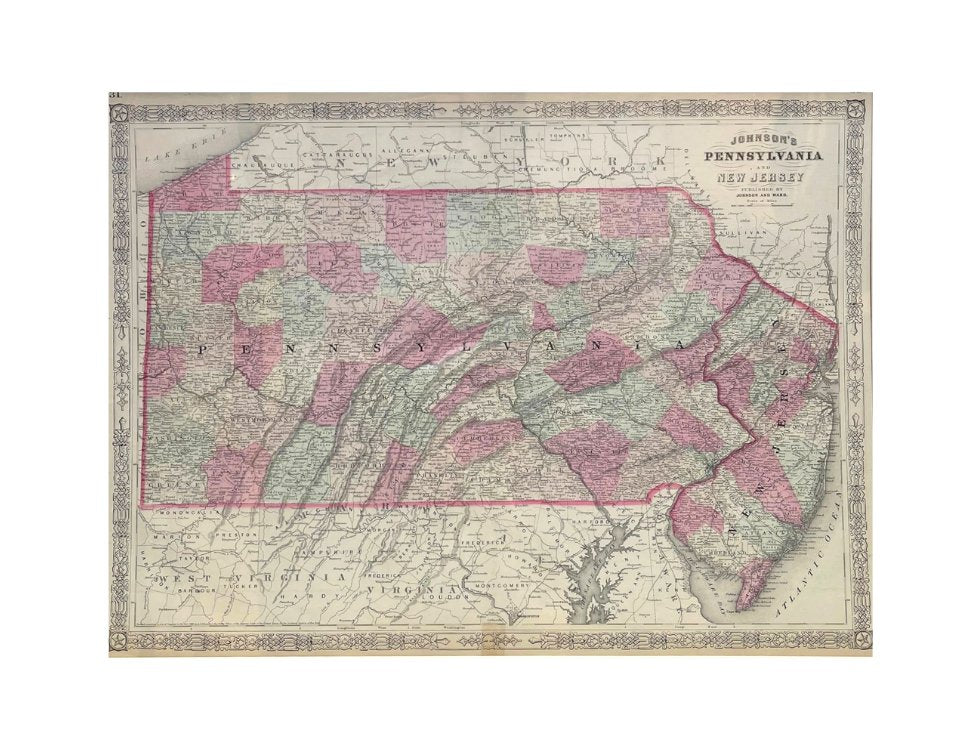
1865 "Johnson's Pennsylvania and New Jersey" Map by Johnson and Ward
Sale price$650.00
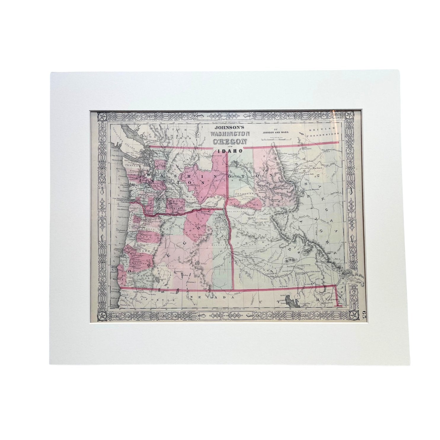
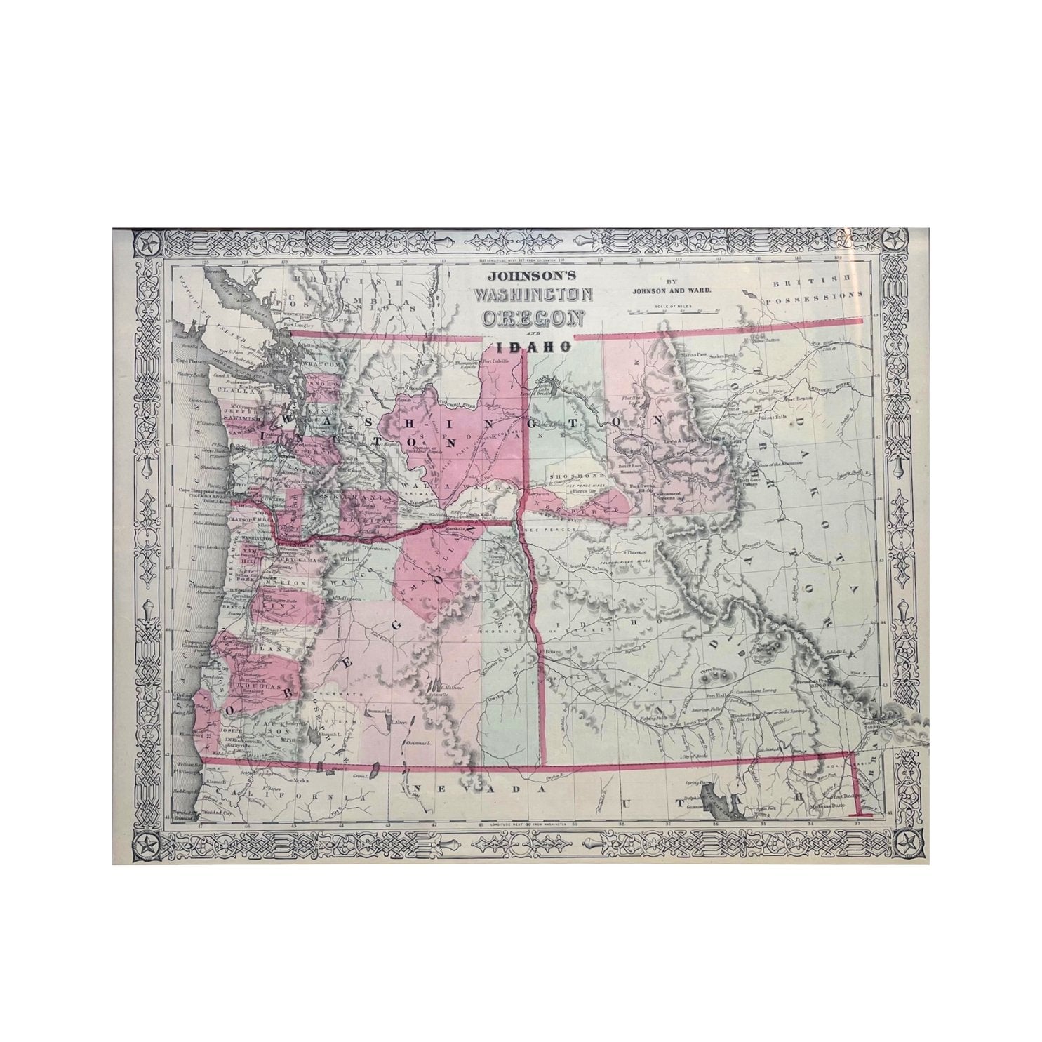
1865 "Johnson's Washington, Oregon and Idaho" Map by Johnson and Ward
Sale price$650.00


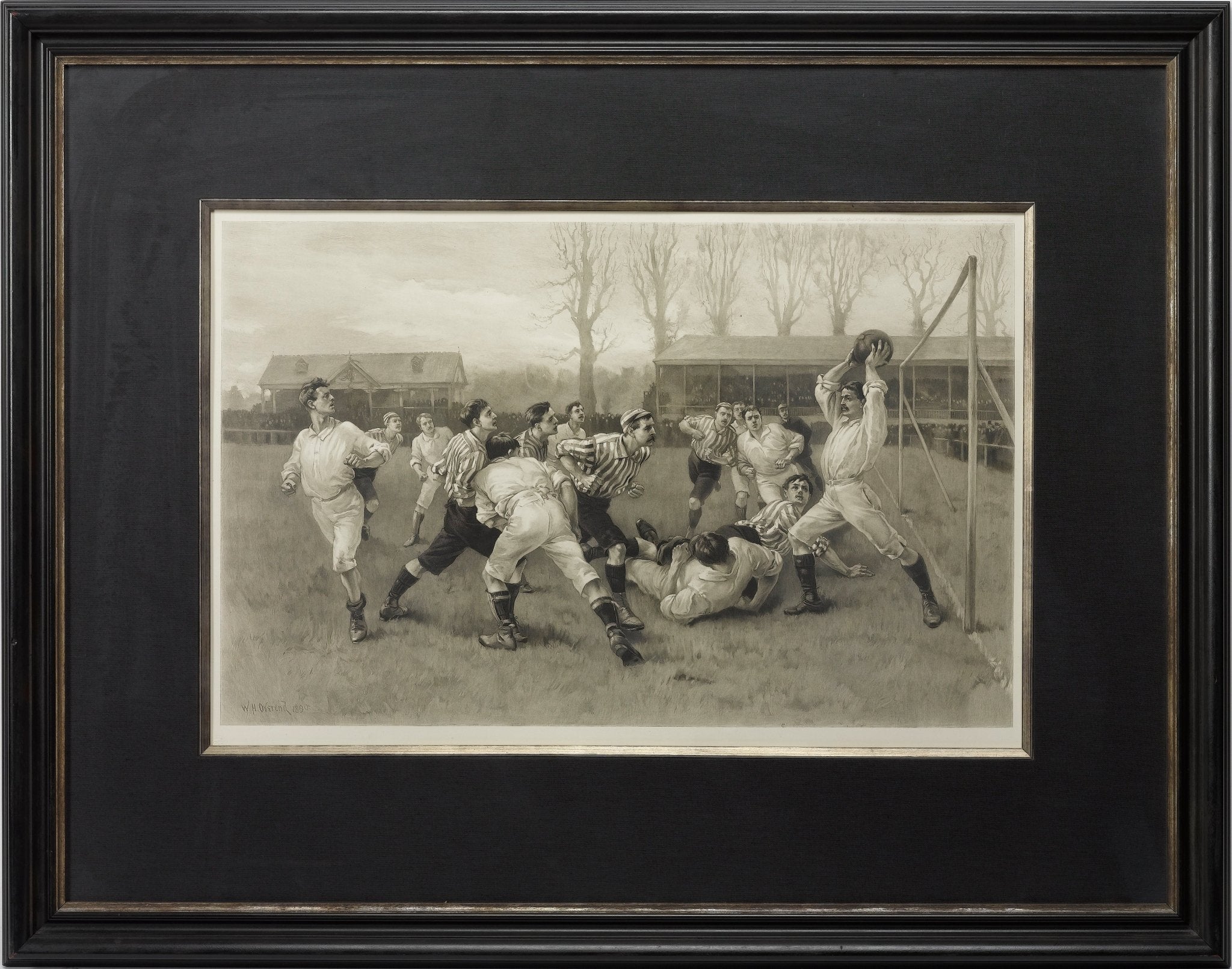
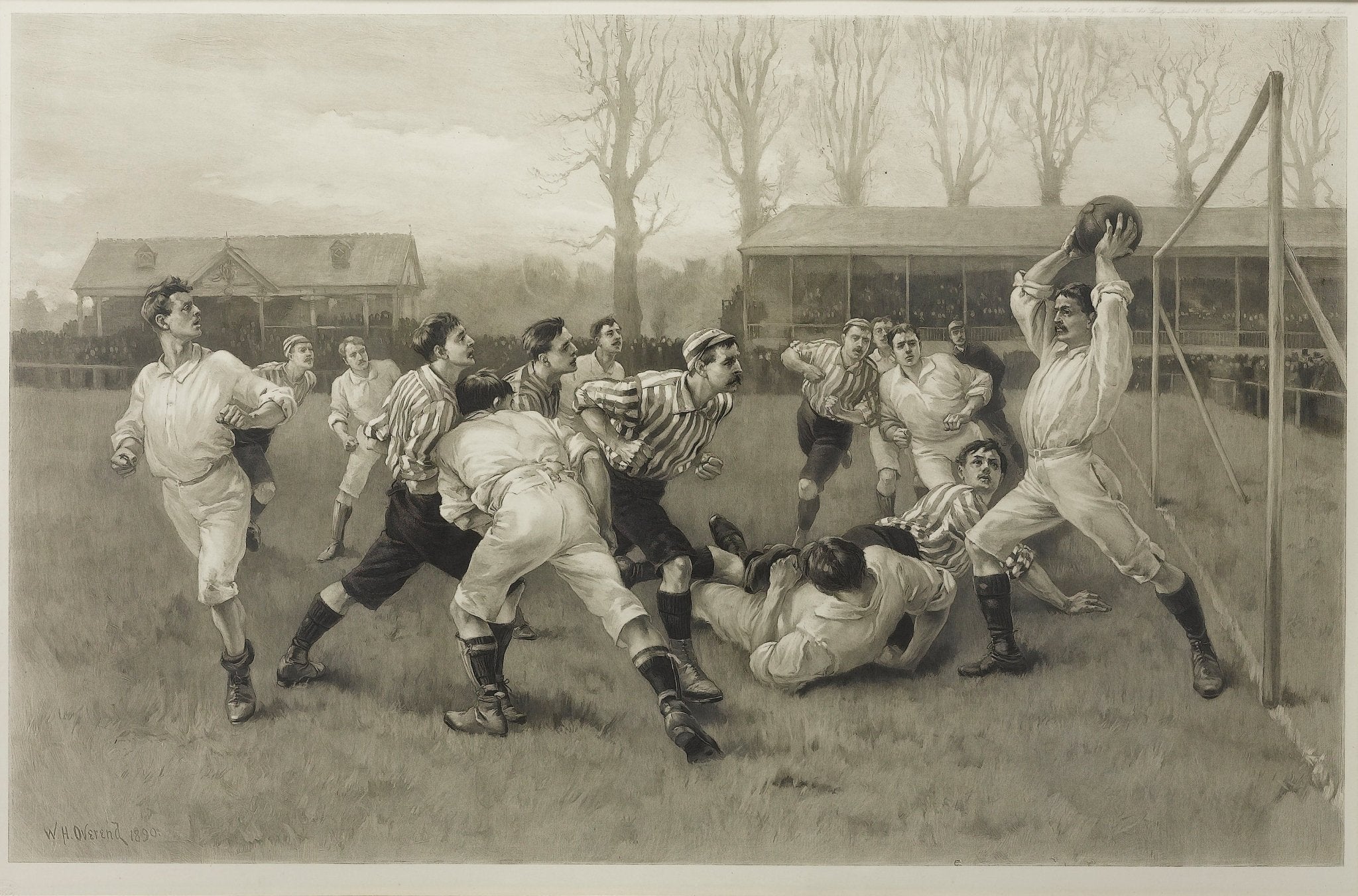
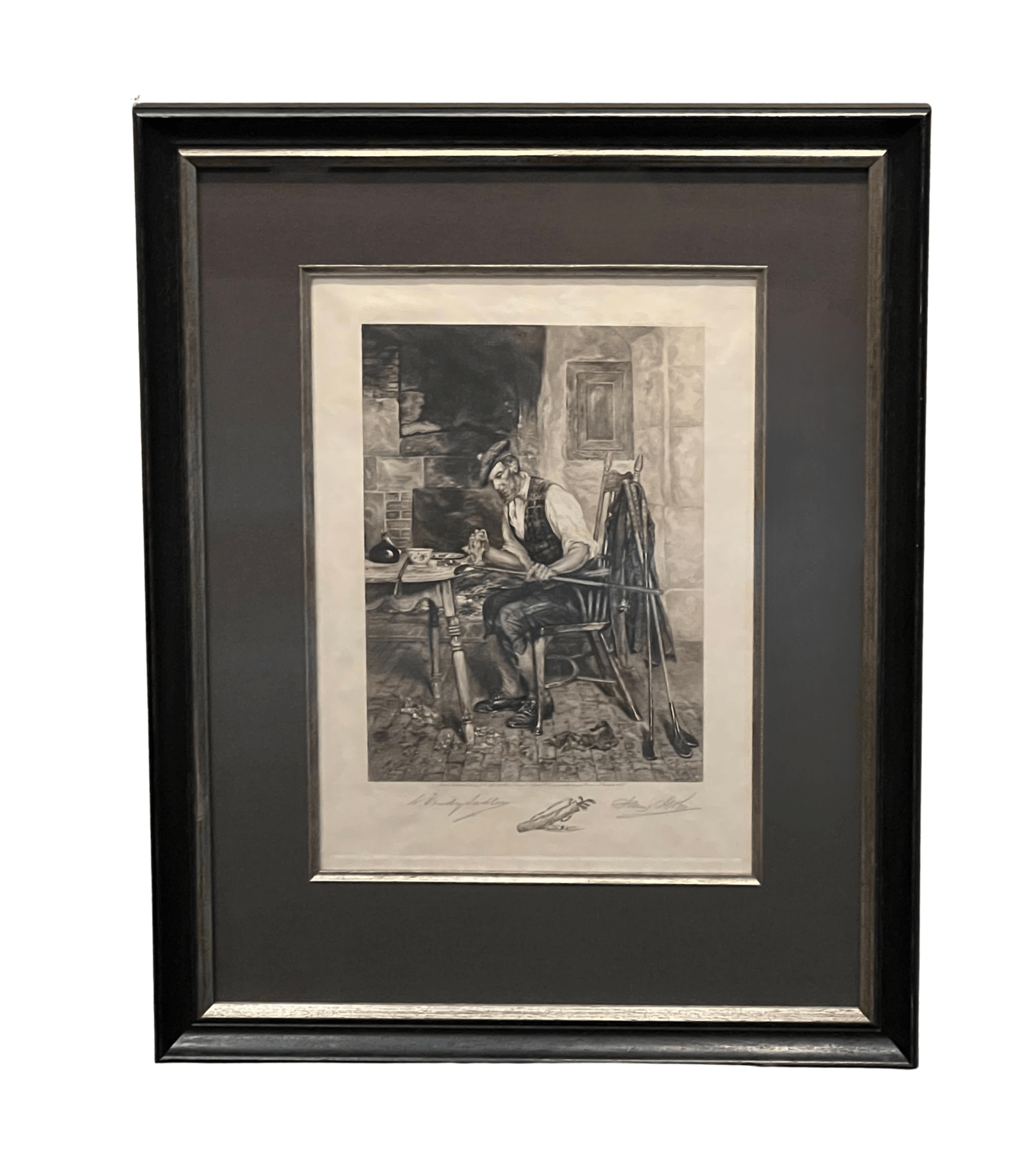
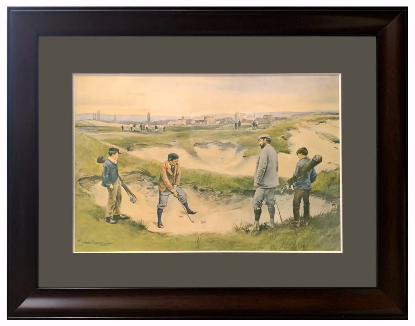
1891 "Football Match and Association Game" Photogravure, after W.H. Overend
Sale price$3,950.00
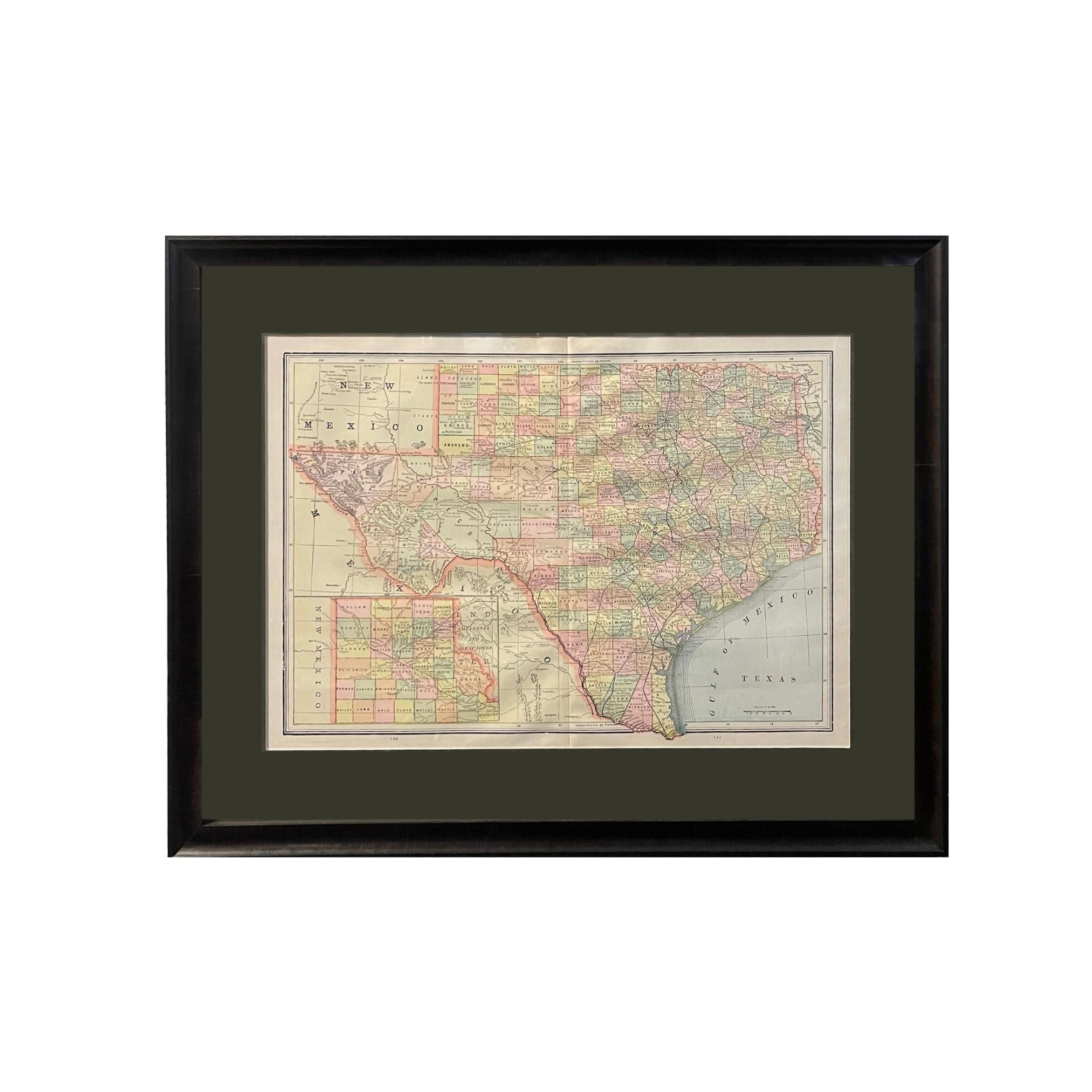
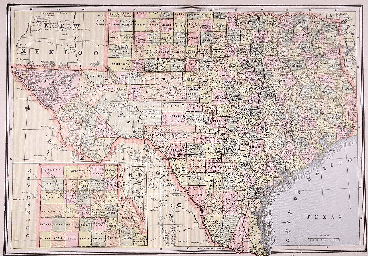
1894 "Texas" Map
Sale price$950.00
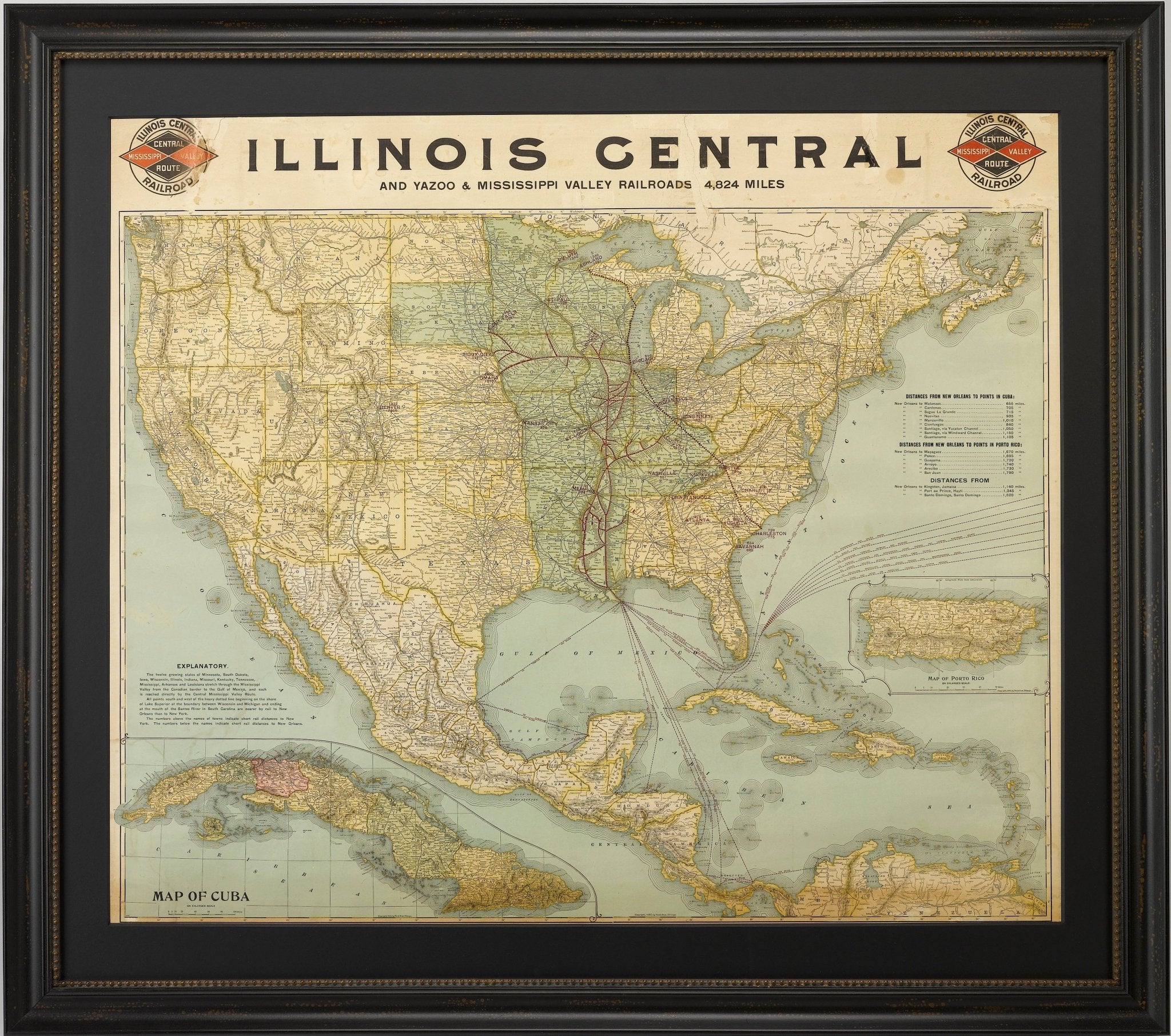
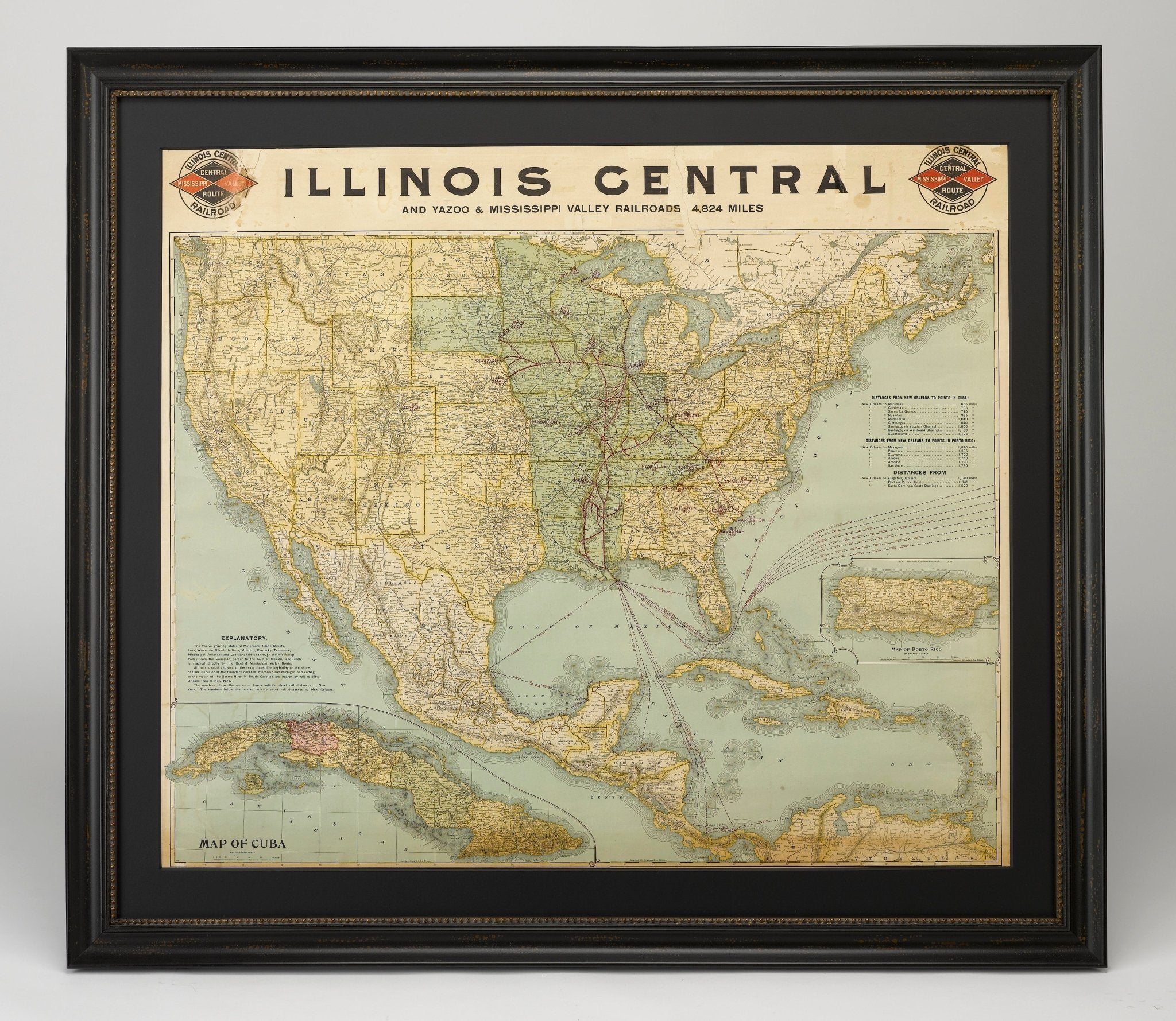
1899 Poole Brothers Railroad Map of the Illinois Central Railroad
Sale price$7,950.00


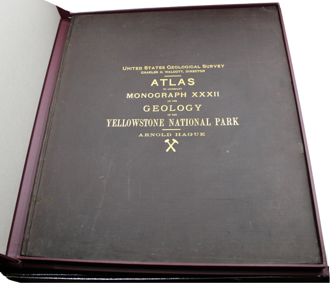
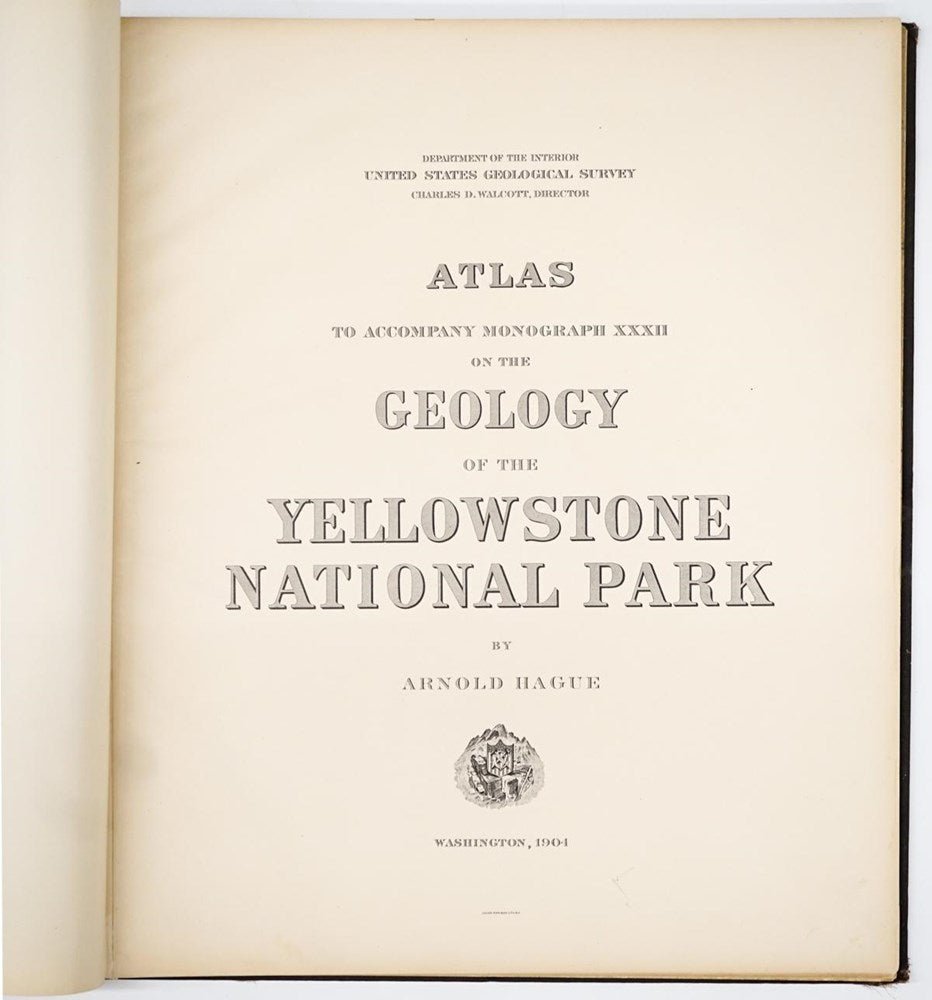
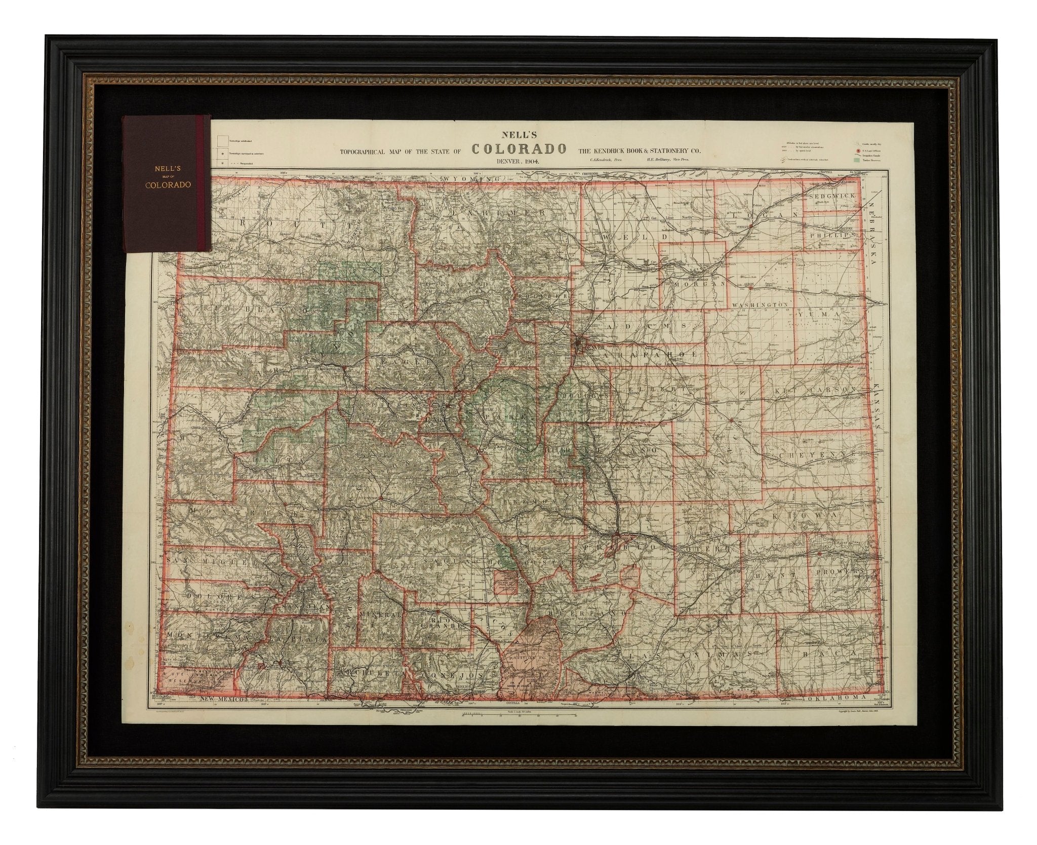
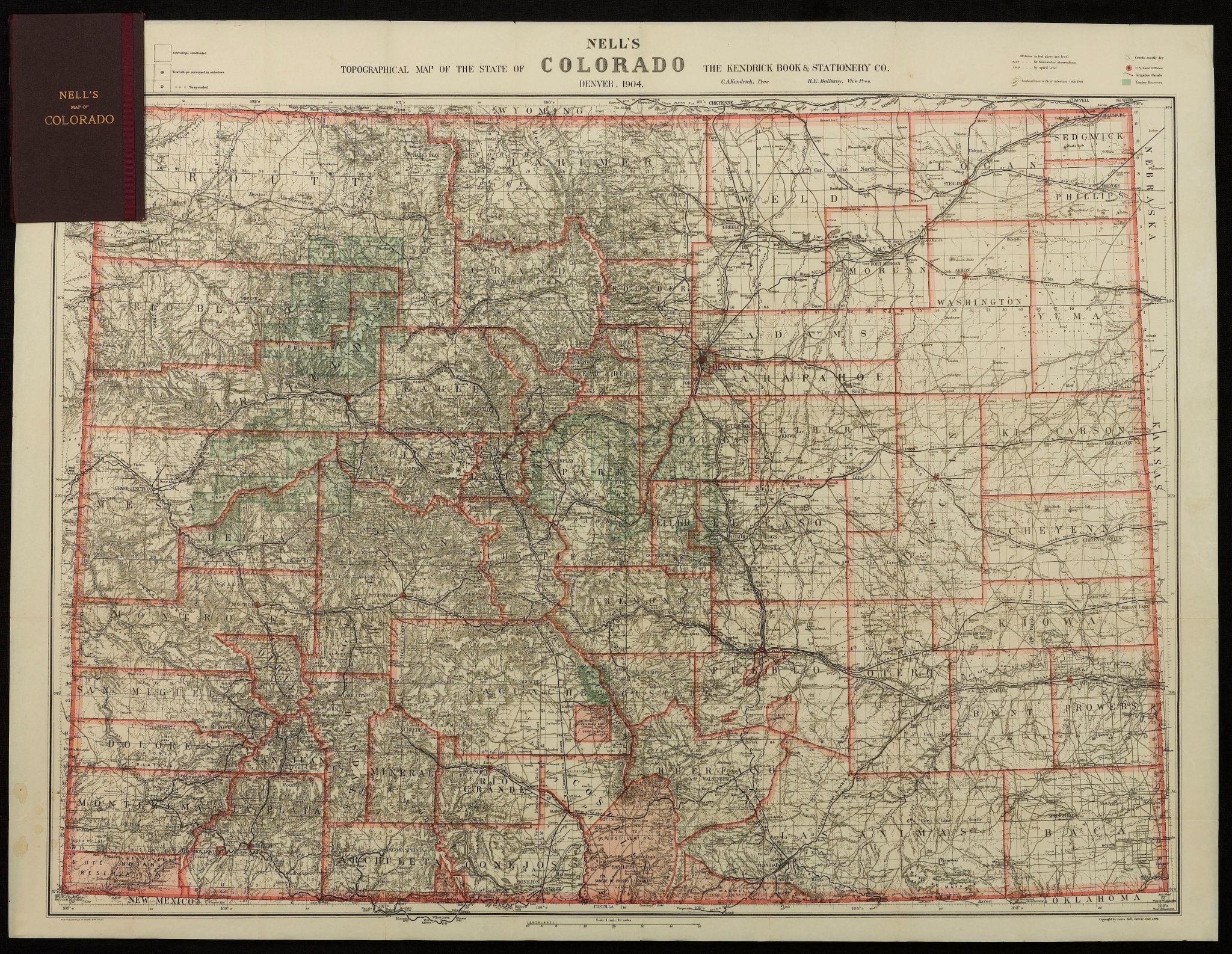
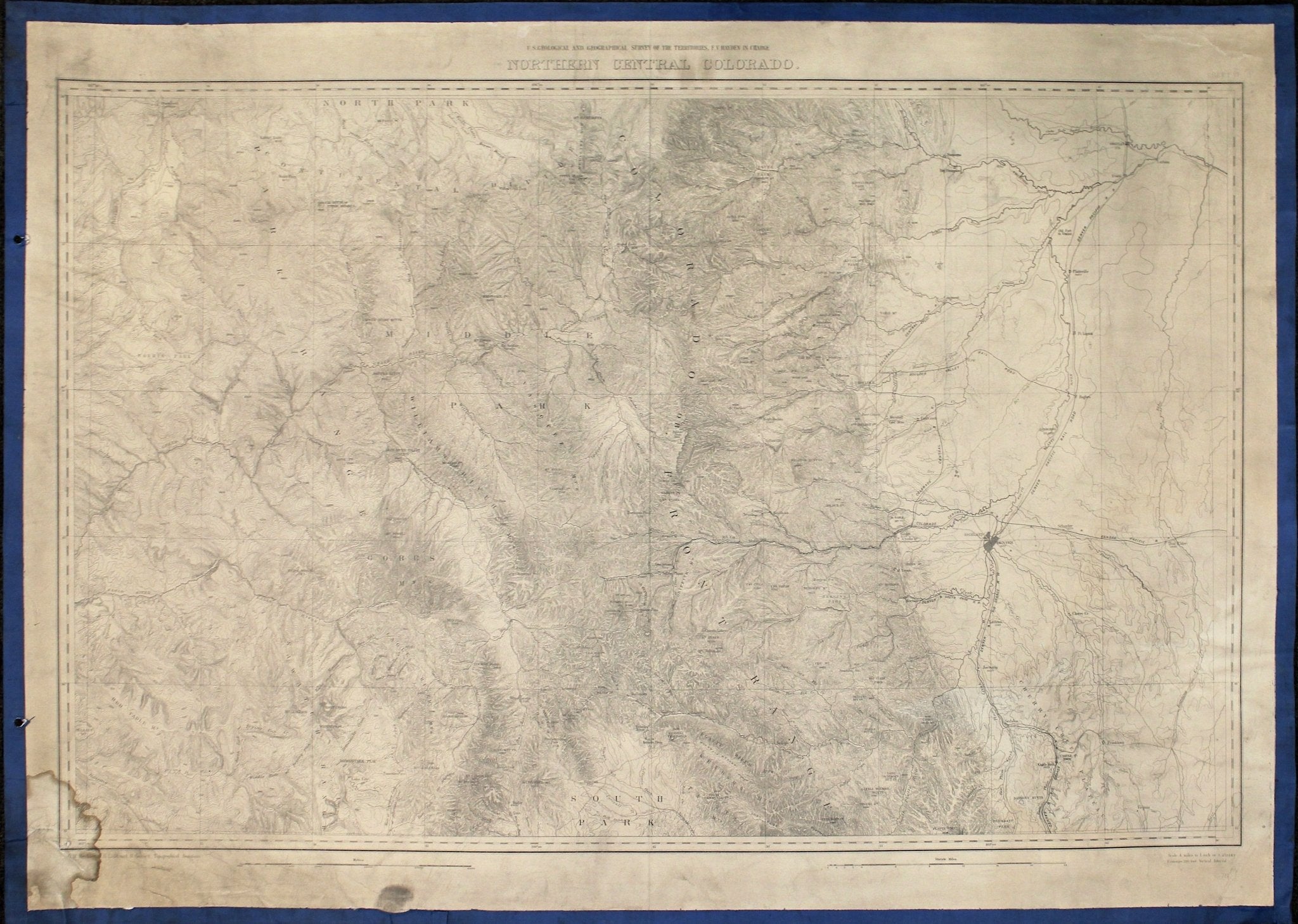
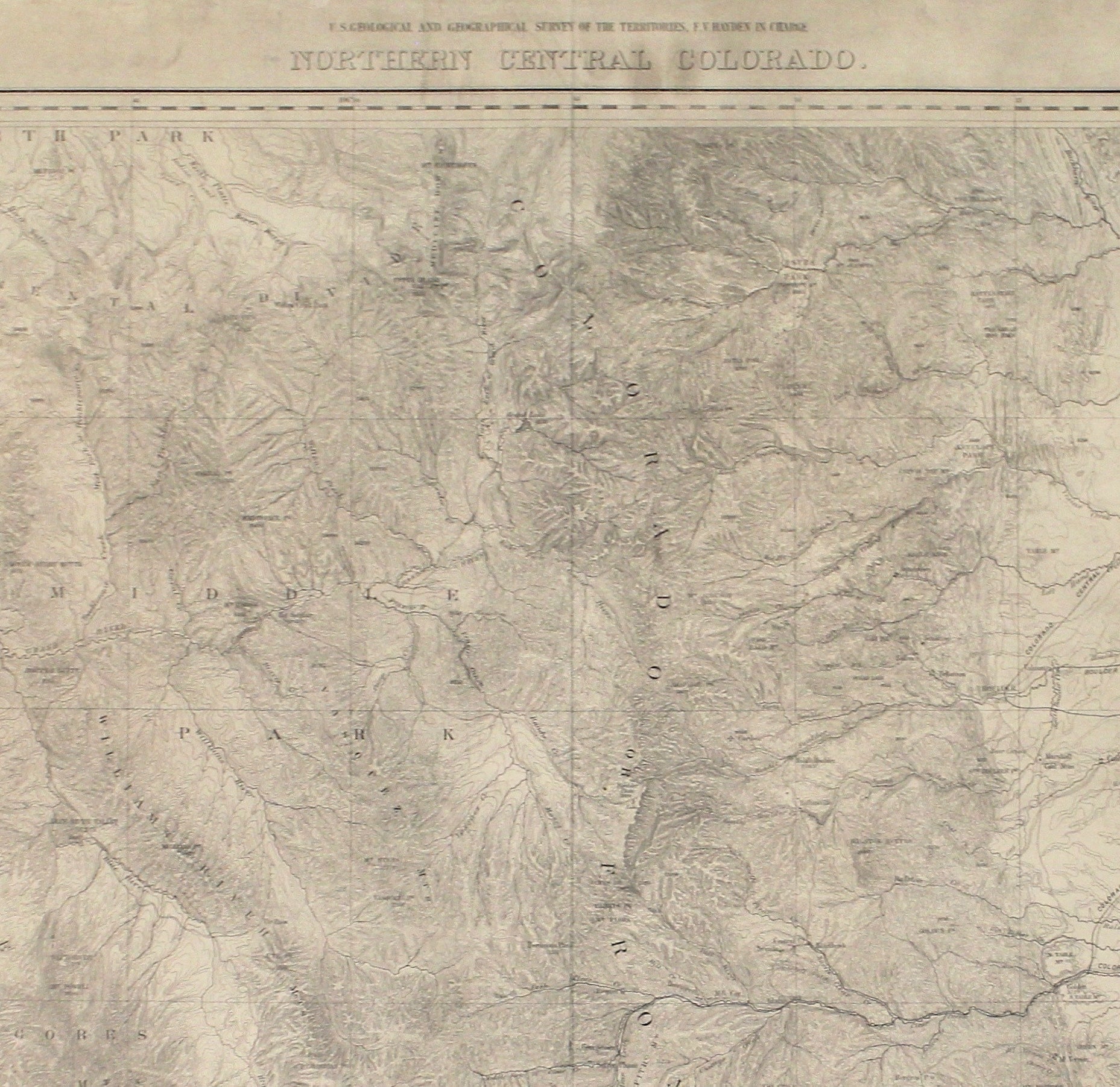
1904 "Nell's Topographical Map of the State of Colorado"
Sale price$6,950.00


1911 Tiffany & Co. Diamond-Encrusted Sterling Silver Polo Trophy
Sale price$25,000.00
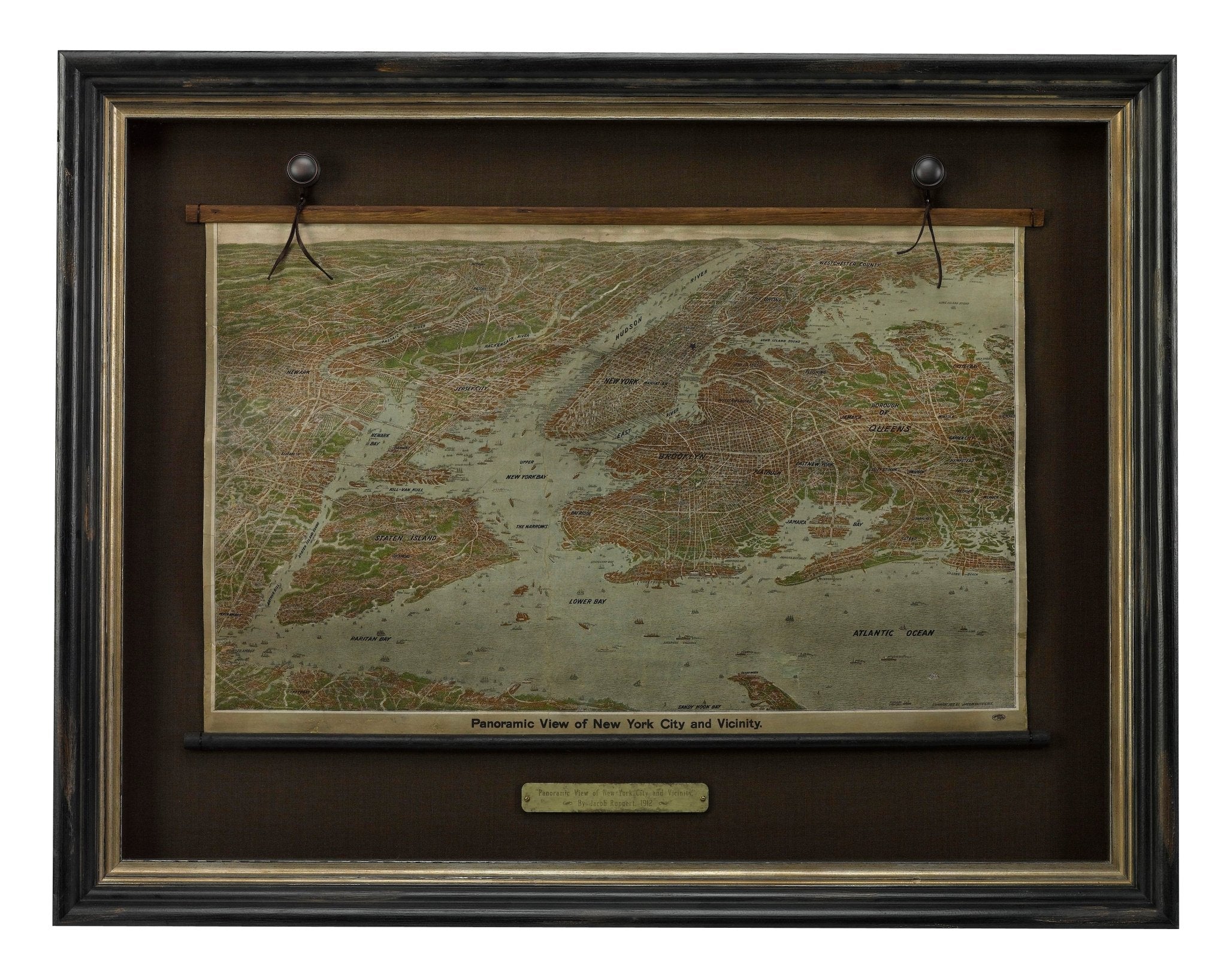
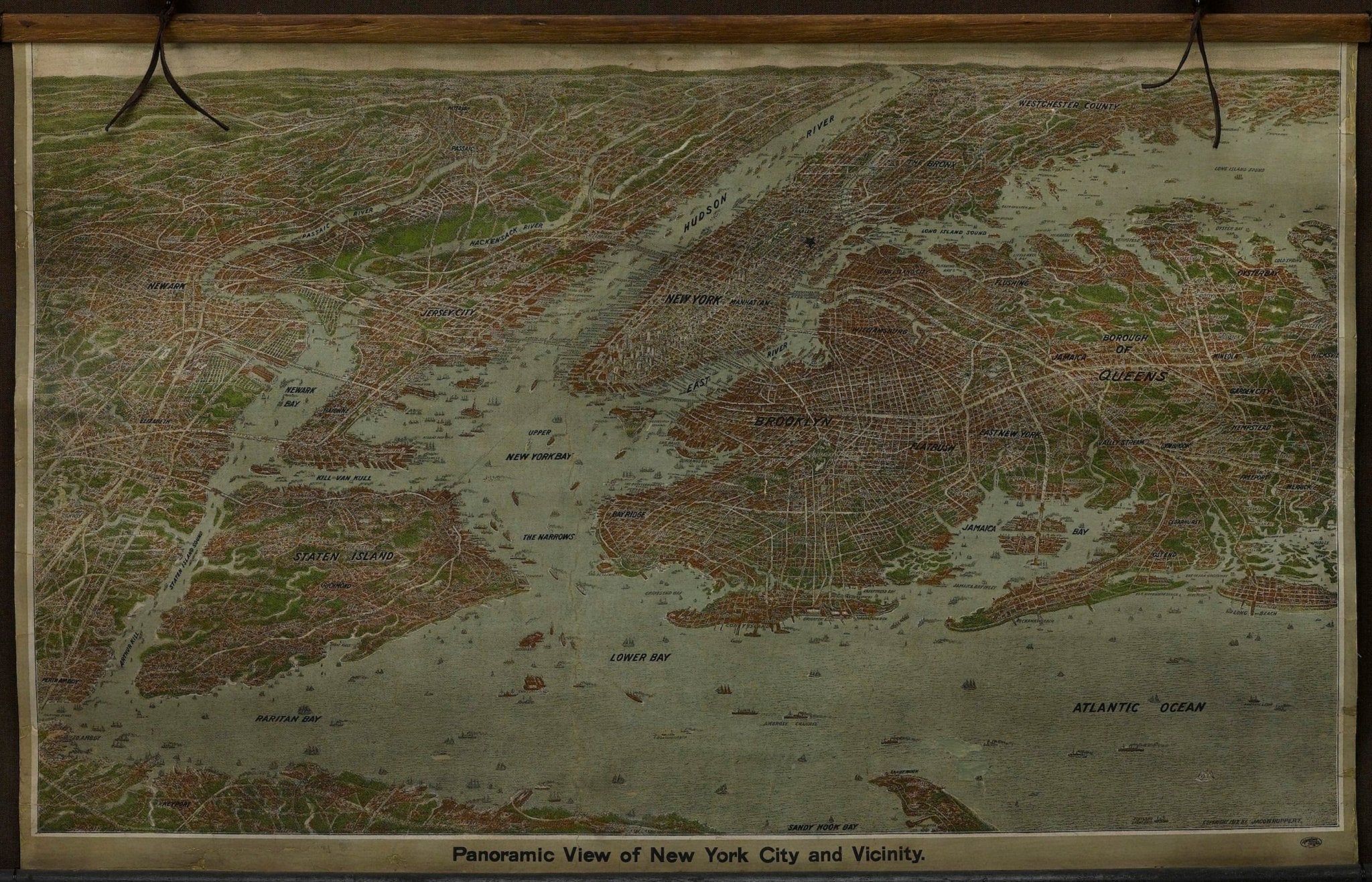
1912 "Panoramic View of New York City and Vicinity" Map by Jacob Ruppert
Sale price$8,500.00
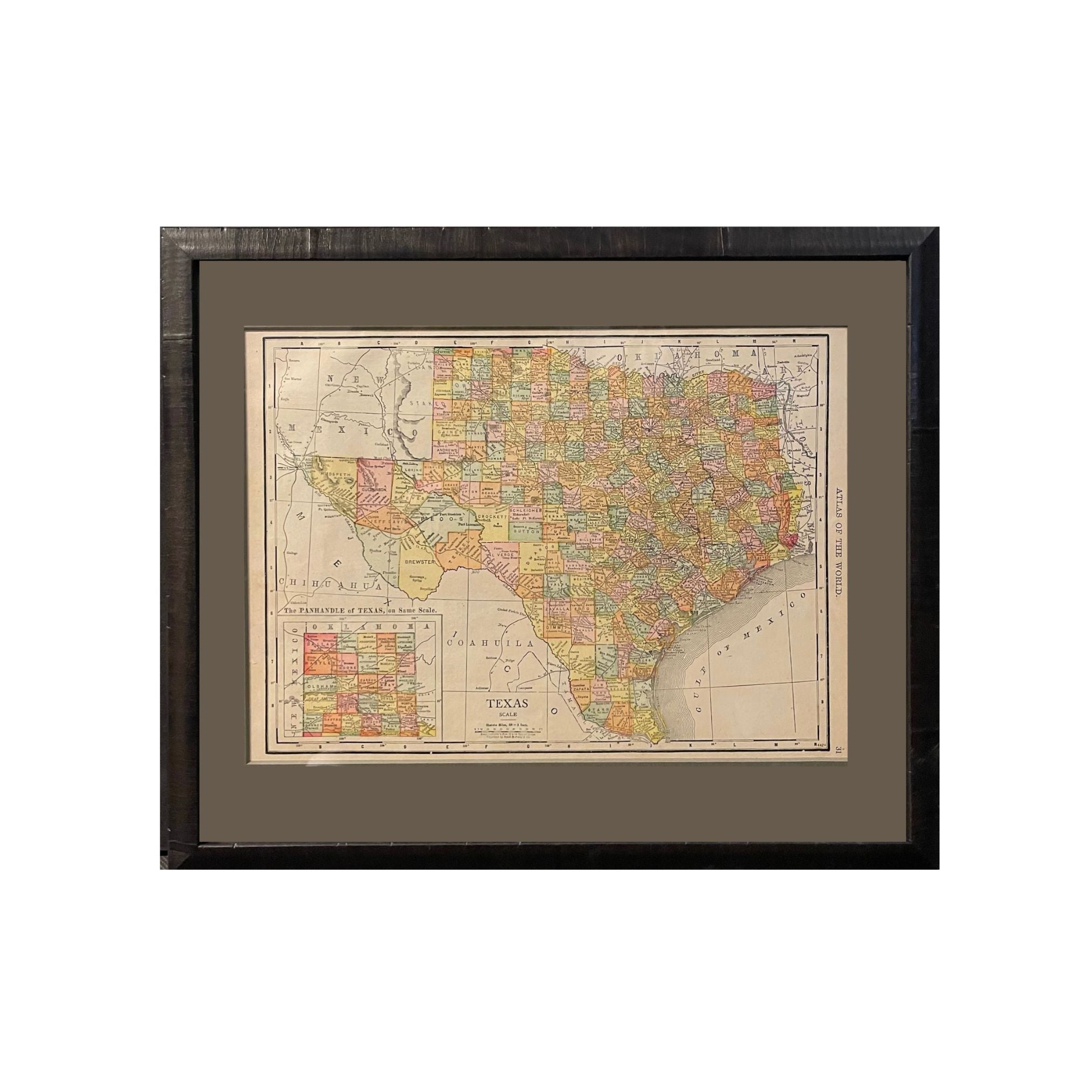
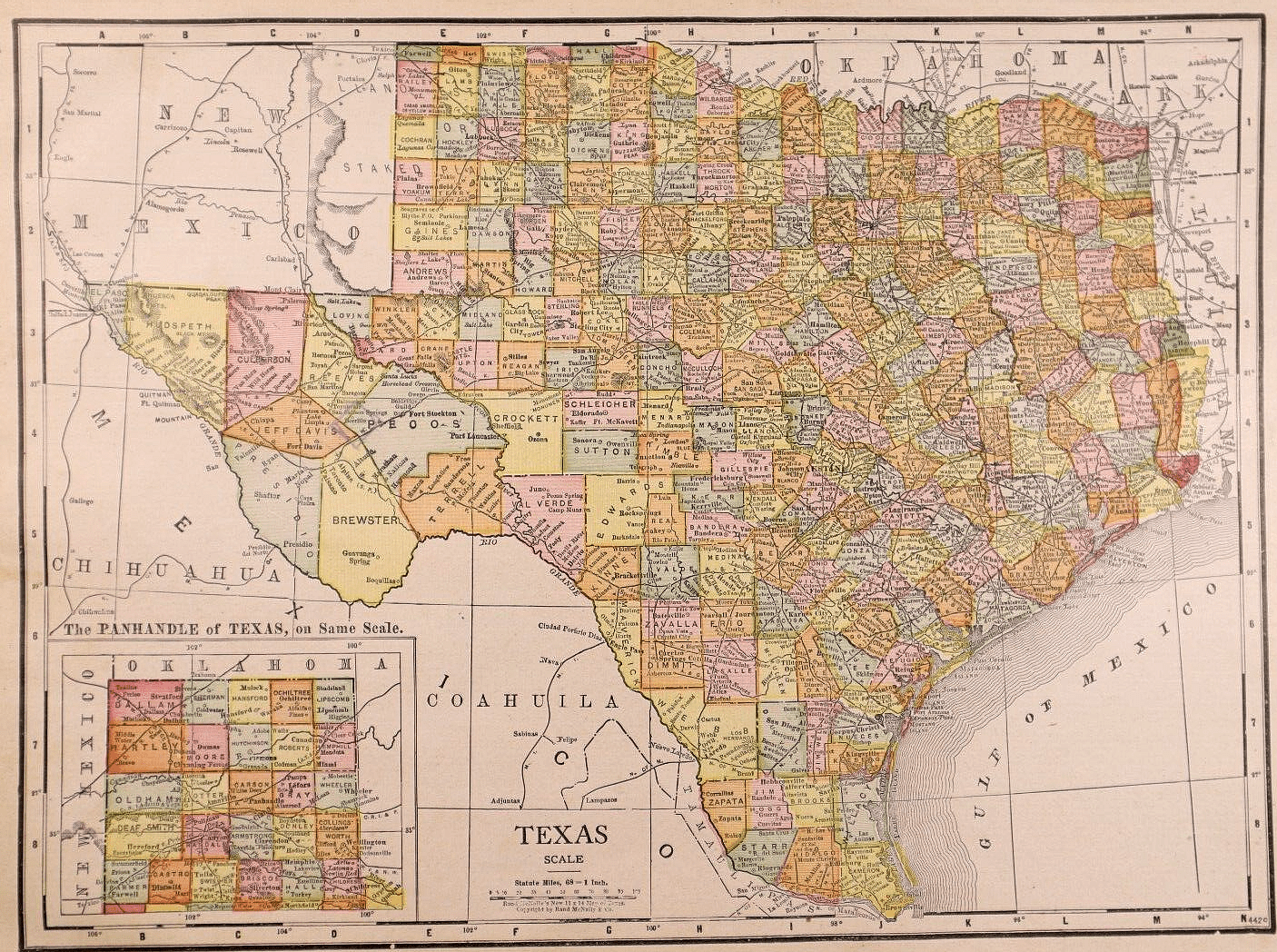
1912 "Texas" Map by Rand McNally & Co.
Sale price$850.00